bwt3650
-
Posts
1,569 -
Joined
-
Last visited
Content Type
Profiles
Blogs
Forums
American Weather
Media Demo
Store
Gallery
Everything posted by bwt3650
-

December 2021 Obs/Disco...Dreaming of a White-Weenie Xmas
bwt3650 replied to 40/70 Benchmark's topic in New England
Obviously, I have a biased toward jay, but gotta respect how up front they are about the weekend. Winds should be kickin up there Saturday.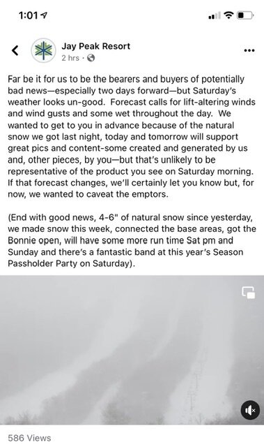
-
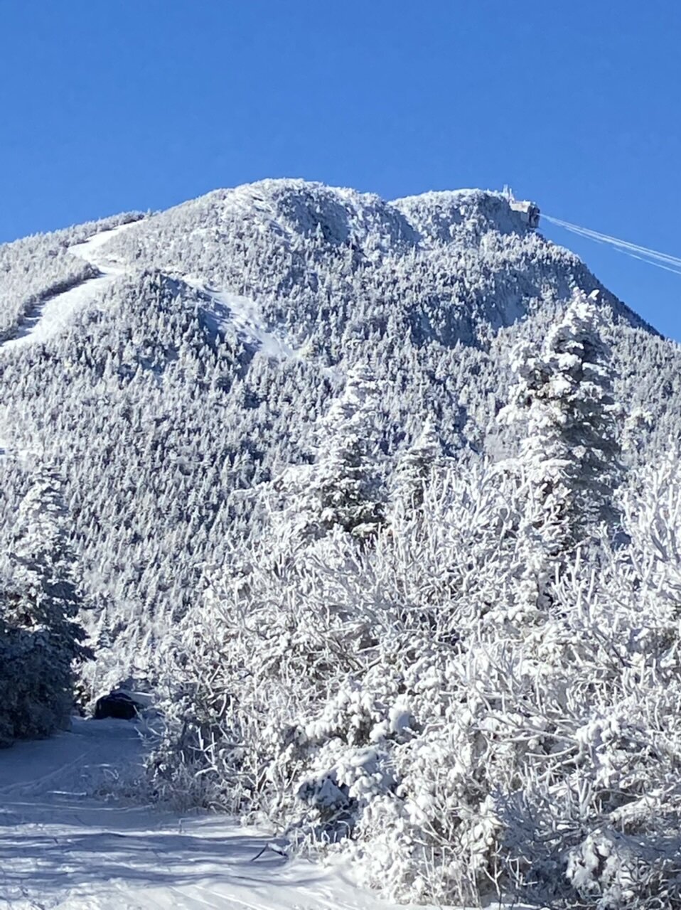
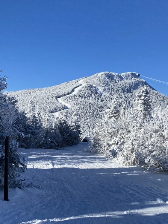
Jay is in really good shape right now..tnrw should be good too. With the Bonnie open, if you hike that little bit on northway to jfk, you’ll find all those glades on tramside basically untouched; just make sure you have a way to get back from tramside. Saturday sucks because they were really getting there.
-
December 2021 Obs/Disco...Dreaming of a White-Weenie Xmas
bwt3650 replied to 40/70 Benchmark's topic in New England
Southern NJ isn’t even part of NJ. Different world. -
Wednesday 12/8 Possible Snow/Ice/Rain? Discussion
bwt3650 replied to Torch Tiger's topic in New England
Who is "they"? If you are trying to make a point about climate change, fine. But usually when people over dramatize things, you lose credibility. There will still be snow in the Sierra in 30 years and it will still snow in New England. We will not see a 48" snowstorm every 2-3 years. I'm not picking a side on the climate change issue, but I am picking a side on the speed and results that some people shout about for attention. -
Wednesday 12/8 Possible Snow/Ice/Rain? Discussion
bwt3650 replied to Torch Tiger's topic in New England
I'm gonna sell the Sierra going from 400" to zero in the next 28 years...little dramatic -
December 2021 Obs/Disco...Dreaming of a White-Weenie Xmas
bwt3650 replied to 40/70 Benchmark's topic in New England
And we get that backside "fake" snow to help resurface too.. -
December 2021 Obs/Disco...Dreaming of a White-Weenie Xmas
bwt3650 replied to 40/70 Benchmark's topic in New England
Every Snow gun in Vermont will be on until Friday. They are pushing hard to make the stateside/tramside connection at Jay before the weekend. I think the real issues won't be the nne resorts; rather places like Hunter or the poconos. They might not even get the occasional night or two to resurface what little they have. -
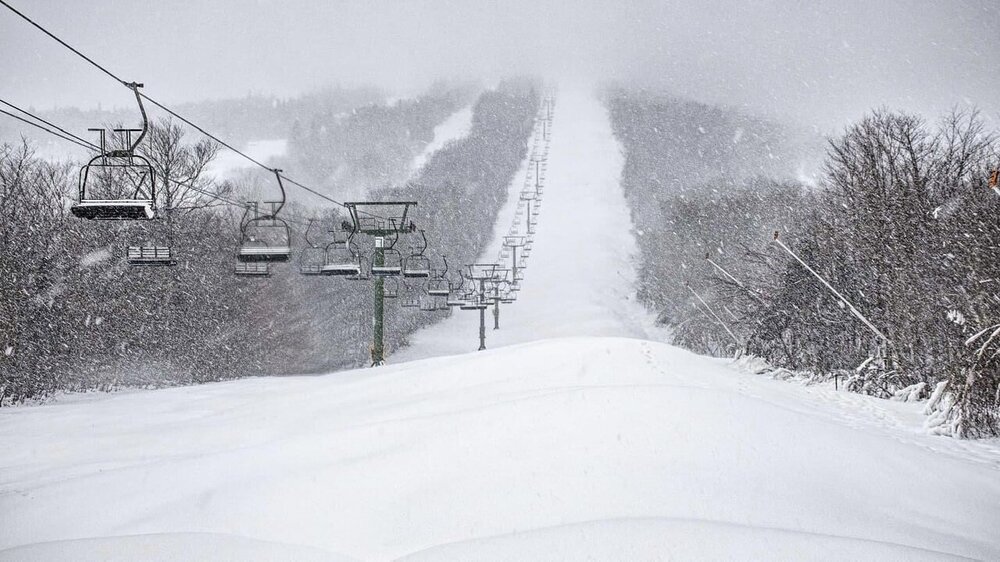
Sounds more promising…. Taking a look at ensemble data for snow levels, our snow levels will steadily rise to around 3000-3500 ft by this afternoon. This should keep all precipitation at summit level across the spine of the Green Mountains and northern Adirondacks as snow. Mid- mountain locations don`t look as favorable as before and we have cut snowfall amounts slightly but have kept the higher amounts at summit level at this time. Once the cold front swings through, our snow levels drop to sea level quite quickly with an arctic air mass quickly to displace the warmer air mass seen this afternoon. A favorable upslope snow shower regime should set up Thursday night into Friday morning with the big winners being Jay Peak, portions of northern Vermont and the northern Adirondacks. By midday Friday, we should lose enough moisture that we will see these snow showers come to an end.
-
Vail seems to be on their own in that regard. Other resorts have not followed. I had more typed out but I just deleted it so this didn’t turn political. When it comes to jobs like mountain ops, lifts etc. I would think you need to find people who really enjoy it because it is hard, physical work in the elements for the same pay as working in a much easier environment. Crap hours a lot of times too.
-
Sounds like some of this is the labor market, but let's face it, vail probably never wanted them. They were attached to the peak deal where vail was after Snow, Hunter and JFBB.
-
Interesting how that chair has been closed for years and they never took the towers down. Is there some sort of back story to that or just figured why waste the money?
-
Ridge was in great shape..top of double dipper too. They probably could have pushed a couple more natural trails if they wanted, but I think the issue is some of the connections. Overall, it’s in really great shape right now.
-
Killington was on point this morning. Great conditions, a few natural trails and lots of snow guns. More crowded than I would have thought for a Monday in November.
-
Teens at night with multiple snow threats. I’ll take.
-
Very winter feel out there. Great snow making window this week too. My panic from last week seems to have eased.

-
Very mid winter feel today. 17 degrees, bright sky, packed powder roads and sidewalks. Looks like the storm cycle was about 12-14 total here; probably more up top.
-
Cue J-Spin and his stats.
-
Didn’t start snowing until about 15 miles out, but by the time I started up 242 at 1000’ it was snowing pretty good. Here at 1850’ it’s a moderate snow and 15 degrees. Definitely winter out there. Wasn’t expecting the upslope to still be going tonight. Tomorrow with less wind should be good out there.
-
My 7 year old has a bright yellow helmet you could use to land planes...best way to find them.
-
Get up here and do some fake skiing on the fake snow!!
-
I think I’m locked for a foot…planing on driving up sat evening to hit it Sunday. I’ll get some fake pictures up Sunday of the fake powder. Happy thanksgiving NNE crew.
-
The Jet looks ready to me…I think I’m twitching looking at that.
-
I’m back in jersey but I can see on my cam that it’s snow at my place at 1850’..looks like a half inch or so.
-
Have to blow the snow..not even a question. And the only one who doesn’t get it and is pissed is “vail sucks guy”…,and he’s already emailed corporate and posted on social media.
-
Nice write up. I always appreciate getting the updates even if it’s bad news. I love the mountains that have more detailed write ups in their snow reports throughout the day. One thing some resorts do well is let you know where they are making snow, and where they are headed. It gives you an idea of how to plan. The people that bitch about snowmaking are the same people that don’t understand why there’s a wind hold because they are at 1500 ft and it’s not windy (meanwhile at tower 15, it’s gusting to 60mph)