
JasonOH
-
Posts
796 -
Joined
-
Last visited
Content Type
Profiles
Blogs
Forums
American Weather
Media Demo
Store
Gallery
Everything posted by JasonOH
-
Another reminder, MIMIC doesn’t update without additional polar satellite passes. With a storm that’s rapidly evolving (like this) and with the latest pass being 8 hours ago, it’s useless.
-
FWIW the energy from fusion due to lighting is orders of magnitude lower than that of the storm as a whole and has no effect on strengthening. It’s a symptom of strengthening and microphysics processes, not a cause.
-
VDM went in as 957mb. Drop had 957 with 25kt wind though.
-
The eastern circulation is side lobe so there aren’t twins. It’s centered over the inflow region, not the hook.
-
Gotta love the long range HRRR and it’s propensity to do crazy things.
-
There's a big time flash flood threat behind this supercell. It's dumping a ton of rain and more storms are popping along the OFB behind it and training along the path. I expect some really bad flooding to occur tonight.
-
Looks like it will go south of Hattiesburg. Looks to end up very close to Camp Shelby.
-
Tylertown storm is really improving its presentation. Hook is becoming evident and the inbounds (outflow) are ramping up like the outbounds (inflow) have been the last few scans
-
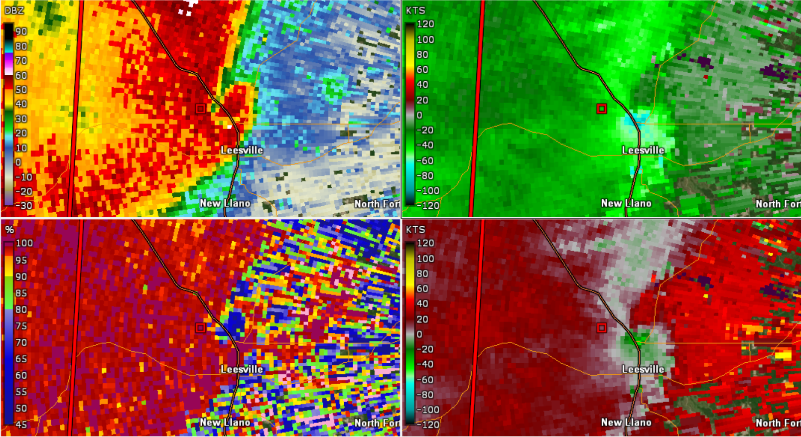
Leesville, LA got a TDS.

-
I don't think that's surface based so there shouldn't be a huge tornado threat from it
-
I'm betting it lofted a bunch of leaves. Plenty of trees in that area and leaves are super easy to lift high.
-
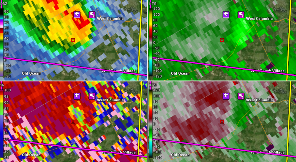
TDS very evident on the LA cell.
-
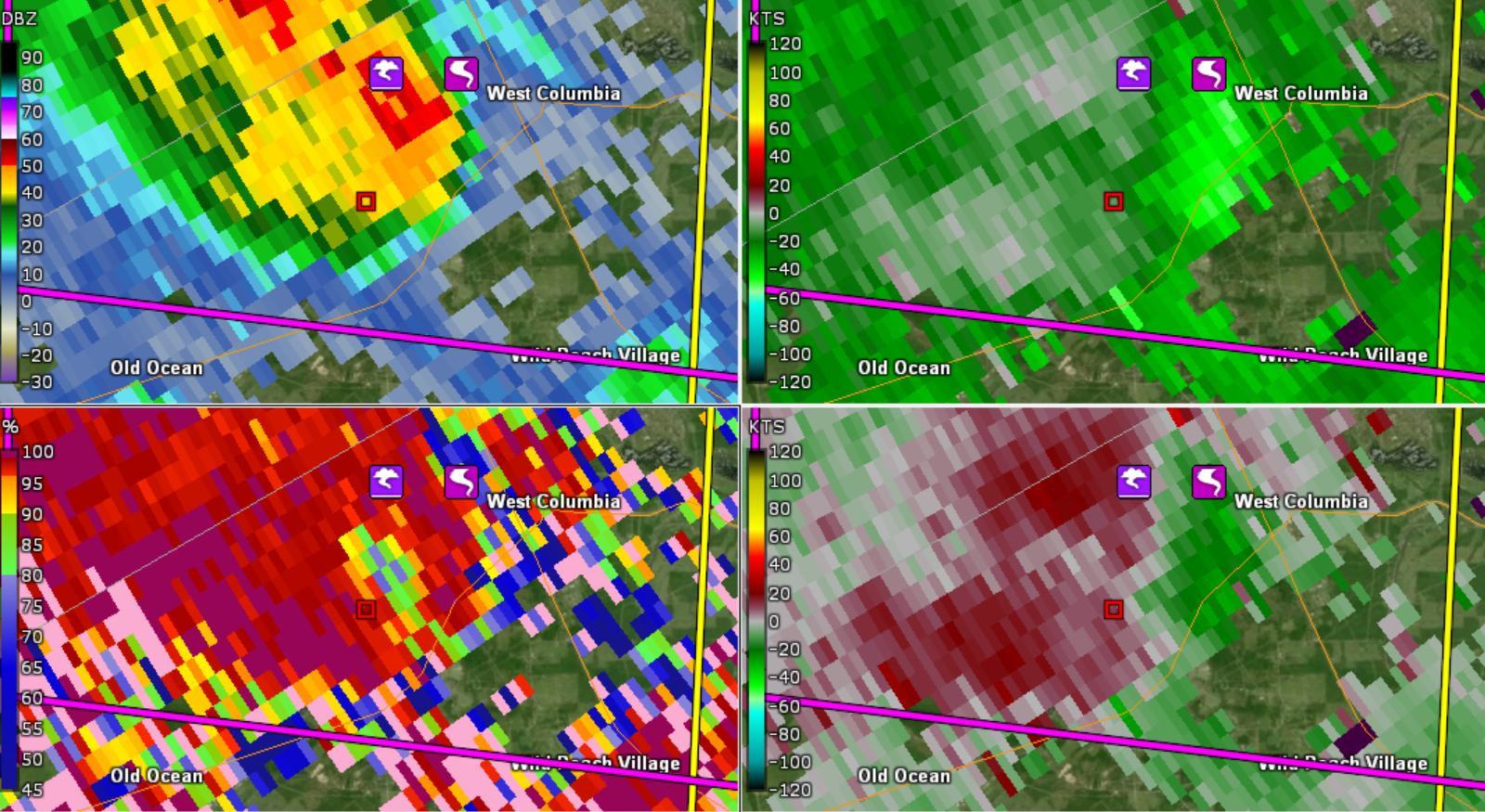
Cell in LA also produced. Quite the CC drop on it

-
Bit of a CC drop on the Texas storm. Spotter confirmed tornado.
-
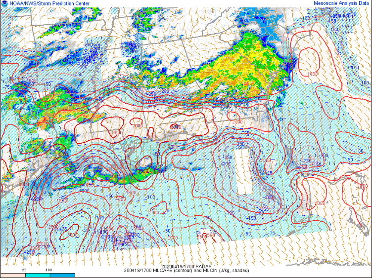
Already a large area with greater than 2500 J/Kg of MLCAPE south of the warm front. Definitely a volatile environment if surface winds are not veered and storms can form.
-
I have a feeling the HRRR is really overdoing they mixing of the boundary layer. There is not any other model support for mixing of that strength and I find it pretty hard to believe it will happen with the quality of moisture. Some mixing will happen, but not as much as the HRRR is modeling.
-
Sometimes that’s a sign that the storms are modeled to be elevated, similar to a lot of the crapvection last week. WAA loves to force elevated convection if there is a layer that supports it.
-
This link will work for any office. https://www.weather.gov/jan/dat_redirect
-
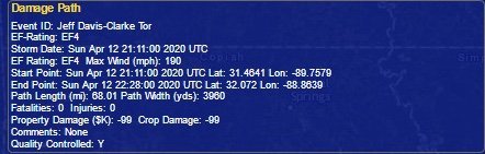
TDLR: Officially prelim 190 mph on the EF4 and 150mph on the EF3. More detailed info tomorrow. Adjustments are possible over the coming weeks.
-
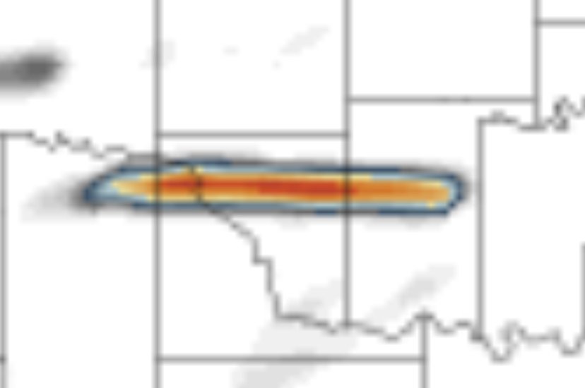
That puts it as the third widest on record behind El Reno 2013 (2.6 miles wide) and Hallam, NE (2.5 miles wide).
-
This was the strongest tornado since Rochelle in 2015.
-
Up to 190mph and 3960 yards based on the viewer.
-
Reverse image search yielded nothing on that tree damage pic. I think we can say it’s likely legit.
-
Walthall county tornado rated 170mph EF4.
-
I wonder if they can only do the lower bound of DOD10 without a review to determine the actual wind speed. More info from a friend: EF4 and above and they typically need to call in a Special team to make the final determination. That would explain the lower bound usage and why it’s being checked again.