BBasile
-
Posts
2,226 -
Joined
-
Last visited
Content Type
Profiles
Blogs
Forums
American Weather
Media Demo
Store
Gallery
Everything posted by BBasile
-
Temp is slowly dropping, from a high of 39F down to 37.6 now. 0.13" of rain.
-
I was just down at ACY and it did have that "tropical" feel to it with the low clouds speeding in from the east.
-
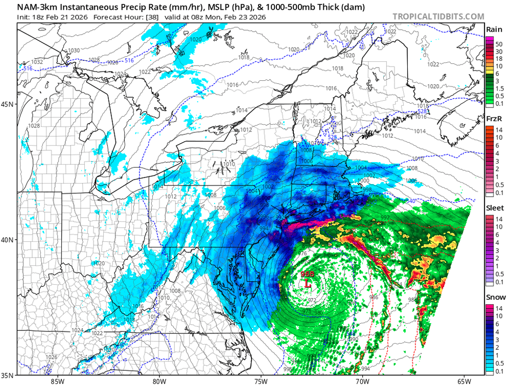
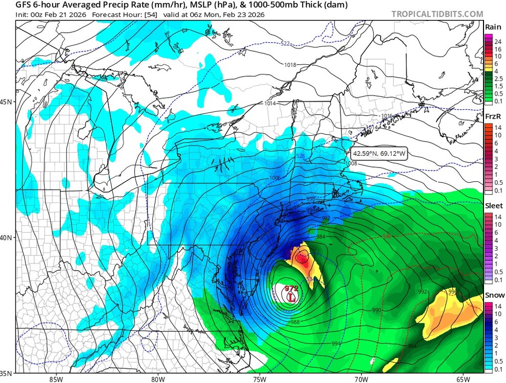
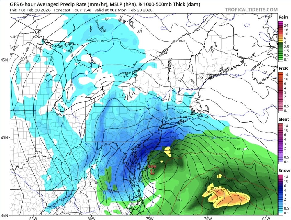
That's basically just a cold hurricane at this point.
-
Indica gummies. zzzzzzz
-
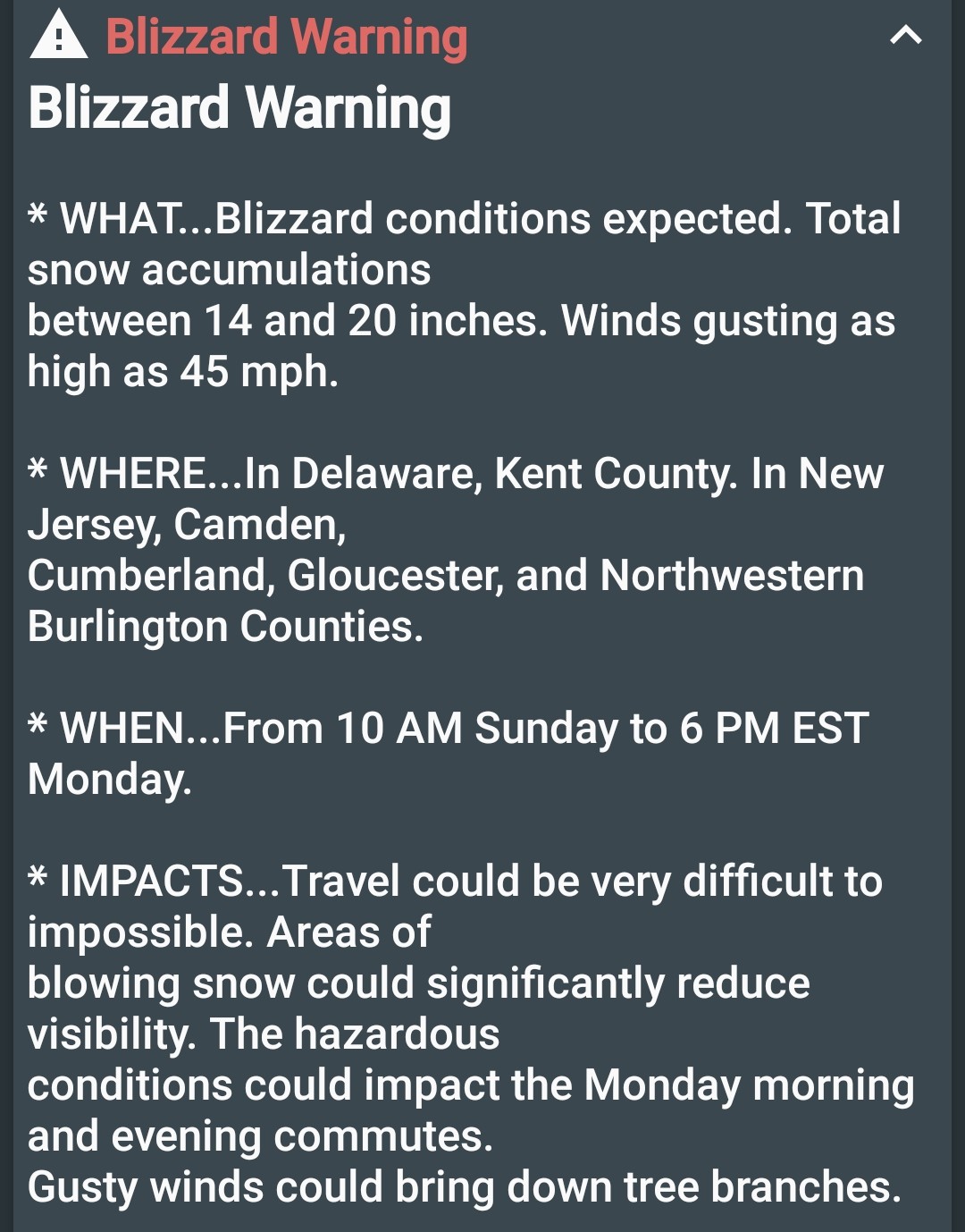
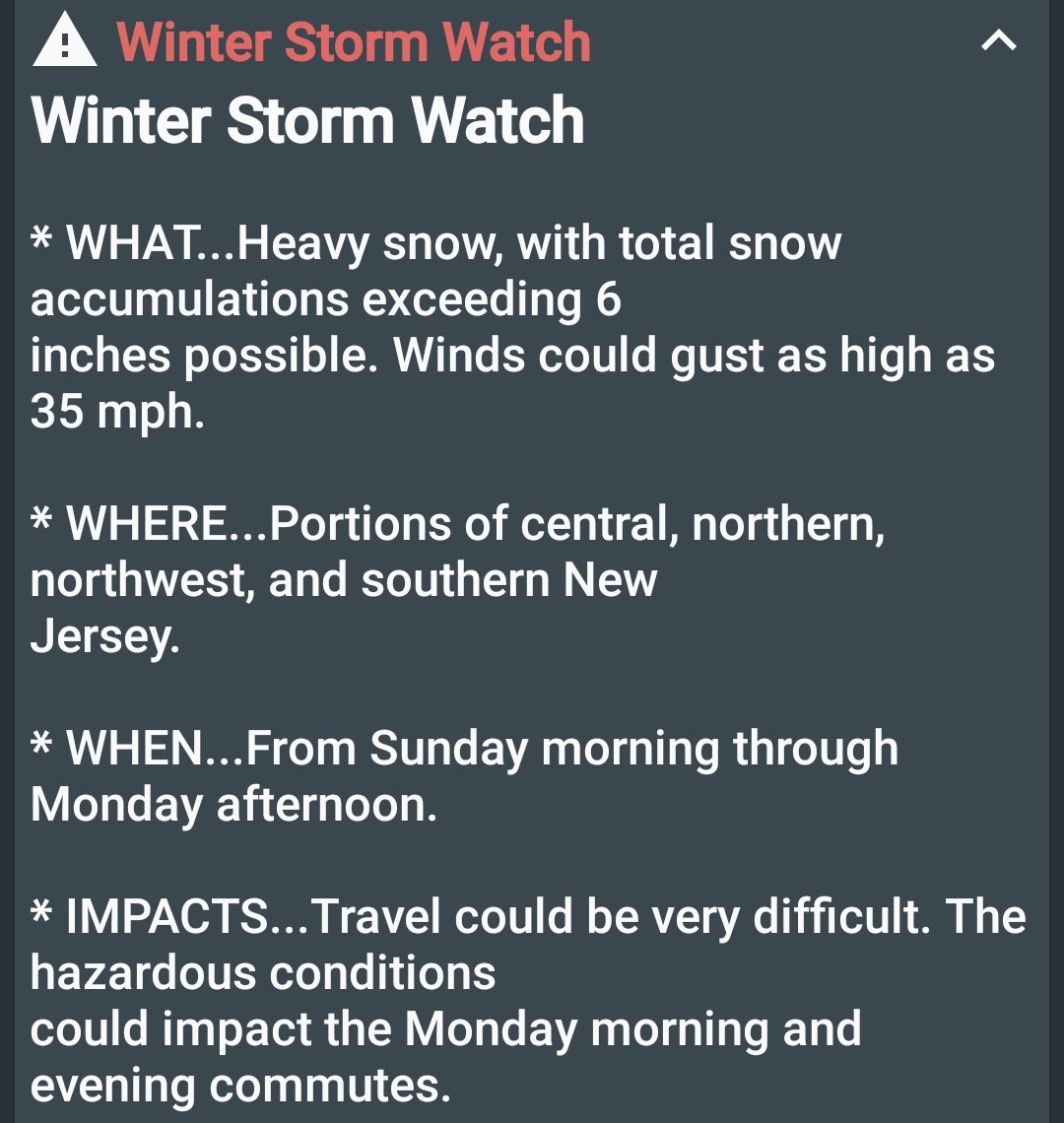
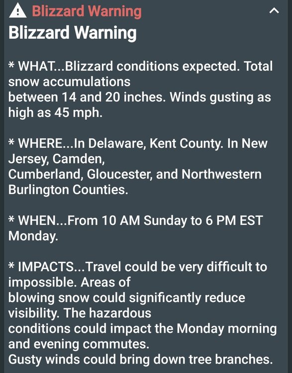
I actually can't remember the last time I was under a blizzard warning.
-
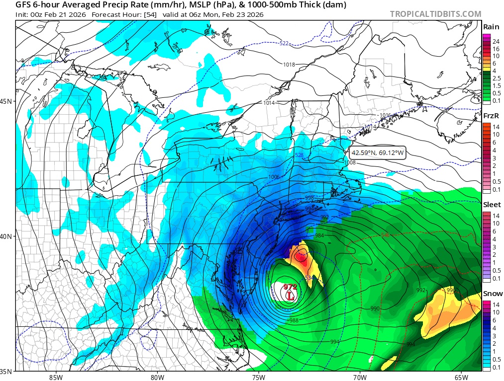
30 mb in 12 hours?
-
I see you, baby...
-
Seems to be a tad from 18z, but still more west from 12z. So maybe.
-
Is the GFS the cult leader with the followers drinking the poison or... Is this shit really going down?
-
Yes. Yes, we can be.
-
Is it the gummy, or does the NAM bomb this thing like 33 mb in 18 hours?
-
Can we be hat-trick NAM'd in one day?
-
Must have been someone with nothing to do in Silver Spring that came up with that. Or Vegas. lol
-
It's the experimental self-deprecating snowfall range map.
-
Caving like the Euro, but with less grace. lol
-
Time to backtrack because "King Euro." If we all are going to owe the GFS a beer, then the pro's with a following owe it a six pack.
-
The GFS is too legit to quit.
-
Yep. Double NAM'd is a thing.
-
We're all gonna owe the GFS a beer on Monday, huh?
-
Can I get double NAM'd? That a thing?
-
The consistency is something to behold.
-
NAM'd. I'll take it.
-
Hopefully we get something. This rain has decimated the snow cover.
-
I'm getting 3 feet of snow? If that verifies, I'm changing the GFS's name to "Tom Brady" and then finding a new hobby.