
Jim Martin
-
Posts
2,469 -
Joined
-
Last visited
Content Type
Profiles
Blogs
Forums
American Weather
Media Demo
Store
Gallery
Everything posted by Jim Martin
-

Central/Western Medium-Long Range Discussion
Jim Martin replied to andyhb's topic in Central/Western States
Looking like an active severe weather day possible for Tuesday. The Storm Prediction Center mentioning a fairly good risk for discrete supercells. -
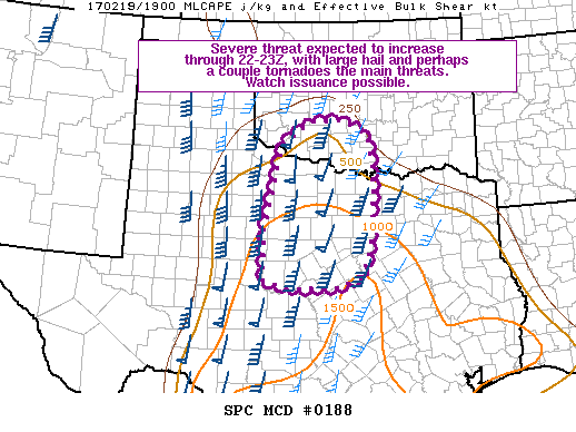
Latest tidbit from SPC on the afternoon Day 2 Outlook... CONCERNING THE SEVERE POTENTIAL, A CORRIDOR OF MODERATE INSTABILITY IS FORECAST TO DEVELOP BY AFTERNOON FROM EASTERN MISSISSIPPI INTO MUCH OF ALABAMA. NAM FORECAST SOUNDINGS AT 21Z IN EASTERN MISSISSIPPI AND NEAR BIRMINGHAM SHOW MLCAPE VALUES REACHING THE 2000 TO 2500 J/KG RANGE. IN ADDITION, THE MID-LEVEL JET WILL CREATE STRONG DEEP-LAYER SHEAR PROFILES ACROSS MOST OF THE REGION. FORECAST SOUNDINGS ACROSS THE SLIGHT RISK AREA BY LATE AFTERNOON SHOW 0-6 KM SHEAR GENERALLY IN THE 60 TO 65 KT RANGE. THIS ENVIRONMENT WILL SUPPORT SEVERE THUNDERSTORM DEVELOPMENT FROM THE MID AFTERNOON THROUGH MUCH OF THE EVENING. THE SHEAR SHOULD BE FAVORABLE FOR SUPERCELL FORMATION ESPECIALLY FROM MIDDLE TENNESSEE SOUTHWARD INTO NORTH-CENTRAL ALABAMA WHERE HAILSTONES OF GREATER THAN 2 INCHES IN DIAMETER, WIND DAMAGE AND A TORNADO THREAT WILL BE POSSIBLE. A STRONG TORNADO MAY OCCUR WITH ANY SUPERCELL THAT CAN BECOME DOMINANT. THE POTENTIAL FOR VERY LARGE HAIL IS ALSO FORECAST SOUTHEASTWARD INTO PARTS OF WESTERN GEORGIA WHERE VIGOROUS CONVECTIVE DEVELOPMENT MAY TAKE PLACE DURING THE EARLY EVENING. THE WIND DAMAGE THREAT MAY INCREASE BY EARLY EVENING ESPECIALLY IF A MESOSCALE CONVECTIVE SYSTEM CAN ORGANIZE.
-
Surprised none of you in here have mentioned the risk for severe weather on Monday...
-
Central/Western Medium-Long Range Discussion
Jim Martin replied to andyhb's topic in Central/Western States
From last night in Southeast Arkansas... 0221 300 PINE BLUFF JEFFERSON AR 3423 9200 MAXIMUM HAIL SIZE MEASURED WAS 3.50 INCHES. (LZK) -
20 years ago next month was the famous Nashville, Tennessee tornado that was captured by WSMV Channel 4 and NewsChannel 5 as it moved through.
-
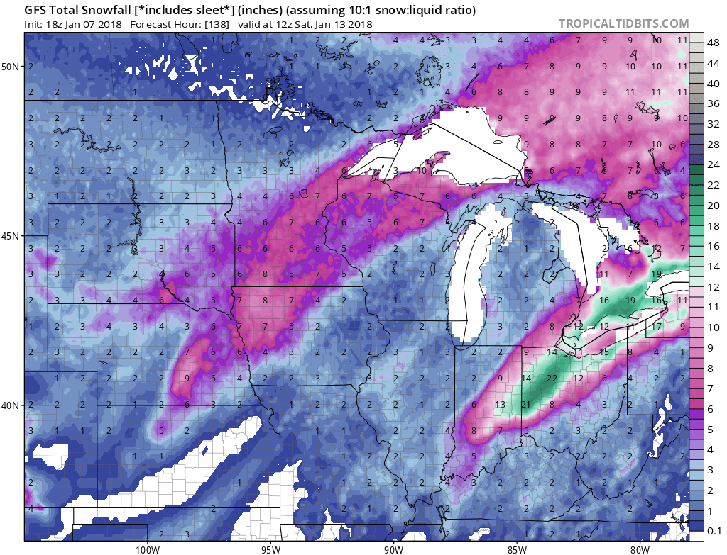
The 18z GFS went absolutely berzerk in Northern Ohio for next weekend. Though some of the precipitation on this run is mixed.

-
-
Central/Western Medium-Long Range Discussion
Jim Martin replied to andyhb's topic in Central/Western States
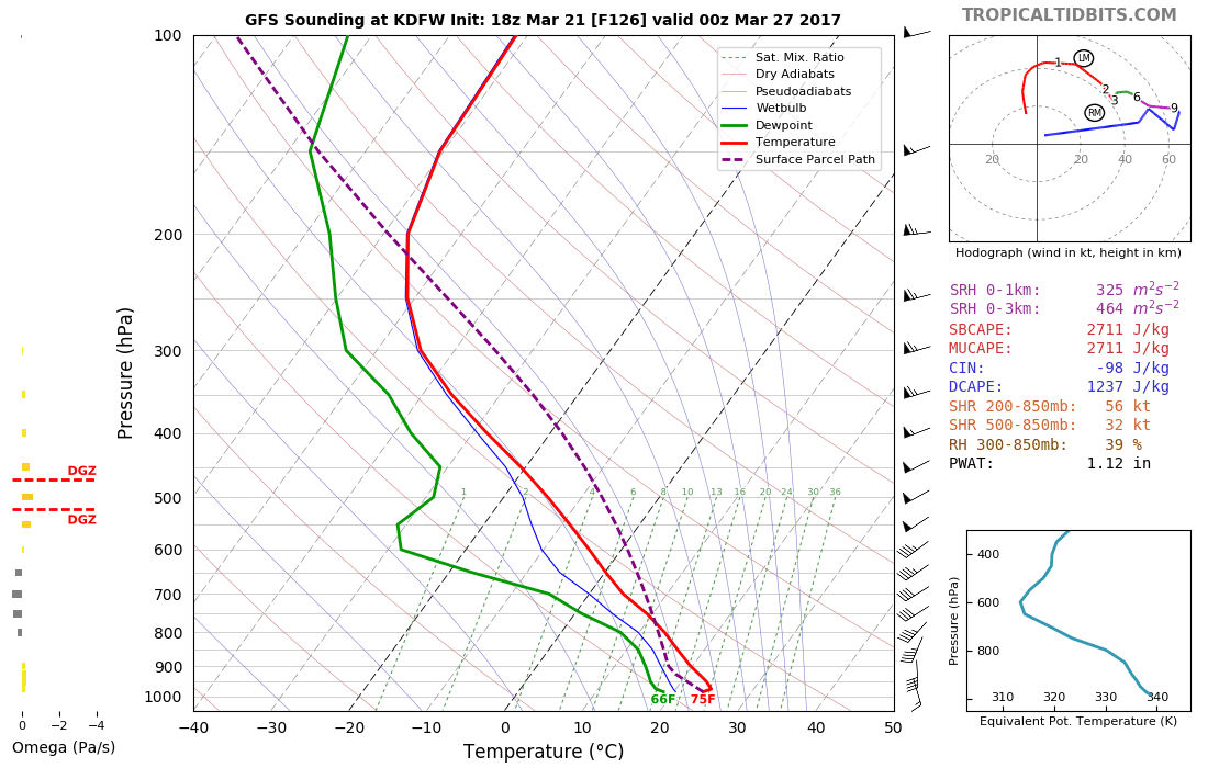
From the Storm Prediction Center... ...Day 6/Tue - Southern/Central Plains... Guidance has become more consistent in ejecting a stronger shortwave impulse across the southern Rockies and into the Plains on Tuesday. Rich boundary layer moisture will have had enough time to surge northward ahead of this feature while a lee low deepens over the northern/central Plains. Confidence in an organized severe threat developing in the vicinity of a dryline across parts of central KS into western/central OK and perhaps the eastern TX Panhandle into north TX has increased enough to introduce 15% probabilities. The severe threat may extend further north into the mid-MO Valley ahead of the eastward progressing surface cyclone, but confidence in quality moisture that far north is low at this time.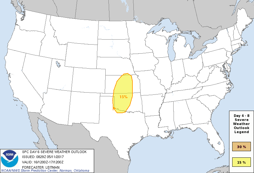
-
Central/Western Medium-Long Range Discussion
Jim Martin replied to andyhb's topic in Central/Western States
For Wednesday of next week.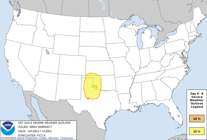
-
Central/Western Medium-Long Range Discussion
Jim Martin replied to andyhb's topic in Central/Western States
Cap breaking possibly?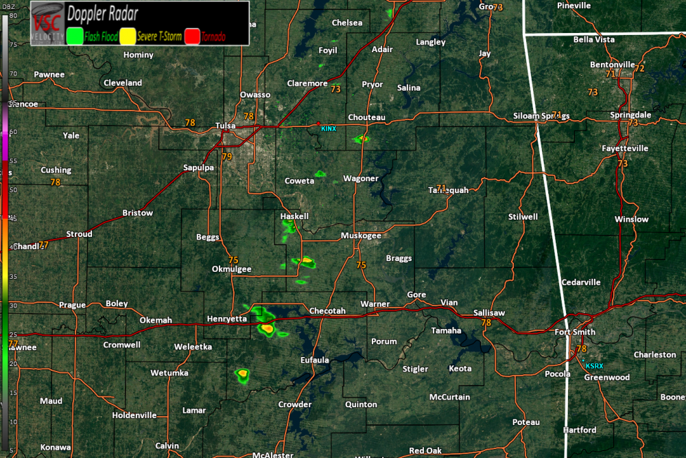
-
Central/Western Medium-Long Range Discussion
Jim Martin replied to andyhb's topic in Central/Western States
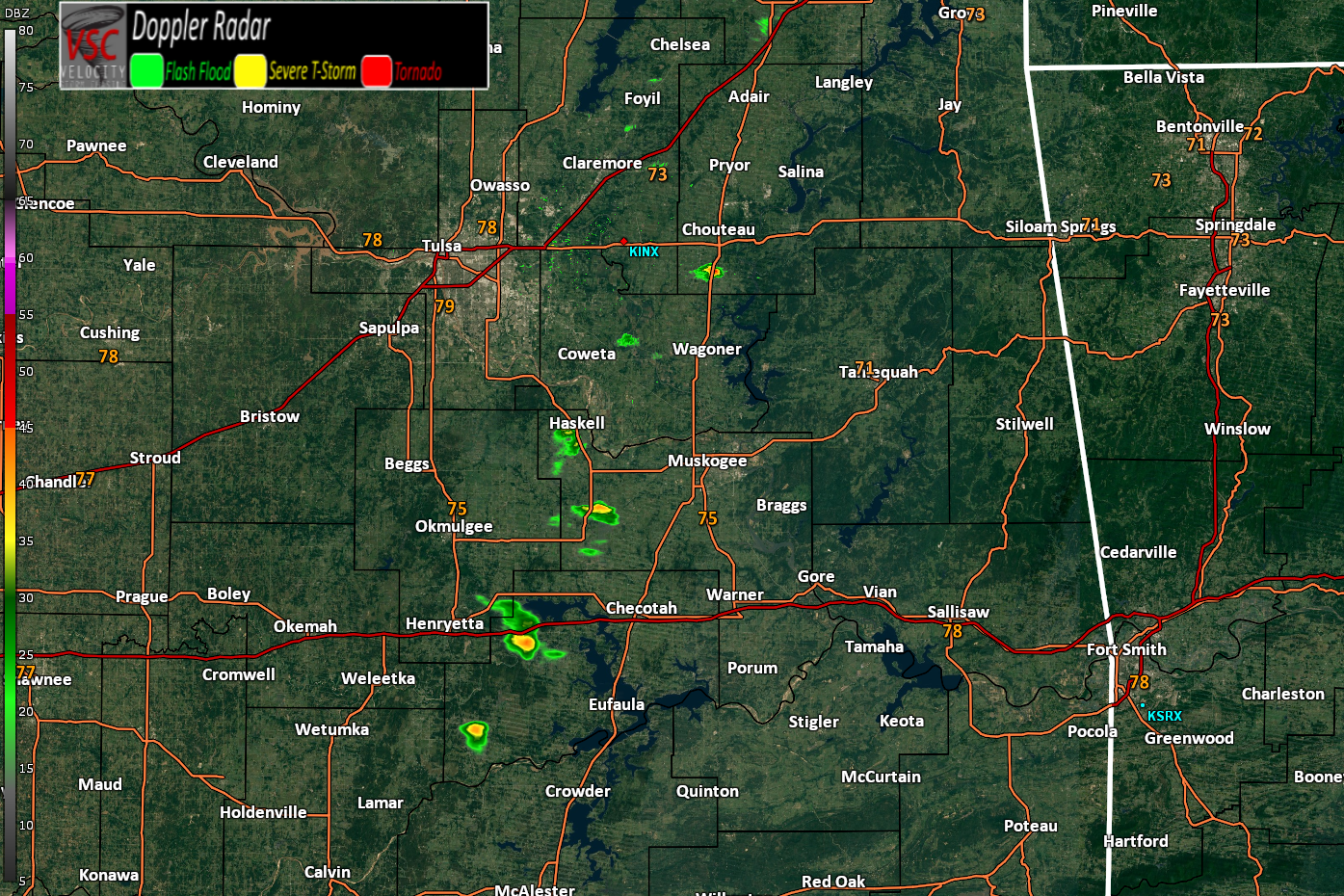
Few cells trying to develop east of Interstate 35 this hour.
-
Central/Western Medium-Long Range Discussion
Jim Martin replied to andyhb's topic in Central/Western States
To what Indystorm is referring to.
-
Central/Western Medium-Long Range Discussion
Jim Martin replied to andyhb's topic in Central/Western States
12z GFS for Sunday Evening.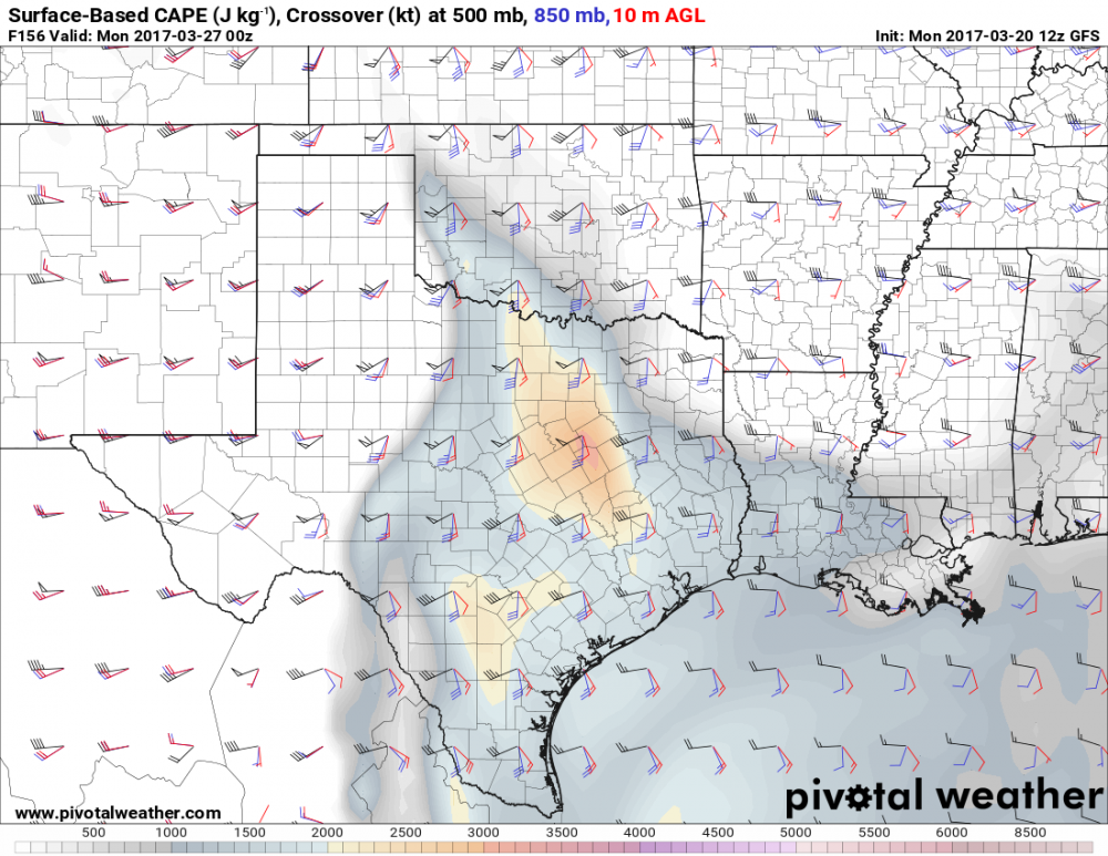
-
Central/Western Medium-Long Range Discussion
Jim Martin replied to andyhb's topic in Central/Western States
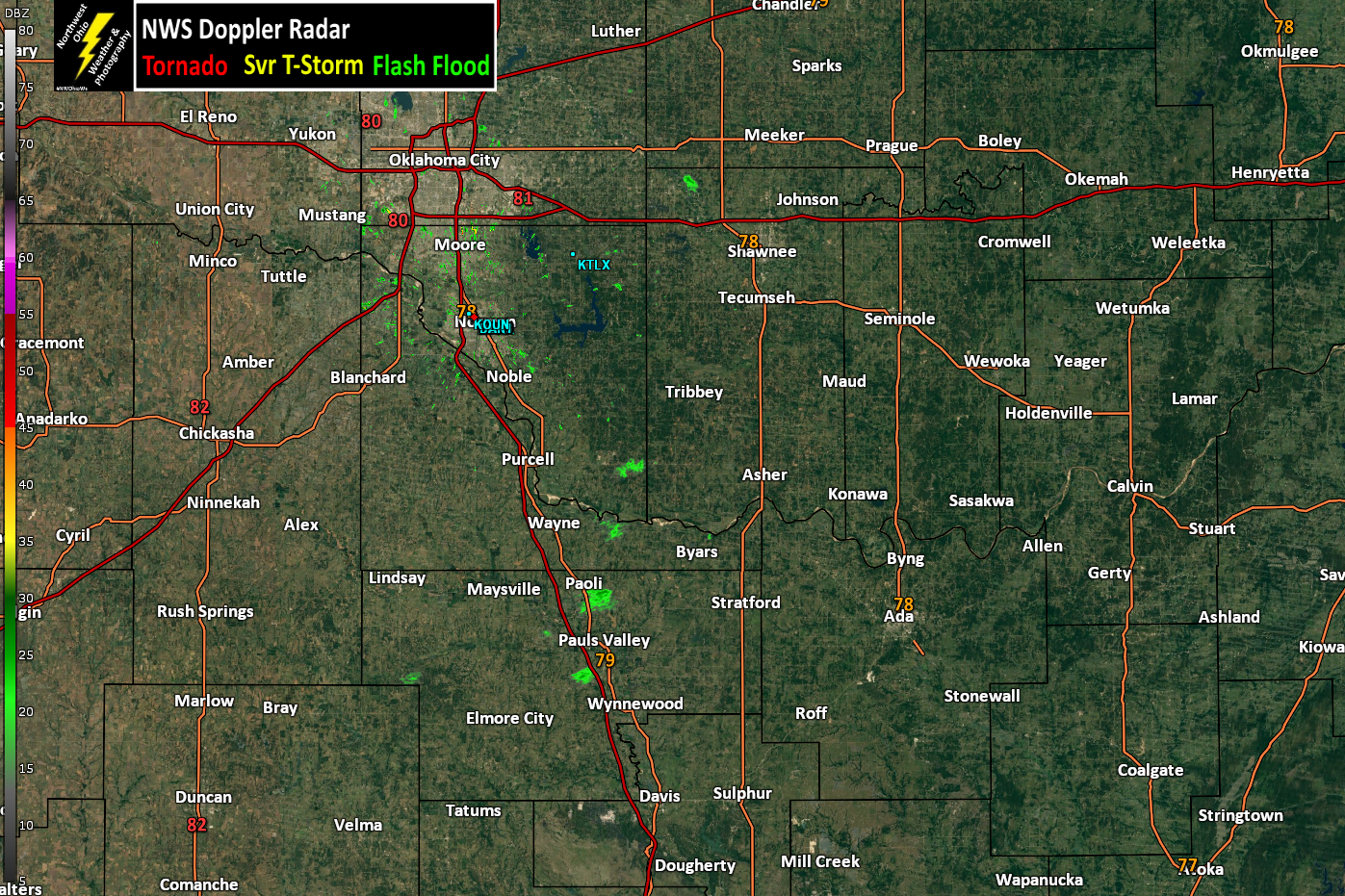
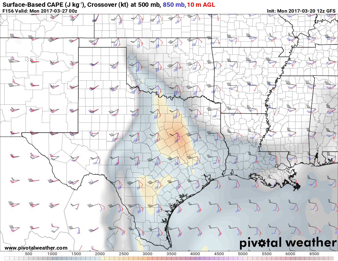
So, the Storm Prediction Center now has Eastern Oklahoma and Northeast Texas for a severe weather risk for Friday (3/24).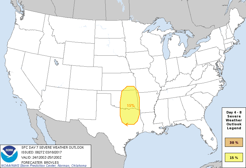
-
iwxchat 2017/03/17 1:09 PM iembot Napoleon [Henry Co, OH] EMERGENCY MNGR reports SNOW of 5.00 INCH at 1:07 PM EDT -- MEASURED BETWEEN 4.7 AND 5 INCHES.
-
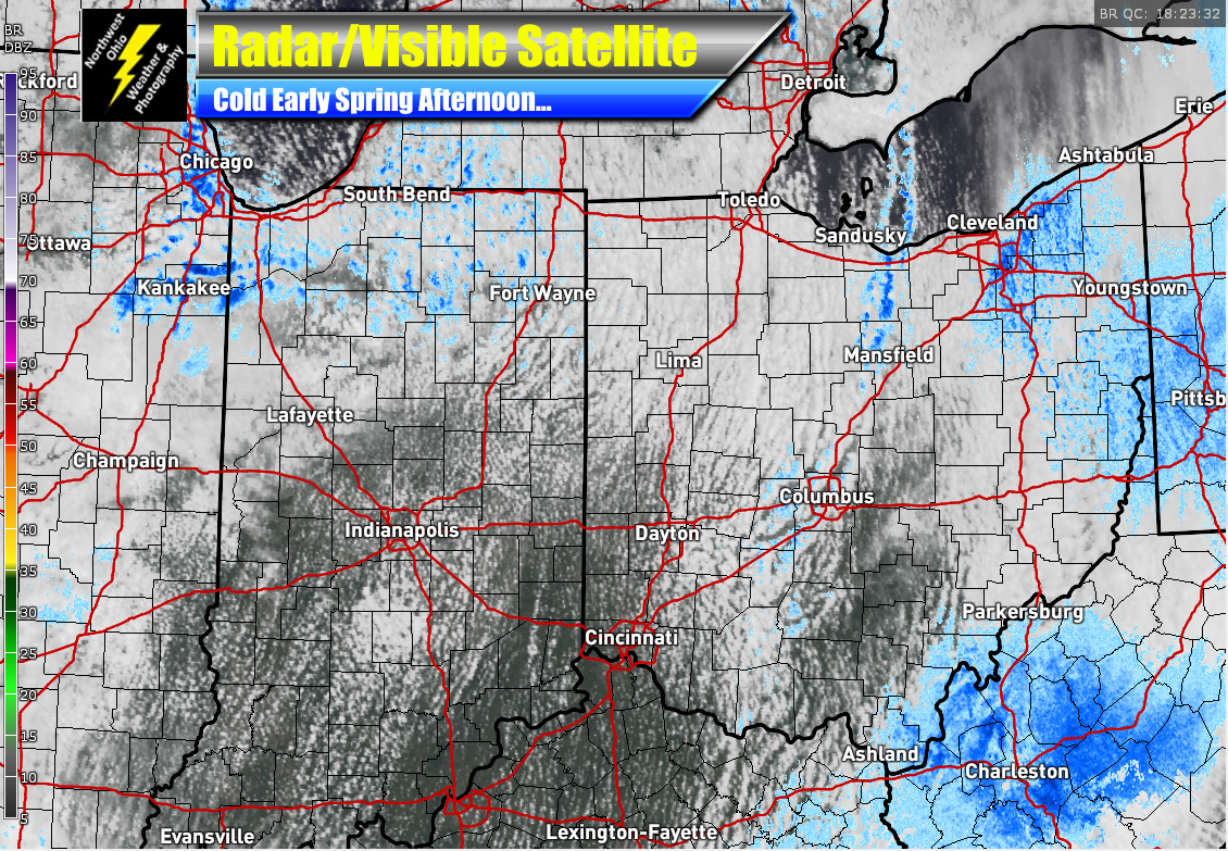
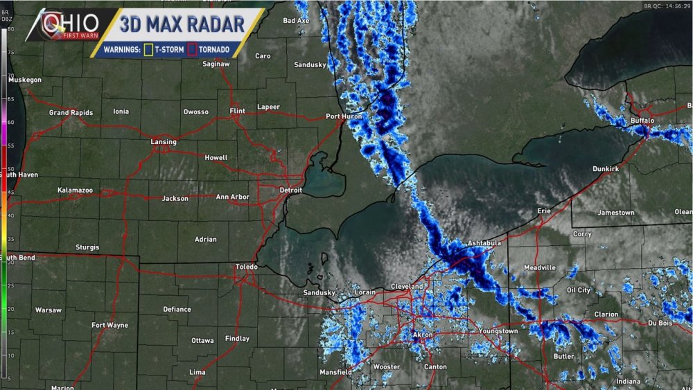
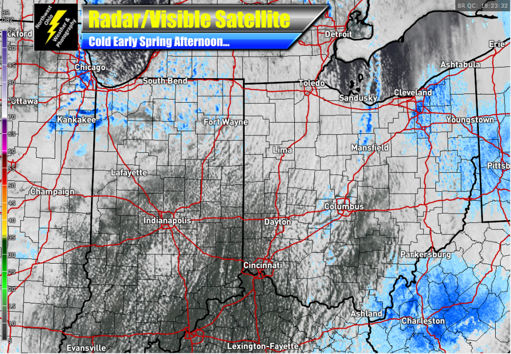
Just that cold feeling to the visible satellite view this afternoon.
-
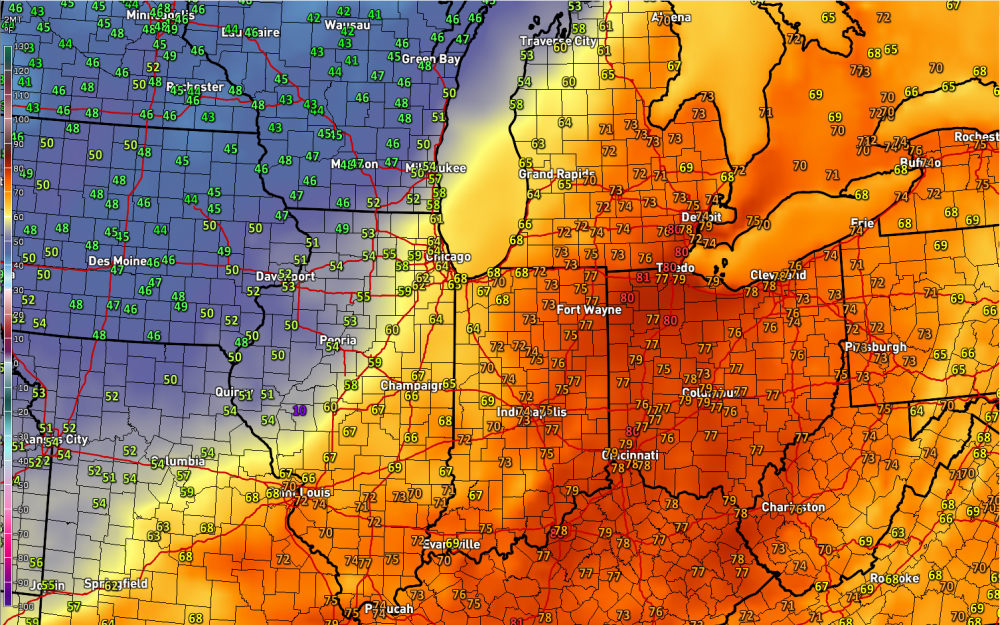
Feels more like January today than this time of year in Northern Ohio.
-
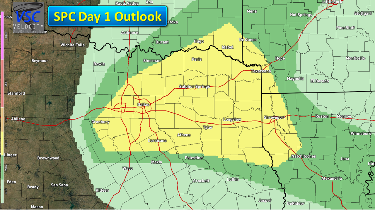
Slight risk for severe thunderstorms today in Northeast Texas. Large hail/isolated tornado main risks.

-
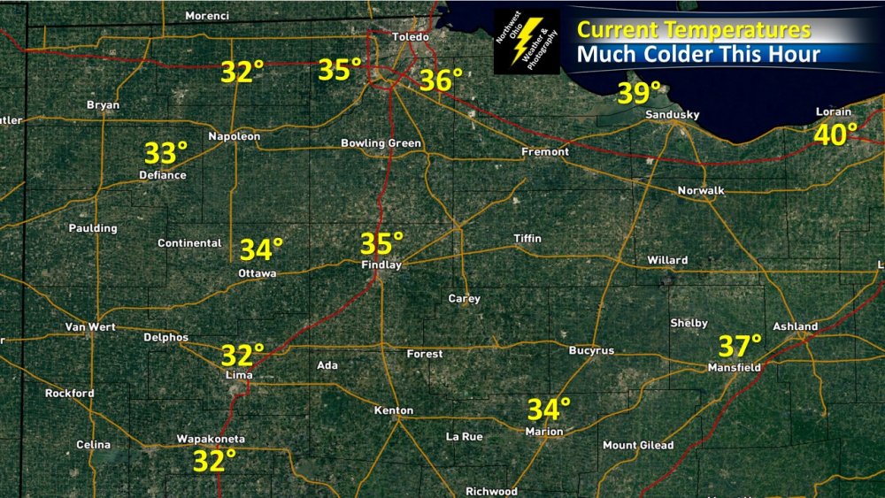
20° to 30° colder now in Northwest Ohio than this time 24 hours ago.
-
Weather Watch possible later today for Northwest Texas. All severe hazards look to be in play.
-
12z Euro basically saying Deep Freeze & Plentiful snow pack by next week...
-
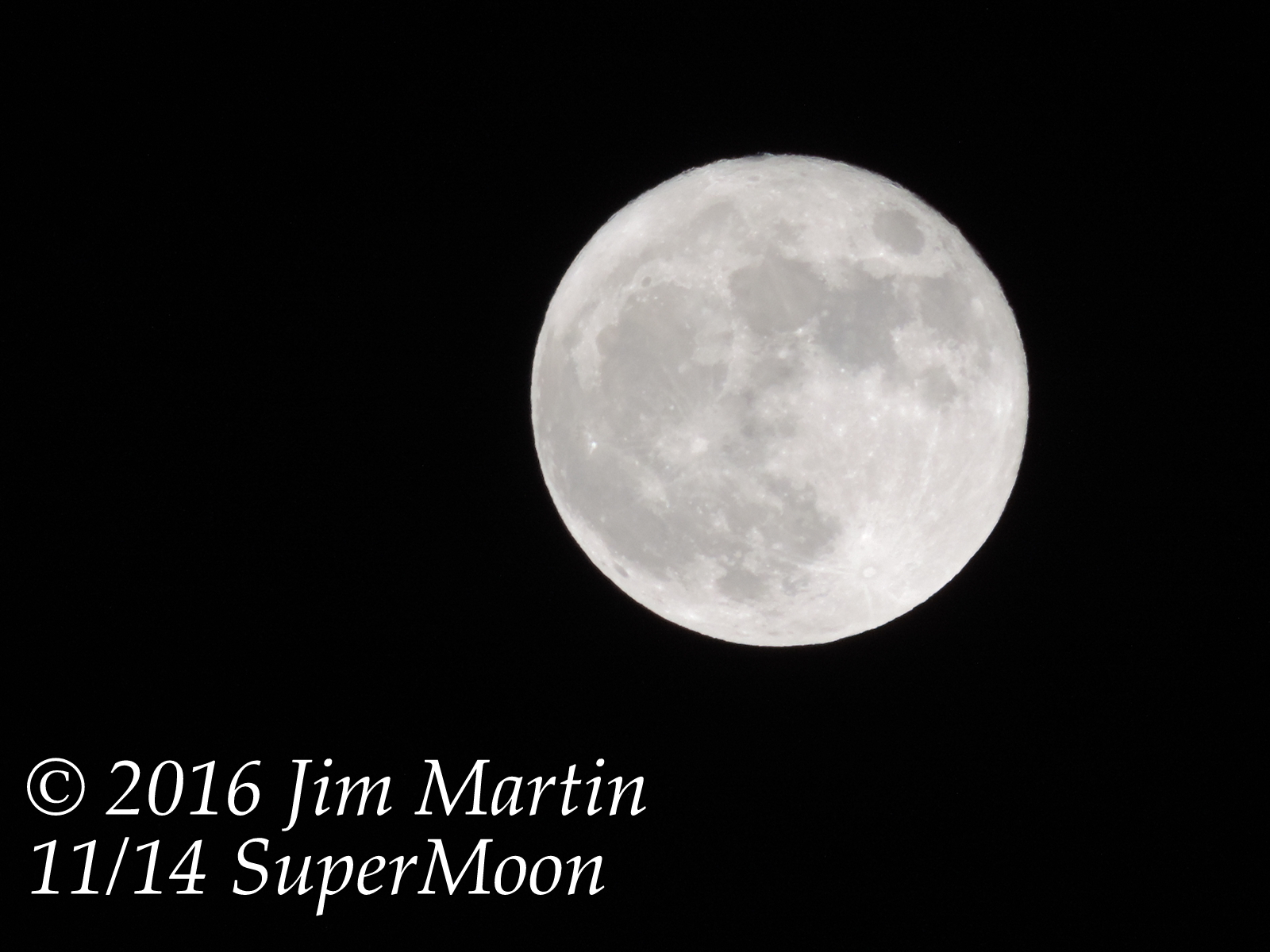
Nice view of the Supermoon tonight in Findlay.

-
Saturday Morning is starting to look a bit nippy for Northern Ohio. The Forecast Models showing low temperatures Saturday down into the lower 30s. Even though the growing season is finished, a heavy frost is looking to be a distinct possibility.
-
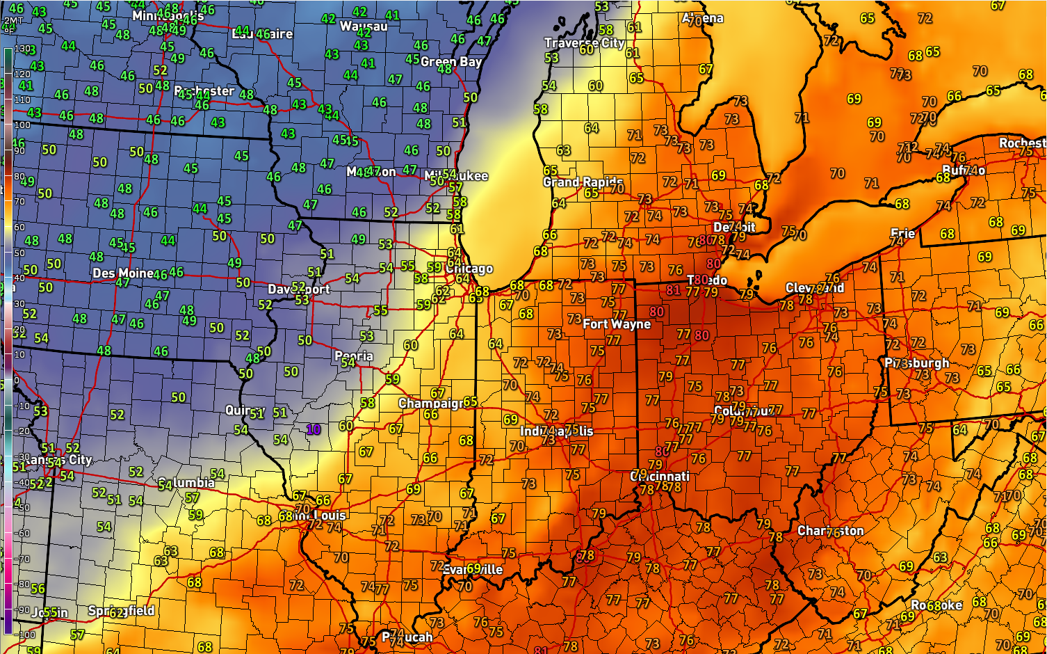
Not too hard to find where the Cold Front is here late this afternoon and early evening.
-
Historic Tornado Outbreak April 27, 2011
Jim Martin replied to CUmet's topic in Weather Forecasting and Discussion
I have had some people on my Weather or Knot blog comment that saying in their home town of Taft, Tennessee, debris from the Hackelburg AL tornado actually fell in their town.