HVSnowLover
-
Posts
2,952 -
Joined
-
Last visited
Content Type
Profiles
Blogs
Forums
American Weather
Media Demo
Store
Gallery
Everything posted by HVSnowLover
-
The Saturday storm bears watching for the NW parts of the subforum and since I have Sat mostly off I might storm chase if it comes to fruition.
-
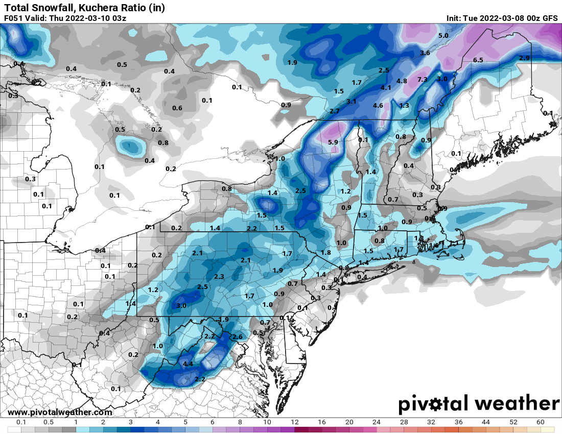
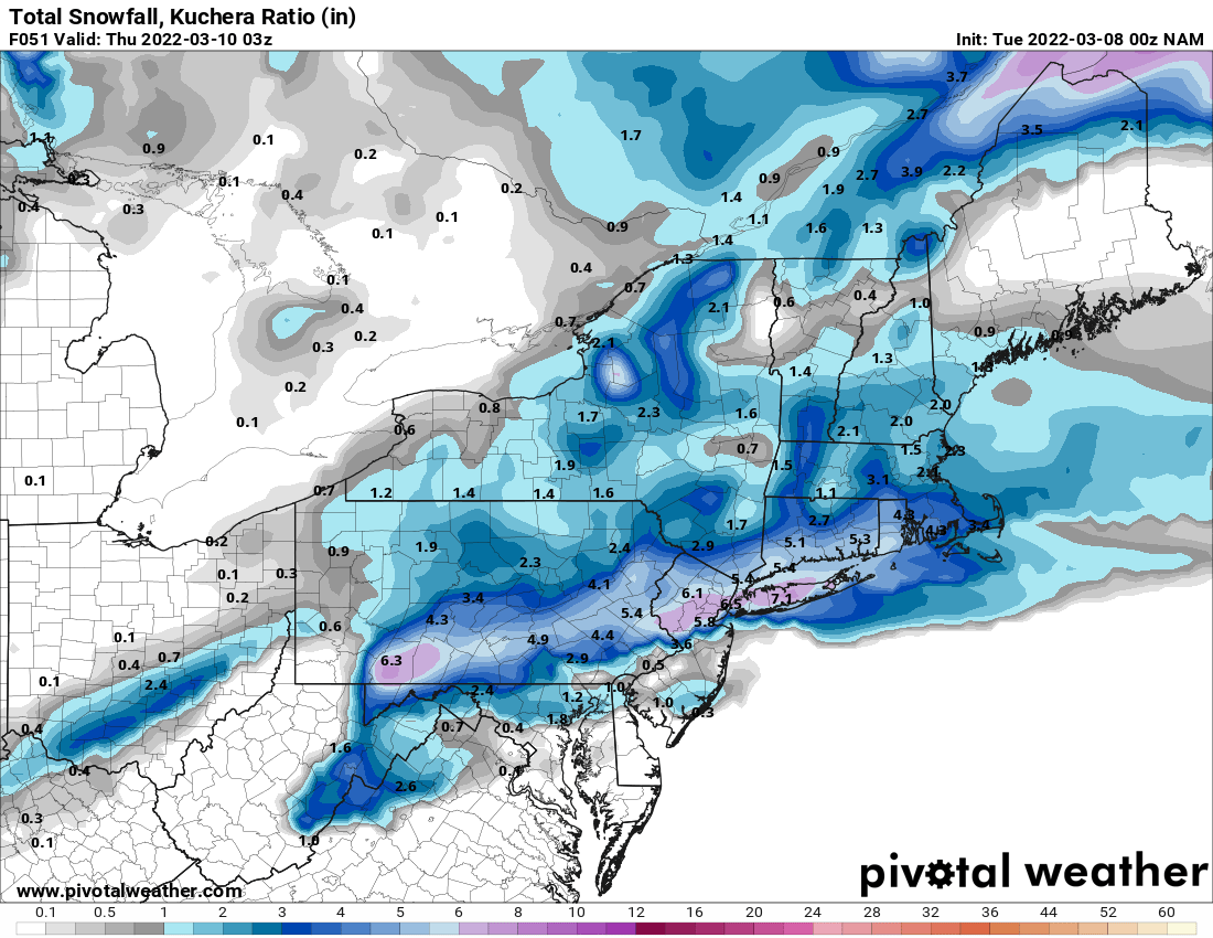
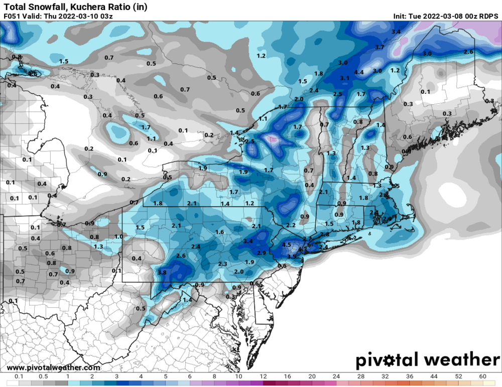
Starting to look like a disorganized mess and all the models other than NAM are basically keeping any accumulations to north of the city which as others have said will be the case unless precip is heavy.
-
Thought Nam overdone and it is but RGEM not bad for the city
-
Think its time for a thread for this.

-
Kuchera is 6 for NYC and 7 for LI, still probably not happening.
-
Suprisingly don't see a thread for the Wed storm but the metro area just got NAM'ed.
-
Initial thoughts CMC did very well with this storm. I could see qpf amounts going up with this as we closer to the event. I think this could be a storm where Manhattan is White Rain and Central and Eastern LI, Jersey Shore, and north and west of the Tappan Zee sees 2-4 inches of snow.
-
Think we may get some white rain maybe on Thursday.
-
Yea I like not having it be cold all the time but the almost 70 in late Feb and early March is a bit too much too early.
-
The Euro did jump over 500 miles east from 12Z Yesterday to 12Z today so not unfathomable the CMC type solution could verify if you compromised the two solutions.
-
CMC is now considered second best model but I agree I won't buy in at all until at least some other models show support.
-
Dont need sustained cold for snow, just need to thread a needle and get lucky.
-
I think maybe we can move from bantering mode back to tracking mode by late next week.
-
Also I used to think North and West literally meant North and West of the city, like a line from Fort Lee to Yonkers to CT Coast (and maybe it did in the 90s lol). But now North and West seems to be more like Mahwah to Ossining to Mount Kisco.
-
Nice to see the far interior finally starting to make up for an awful winter. Hopefully that snow line can move down to near NYC and the NW suburbs at some point this month. SE of NYC has already gone well over seasonal averages.
-
Agree if you listened to the news it's always 1-3 in the city, more North and West, yet winter storms are not that simple.....
-
I love your geographical and historical posts but it's not like its frozen tundra everywhere north of the Tappan Zee. I think exposure to these places helps because as a child growing up in Queens I used to think that way too.
-
I dont live near I84 but my nearest airport would be HPN.
-
Ok so maybe the area has been averaging out more if NYC totals have gone up in the last 20 years and I84 corridor has gone down?
-
Agree with combo of the two, Ocean and Sussex are crazy far off from each other climo wise and neither is that close to NYC.
-
Yea I would agree all of NJ north of a line from Trenton to the coast should be included with our zone.
-
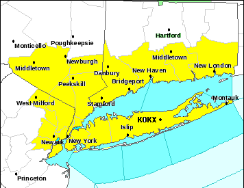
Im surprised Monmouth and Middlesex Counties are not part of Uptons zone. South and west of there is also very different climo from NYC.
-
The part in yellow is uptons forecasting zone.
-
Agree with bolded which is the real total I'm going by. Also since when did average become 29.8? I thought it was like around 26.