
WxBlue
-
Posts
2,718 -
Joined
-
Last visited
1 Follower

About WxBlue

Recent Profile Visitors
3,309 profile views


-
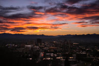
I will agree with this. I did a tornado re-analysis GIS project for my employer over the summer and that involved looking at a lot of damage pictures. This tornado had the intensity similar to Smithville (MS) and the lengthily swath of violent damage (EF4+) similar to Hackleburg (AL). Some of scenes also reminded me of Joplin, too. I don't think we should be sugarcoating how bad and extreme this tornado was regardless of the time of month. This was simply a top-tier tornado and I strongly believe we'll get epic survey results once we get everything put together.
-
That's what I thought too. Probably too warm right on the coastline, but we'll see...
-
Ahh yes... found myself looking at wintry weather of the Northeast again. I'm supposed to have a layover at Logan Airport in Boston this Sunday (from Las Vegas) so I'm definitely nervous about the icy weather.
-
Our best snow chances tend to happen with deep cold air mass ahead of it. I don't like the cold-chasing moisture events like models are hinting... they don't pan out often.
-
2019/2020 Mountains and Foothills Fall/Winter Thread.
WxBlue replied to Tyler Penland's topic in Southeastern States
Seems like a good high-elevation snow producer on models so far... we'll see. -
I'm not buying frozen precip threat until we get some more credibility from ensembles. It'd be a major climatology-buster outside mountains, otherwise...
-
Living close to family and friends again will always be worth it over weather seasons. Can't take away incredible memories of last two winters, though
-
After witnessing over 160 inches of snow last two winters, adjusting back to North Carolina winters will be very difficult. Not thrilled about living in area with 6"/year snowfall average rather than 60"/year. I'll miss having snow depth of over 6" for three months straight.
-
Yep, NAM captured my attention earlier this evening. Will be a rough couple days across Dixie Alley.
-
7.5" on the snowboard here. Solid event.
-
Just broke through 2" mark.
-
Great source for upper level divergence to assist with the lifting. Another good source is the left exit region of jet streak, but that's not relevant to this event.
-
I'll be back for it this year.
-
March 12/13/14 Blizzard/Winter Storm/WWA etc
WxBlue replied to Bostonseminole's topic in New England
I have Advanced Skywarn training from NWG GSP office, but that was a warm-season training. Definitely need to do cold-season training to get my spotter ID. -
March 12/13/14 Blizzard/Winter Storm/WWA etc
WxBlue replied to Bostonseminole's topic in New England
I called it too early. We had about 1.6" new snow on my car when I woke up so I'm calling it at 24", setting a new PR for single-storm snowfall. What a monster storm.

