jjwxman
-
Posts
343 -
Joined
-
Last visited
Content Type
Profiles
Blogs
Forums
American Weather
Media Demo
Store
Gallery
Everything posted by jjwxman
-
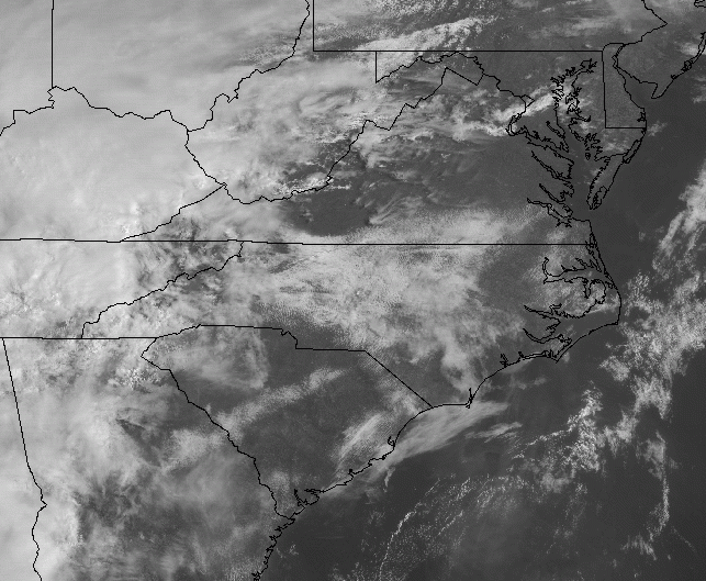
That's good analysis from RAH. The sun is beginning to break through now in south Greensboro, seeing some blue sky finally.
-
It want be long until the sun starts to break through.
-
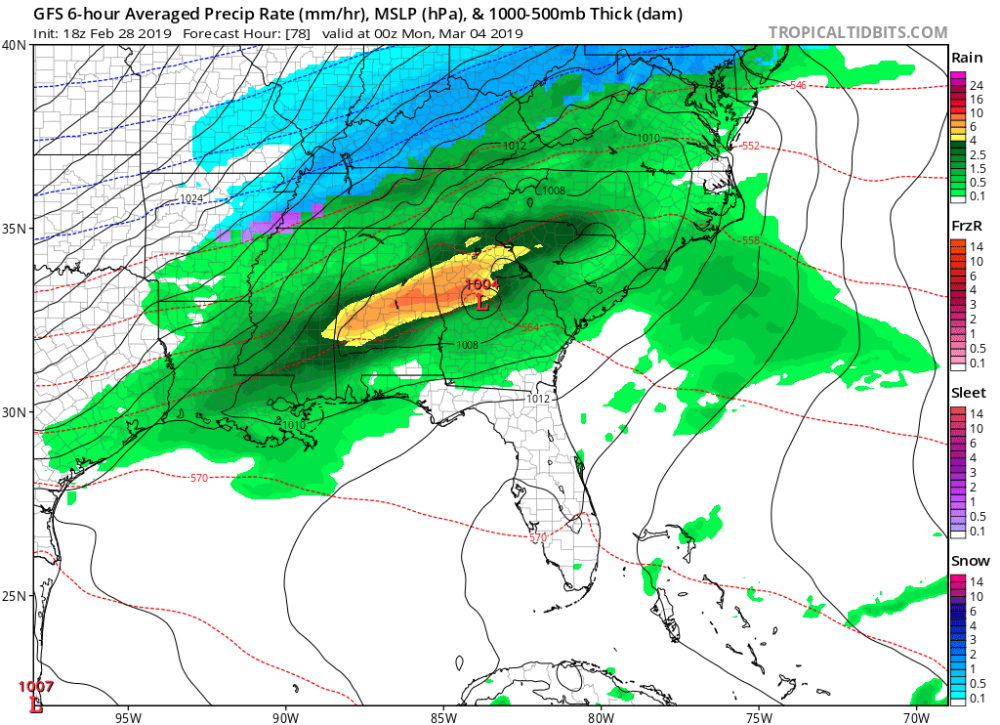
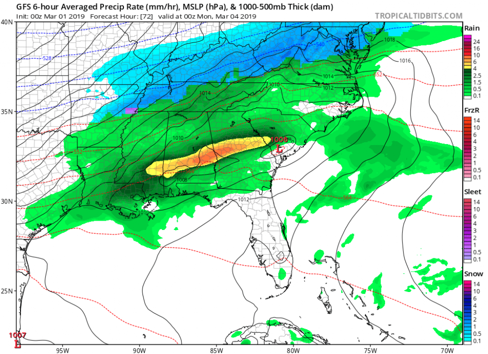
Here's the 12z HRRR sounding over central NC at 20z. Storms begin to initiate shortly after this sounding at 21z. Damaging winds, and hail seem to be the main threats. Wouldn't rule out a spin up on the more discrete cells that form ahead of the main line of convection.
-
Where the heck was this in Jan and February... lol, What Beautiful set up... The 12z Euro was just a hair too warm this run.
-
Trying my best to not get sucked in....
-
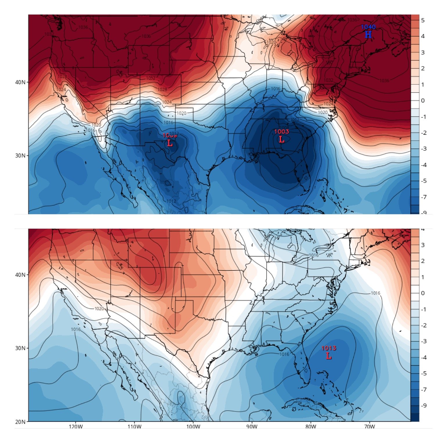
The 00z GFS has the LP considerably further south than the 18z run. Probably nothing, just intriguing to me.
-
Shocking isn't! Glad I held on to my big grain of salt! Ha!
-
Ha, the Euro now has temps in the mid 60's over central NC with thunderstorms Sunday evening/night. Ugh..............
-
Exactly... we've seen this all Winter long from one model or another. In this case most of the globals show the storm system, which is encouraging, but I'm holding on to my big grain of salt for now. Lol
-
This thread is now "hot".... Must have been a nice 12z model suite! Let's finish Winter 2018- 2019 strong!
-
Enjoy this eye candy while it lasts...
-
That HP is in a great spot for a CAD special.

-
Well at least it's not just the FV3 on board this time, there's actually some support from the globals. Something watch, but yea wouldn't surprise me at all to see it go poof!
-
GFS-FV3 now with 4-5 consecutive runs of a significant winter storm for the CAD favored areas of NC/SC/N GA. 150 hrs out... So hard to trust this model though.
-
That’s more like a leap in the wrong direction compared to the 18z. Ouch.
-
Here in the NW Piedmont of NC it hardly ever works out because of downslope. There has to be a secondary trigger like a wave of LP or an upper air disturbance to wring out any left over moisture. I'm not sold yet.
-
While we got a long ways to go, maybe just maybe this will turn into something. The CMC and Euro showing at least some potential in the Day 9 time frame. Would love to see the EPS have this closer to the coast. 12z Euro below:
-
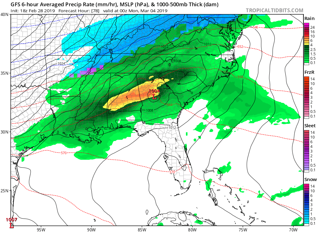
18z NAM taken verbatim, in GSO freezing rain Wednesday Morning with temps near 30, by Midnight temps could warm to near 60 degrees.... Ok, Gotta love it.
-
Great Euro run... but man I wish we were talking 5-6 days and not 9-10. But hey the CMC had this storm as well, so there's that.
-
Swing and a miss for the 12z GFS (old). Give it time...
-
That's the 12z CMC.
-
The RGEM was way overdone on cold and precip on the 12-13th event.
-
FWIW: 1/25/19. 12z OP GFS vs 12z GEFS.

-
12z HRRR...
-
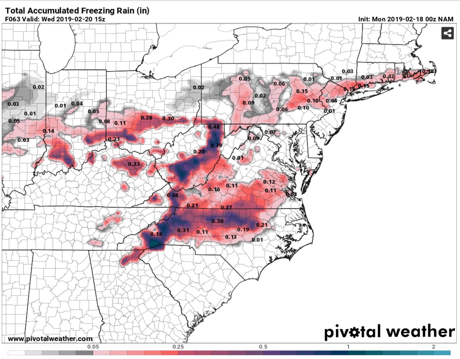
Pivotal now has skew-T plots for the CMC. Classic Ice Storm over Central NC at hour 138. Just one of many outcomes still on the table. http://www.pivotalweather.com/model.php?m=gdps&p=prateptype&rh=2019010712&fh=138&r=conus&dpdt=&mc=