jjwxman
-
Posts
343 -
Joined
-
Last visited
Content Type
Profiles
Blogs
Forums
American Weather
Media Demo
Store
Gallery
Everything posted by jjwxman
-
The 12z GFS is cooking up something massive for Christmas week.
-
I agree @SnowDawg. For reference here's Monday's 00z run and Tuesday's 00z run of the Euro for the same time frame.
-
If the CAD can lock down, it would make sense because the precipitation would arrive earlier.
-
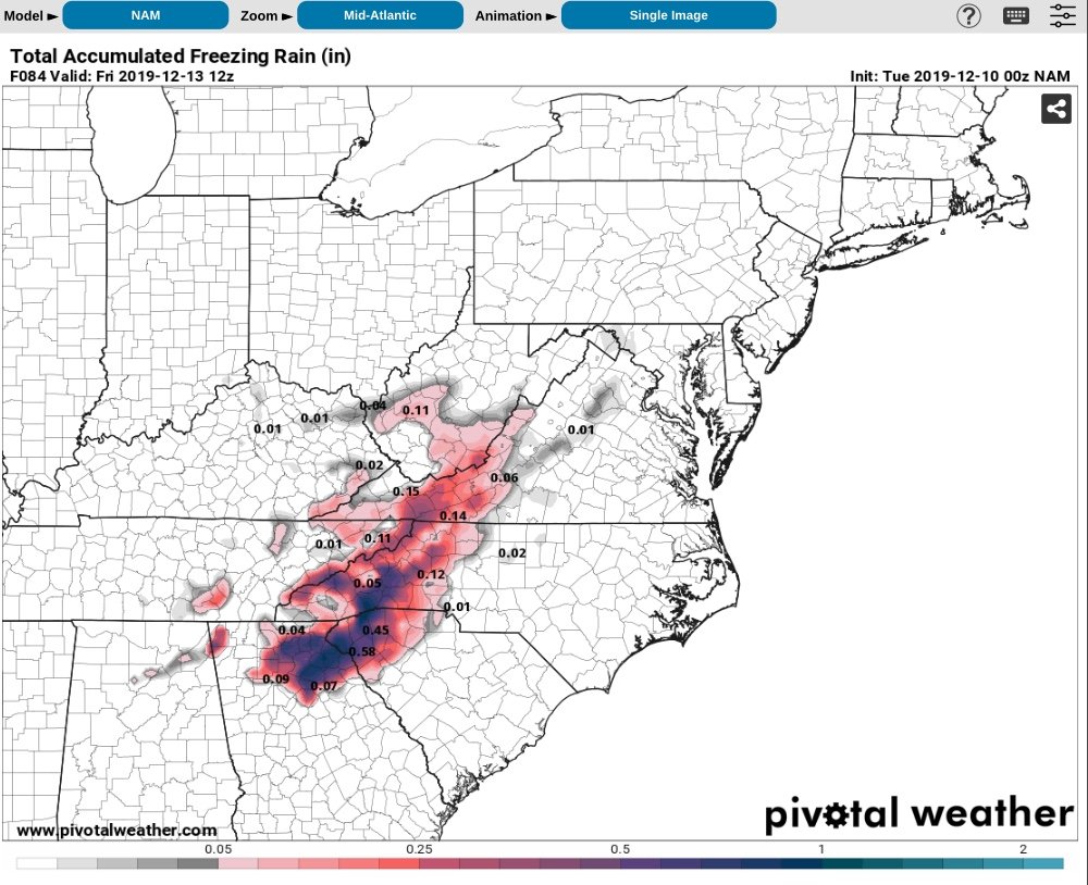
The 00z NAM serves up a Foothills special. If icing is to occur, west of I-77 seems the most plausible outcome.

-
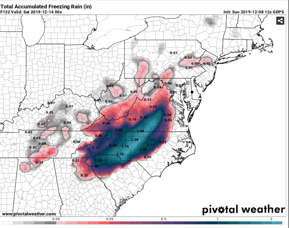
The NAM has not been as quick to move the HP out like the GFS. At hour 84 the NAM has the HP centered over Mass. while the GFS has the HP already over Nova Scotia. I tend to agree with @griteater . If anyone gets anything frozen it will be the result of impeccable timing.
-
Be careful... it's really easy to be NAM'd!! Lol But yes, that's something to keep an eye on. Looking at the 12z NAM run, the Dew Points Thursday evening are in the mid to upper teens in NC and the Upstate of SC. For comparison the GFS on the 6z run had dew points in the upper 20's, low 30's Thursday evening. The 12z NAM is actually colder dew point wise than the 00z CMC at the same time frame.
-
I deem this not safe for social media.

-
Taken verbatim, 00z GFS has a nasty Ice Storm in NC along the HWY 1 and I-95 Corridor. Some measurable snow falls in the Triangle and Triad. Temps are very marginal, so melting/run off would likely cut into all amounts shown.
-
00z GFS is barely hanging on.... for NC folks. It’s a very quick mover. We’re approaching 5 days out. We got to get some agreement from the remaining globals before I bite. @mackerel_sky not ready to pass just yet... but you’re right... the trend is your friend.

-
Wow... Now that's a text book CAD set up.
-
This is definitely intriguing. Particularly since the global models tend to underestimate the CAD at times. This has the makings of a sneaky little system.
-
With this technically being the first Winter for the new GFS... I’m anticipating whiplash all season long. Lol
-
2019 Atlantic Hurricane Season
jjwxman replied to AfewUniversesBelowNormal's topic in Tropical Headquarters
LOL at the long range 6z GFS. Basically the entire east coast will be shut down after that one. -
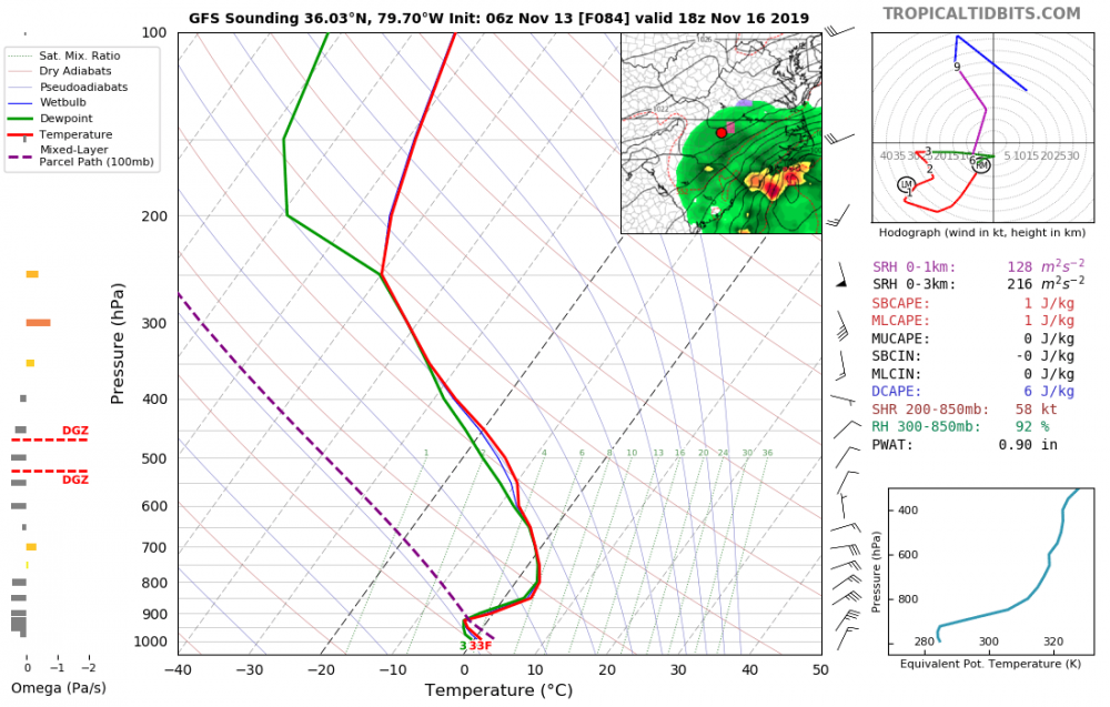
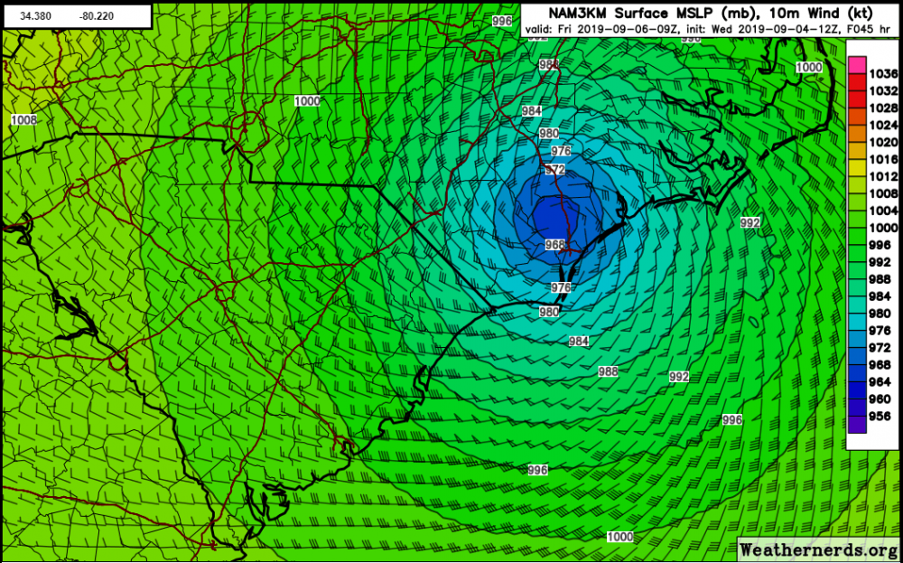
The NAM 3km overdoes the intensity with Hurricanes, we all know that... but it has a pretty good record on the tracks of Low Pressure systems. With that being said, it has been consistently showing a more westward track. The center is actually west of Wilmington on the 12z run when it comes on shore. That would definitely increase the impacts to all of Eastern NC especially since the stronger winds are east of the center. The OBX would get spanked on this track.
-
Interesting, the 6z GFS Ensemble had a quite significant shift west and has a landfall across most of extreme eastern NC now.
-
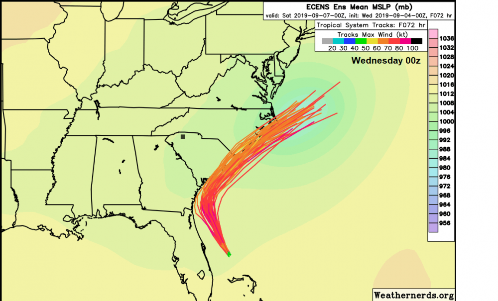
The 00z ENS also shifted closer to the coast. Image courtesy of weathernerds.org. (free site btw)
-
...And now has a 956mb Major Hurricane off the SC Coastline... I hope the Carolina's haven't let their guards down!
-
12z Euro stalls Dorian just off the FL coast for at least 24 hours at hour 96. Then the trough picks Dorian up almost due north.
-
Dorian is now a Major Cat 3 Hurricane per the 2pm Intermediate Advisory from the NHC.
-
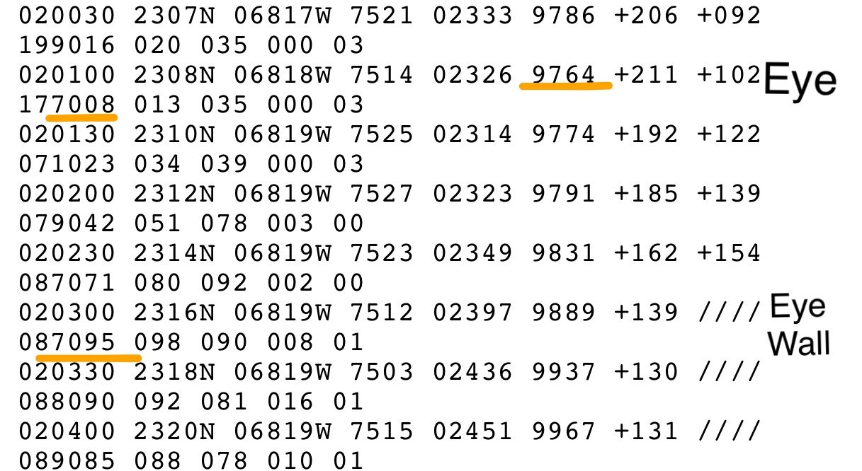
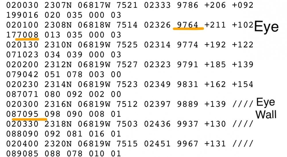
Dorian is now a Cat 2 hurricane. 976.4 mb 95 knots (109 mph... 105 mph officially) Here’s the raw data:
-
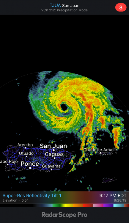
It’s not often you get to watch a strengthening Hurricane on radar. Dorian is looking healthy tonight.
-
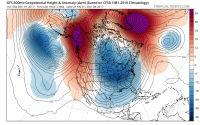
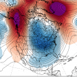
Regardless, I'm not sure if I've ever seen wind speeds this high above the surface over NC. Incredible. Lots of potential, but like @downeastnc said the bust potential is high as well.
-
The word "Historic" should only be used during or after an event IMO. 4/16/11 was historic.
-
But the 12z NAM suite just made a case for the moderate risk... Geez look at those backing SE Surface winds. Increased surface cape as well, slower with the system.
-
For the Carolinas: I don't think we'll see a Moderate Risk. (but what do i know ) There are few things that will plague this forecast. 1st. The influx of tropical moisture will likely cause a warm layer around the 700-500mb level, this will weaken the mid level lapse rates. 2nd. The whole column looks very tropical, there will likely be a lot of cloud cover so CAPE will be limited. 3rd. PW values will likely be at record territory for this time of year, and with the slow progress of the system west to east, flooding will probably be the forefront of this event from training storms. I wouldn't be surprised to see some 2-4" rain totals in some areas. 4th. If we do see some sun and decent destabilization then this could turn out to be a significant severe weather event, particular for damaging winds, the hodographs are more elongated than curved, so the tornado threat should remain isolated in nature unless we get more backing from SE surface winds. A lot to decipher over the coming days.