jjwxman
-
Posts
343 -
Joined
-
Last visited
Content Type
Profiles
Blogs
Forums
American Weather
Media Demo
Store
Gallery
Everything posted by jjwxman
-
It doesn't get more textbook than that. What a Beaut!
-
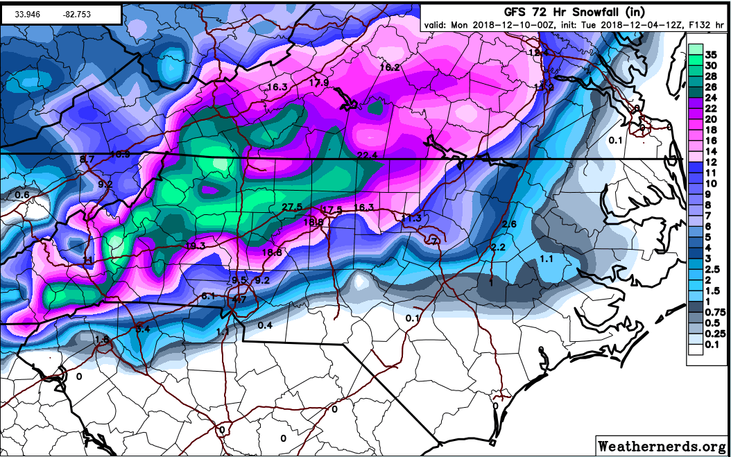
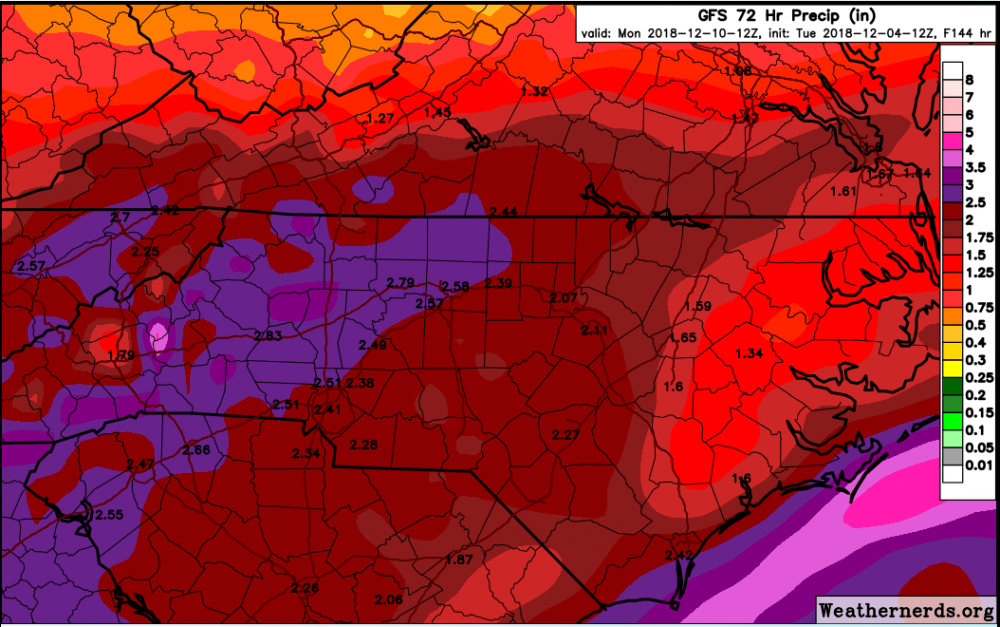
This is incredible, just the shear amount of QPF makes the Wintry part of this storm system very unique for this area.
-
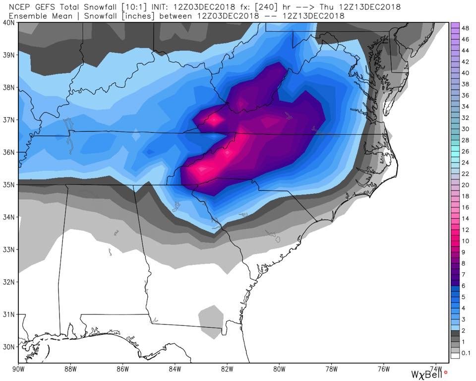
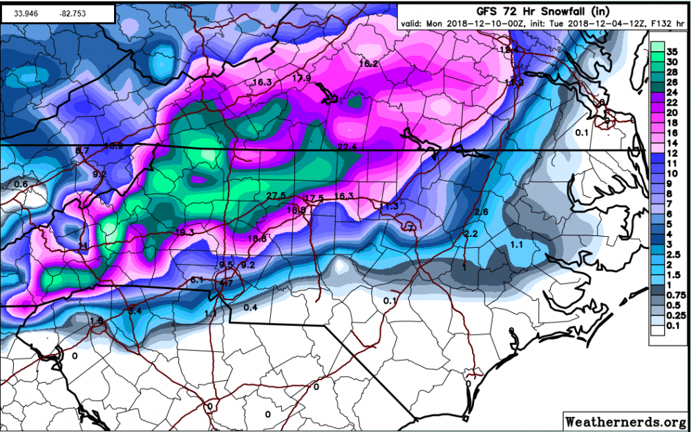
Weathernerds.org has a better snowfall map than TT IMO. It still hammers the NW Piedmont, Foothills, and Mountains. Some 30-36" totals in the mountains. Crazy. The Triad areas transition to rain but not before 1.75 if QPF as all snow falls. Damage done.
-
One thing to keep in mind is with the saturated ground and many trees that have been weakened by Michael and Florence, and many still have foliage, then you add heavy wet snow or ice, we are going to have a lot of power outages from falling trees.
-
At hour 150 there's a good 6-8" along and north of the I-40 corridor from GSO to HKY.
-
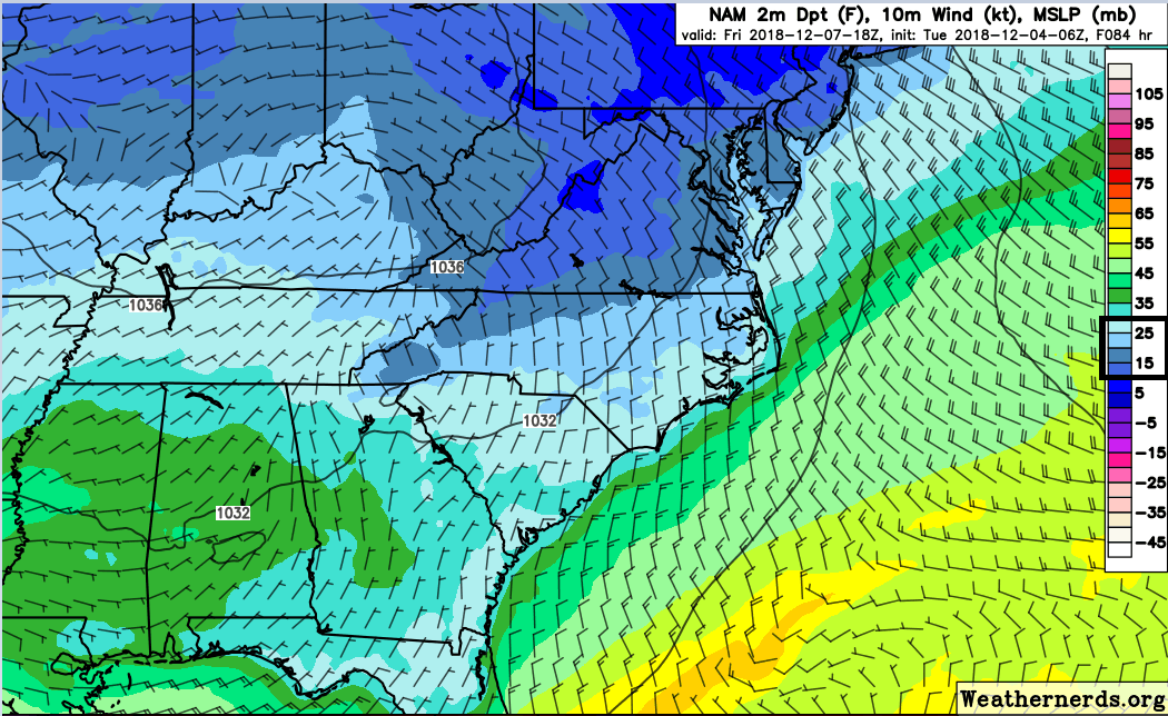
Like this? 12z NAM:
-
I agree 100%. The dewpoint on the NAM at 84 is 10-20 degrees cooler than the GFS. Now we all know the NAM past 48 hours can be a crap shoot, but these numbers are probably not all that off.

-
The HRRR also nailed the warm nose in that Jan 2017 system.
-
O M G... And here comes another LP at hour 156. These totals are going to be unbelievable... literally.
-
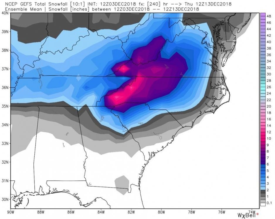
Wow, almost a carbon copy of the GEFS mean. Incredible really.
-
Does anyone have the 12z EPS mean snowfall they can share? Or what does it show for the NW Piedmont of NC? Thanks.
-
12z EPS: You really can't ask for much more than this at this stage in the game. Roll on!
-
12z GEFS snowfall mean.
-
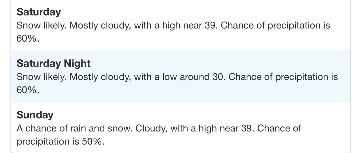
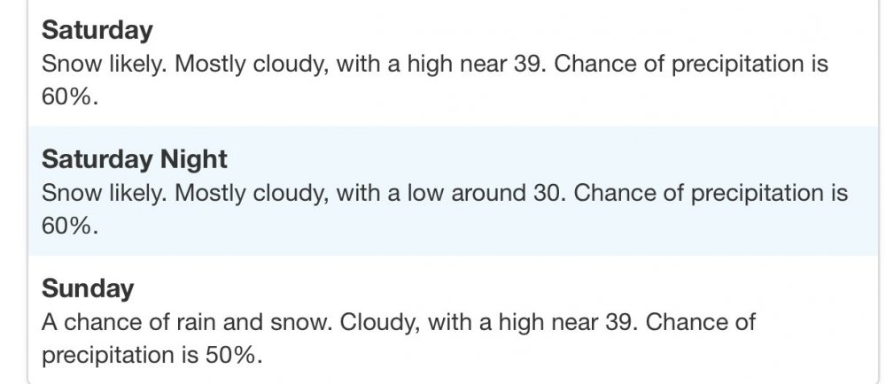
In RAH’s video update put out around 12:30pm on YouTube they told folks not to change their weekend plans, just keep aware of latest forecasts.
-
It's the NEW GFS! What could go wrong??
-
The FV3 is all love for a good portion of NC and Southern VA.
-
The 12z GFS is about to start it's run on TT. Let's see what kind of craziness the the 12z suite will us bring today.
-
FWIW the 6z GEFS had several members jump north, although the mean still looks further south.
-
I did take note of that. There were only two or three EPS members that had a somewhat close 00z OP outcome. 0 out of 50 had 30" totals like the OP had for the NW NC Mountains and SW VA.
-
RAH is all in for the Triad. Makes me a little uneasy.
-
Yea, RAH is wisely erring on the side of caution as they often do. They are mentioning that CAD favored areas may see at least a wintry mix of all P-Types Saturday night.
-
Yes I will be very surprised if the GFS doesn’t commence a more suppressed campaign for the next 24-48 hours. Always happens it seems.
-
Global models underestimate the CAD, so it may be more of a realistic outcome.
-
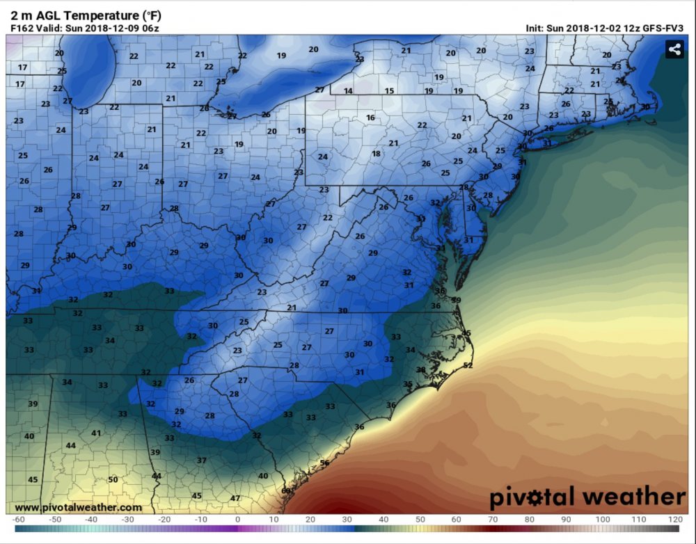
The 12z FV3 was a very cold run. http://www.pivotalweather.com/model.php?m=gfs_fv3&p=sfct&rh=2018120212&fh=162&r=us_ma&dpdt= http://www.pivotalweather.com/model.php?m=gfs_fv3&p=sfct&rh=2018120212&fh=162&r=us_ma&dpdt=