
dailylurker
-
Posts
6,037 -
Joined
-
Last visited
Content Type
Profiles
Blogs
Forums
American Weather
Media Demo
Store
Gallery
Everything posted by dailylurker
-
Why can't it just rain lol
-
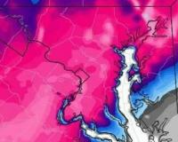
NAM is also way better this morning. Shifted the heavy rain that was over pa down into our area. Level 2 for excessive rainfall as well.
-
NAM trended south over our area for heavy rain tomorrow. 1-2" across the area. Fingers crossed
-
Looks like the drought north of us is about over while it gets worse and worse around here. All that will miss to the north. Book it.
-
Hrrrrr brings a chance for storms this evening. It definitely won't happen. If it does it's just going to hit Frederick lol
-
After Monday fails (north) that's it for rain changes. I'm glad I didn't do a garden. Come on October!
-
Clouds and no rain basically killed the chance for storms later. Looks like that storm Monday stays north. I'm getting worried mandatory water restrictions are coming. Sucks when you make a living using water lol
-
You're totally correct. I ran my mouth and cursed the lowlands. This winter will be a parade of storms that crush north of 70 while I get a wintery mix and 33 lol.
-
Wow! I haven't seen any weather since sleetfest. It sounds fun out there. Just super exciting drought here. I'm waiting in anticipation for the dark red on the drought map to move north a little bit. It's as fun as sitting in traffic on the beltway on a Saturday. I can't wait until the first LES chase this fall.
-
It's going to suck watching that heavy rain and storms in WV dry up as it comes into the desert. Edit: Not falling apart yet. Maybe a morning miracle? We'll see..
-
I've never been there during the warm seasons. I do my hiking during winter. Colder the better. I've done all the popular hikes, but without seeing a soul. I hiked to Annopoils Rocks and back from route 40 in 2024. It was -5 at the trailhead and probably -8 or -9 at the rocks. I didn't see one single soul. I've been to Cunningham Falls twice and never saw anyone. The Falls were frozen. It was really cool. I love extreme winter conditions for my hikes. I like to hike on top of the Catoctins during the windiest days of winter. I've got all kinds of stories lol Ridiculously beautiful day today. Unreal
-

2026 Mid-Atlantic Severe Storm General Discussion
dailylurker replied to Kmlwx's topic in Mid Atlantic
So just boring ass drought? Looks like it all misses to the north where they have a rain surplus lol The 10 day gfs precip map really tells the story. Just incredibly boring. -
2026 Mid-Atlantic Severe Storm General Discussion
dailylurker replied to Kmlwx's topic in Mid Atlantic
Just got done reading all the hype on Facebook lol. I just want rain. I don't care about severe. Hopefully that happens. -
What a beautiful day. I'm going to use my "I'm the boss card" and take the afternoon off. I'm meeting a friend for an afternoon hike. It will probably involve a moderate strength edible. Hopefully Thursday is active. I might use my card again and find a good view.
-
2026 Mid-Atlantic Severe Storm General Discussion
dailylurker replied to Kmlwx's topic in Mid Atlantic
Crickets in here. Models don't look super interesting for today. Hrrr develops a line of storm over DC and moves east. It looks pretty strong down near oc. It has the line coming through the lowlands around 9pm. I love a nice evening storm. Hopefully everyone gets a good soaking. NAM is congrats PA line and north.- 1,010 replies
-
- 1
-

-
- severe
- thunderstorms
- (and 7 more)
-
2026 Mid-Atlantic Severe Storm General Discussion
dailylurker replied to Kmlwx's topic in Mid Atlantic
Maybe we're on a hot hand. Last evening an orange thunderstorm rolled through around sunset. Just east of me got blased with a downburst as the storm started to collapse. I might ride down 450 and check it out later on. -
It seems like ever since 2018 the hottest weather of the season is in June. Severe thunderstorm watch
-
If we lose today at least Sunday is looking better as far as timing. Late afternoon instead of late evening.
-
Yeah. I just noticed that too. Weird
-
Just a quick shower last evening. The NAM says no worries of any storms until possible late Sunday. I thought today was the best day for storms. Bummer
-
Yup.. sucks lol. Working outside now sucks. Oh well. Better then being stuck in an office building.
-
I haven't seen all my windows fogged up like this since last season. That's always a good sign on a thunderstorm day. Last evenings classic summer thunderstorm was great. I sat outside for the entire thing. I even got to experience a couple close strikes that rocked the ground. Today looks like storm chances hold off until later in the evening. Getting another storm today would be beneficial.
-
Damn good storm imby. It wasn't one of those pours for 5 minutes and that's it. It kept coming and coming. It's still steady moderate rain and thundering. I'd estimate an inch or more. It was a classic thunderstorm.
-
2026 Mid-Atlantic Severe Storm General Discussion
dailylurker replied to Kmlwx's topic in Mid Atlantic
Full sun as well. Radar looks more impressive than I thought it would at this time of day. -
Wow! Down here in the severe drought region we're watching it dry up on radar as it approaches. My area lost its hot hand from last July.
