Go Kart Mozart
-
Posts
3,122 -
Joined
-
Last visited
About Go Kart Mozart

Recent Profile Visitors
10,670 profile views


-

-
We should move to the Catskills

-
I doubt the sun comes out...even down here.
-
Poundage.
-
Did 76-77 have a thaw of more than a day or two?
-
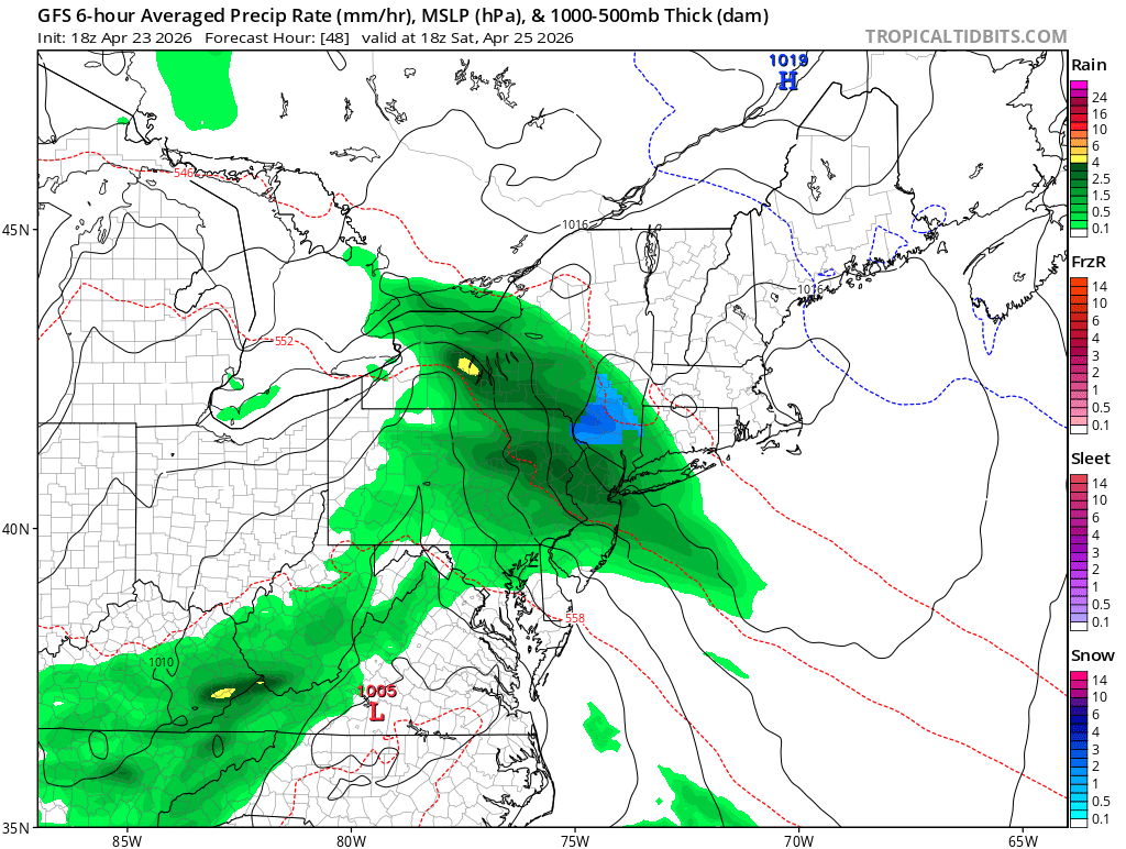
I see lots of light and mod rain obs over ePA, although a lot of dry air is pouring in below 700mb.
-
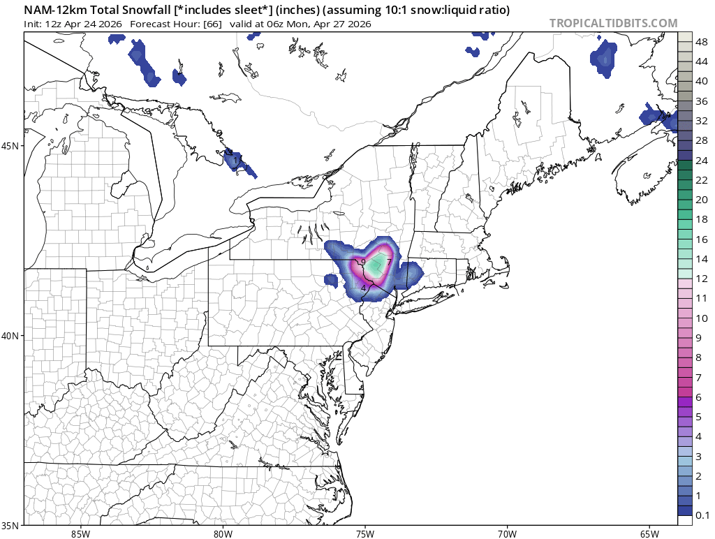
1-3", lolies to 4"
-
Big anafront event incoming
-
I was living in the north end of BDR at the time. 6".
-
As the Jon Voight character said to Ned Beatty's character in Deliverance, "we're not out of this yet".
-
Euro Skynet with lots of snow mid-month.
-
"The law of averages". You can't argue with advanced mathematics like that!
-
I am going to the Lourdes Shrine in Litchfield to light a candle for this.
-
You forgot to mention that it was uphill, both ways!
-
If we get a snap-back blizzard after the heat, I hope it comes after a couple of cold days. We don't want the snow melting on warm roads. Snow covered roads are a necessary for our enjoyment.