OSUmetstud
-
Posts
16,521 -
Joined
-
Last visited


-
Helene is not east of 84 w anyway. It's latest position is 84.2.
-
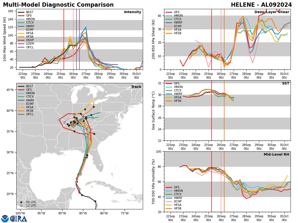
I don't really understand the question. The spaghetti models are not wholly separate from the global models. The global models are here on these plots...they're just adjusted for the current position of the hurricane in time. These are the models the nhc has used for years. The same ones.
-
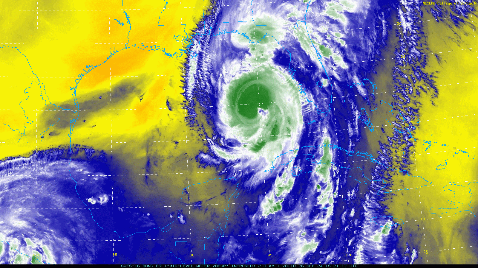
The northern eyewall is the only part producing lightning. The southern eyewall is likely not open but it's also weaker.
-
im a big fan of the hafs modeling project in general, but man these runs of going back and forth between intense hurricane and weak to moderate hurricane are a bit much.
-
These are inundation maps based on different hurricane categories. It depends on a lot of factors like the topography of land that the water is trying to flow over. https://experience.arcgis.com/experience/203f772571cb48b1b8b50fdcc3272e2c/page/Category-4/
-
This is something that Eric Webb brought up the past few days before Helene took off. I see some elements from the WSW drifting toward Helene on the mid-level WV that are originating from John's outflow to the southwest that could be affecting things. Mostly internal factors, but i think there could be something there. This is shear that's underneath the outflow layer.

-
Getting pooped emojied for having weather opinions lol
-
Yeah i thought that too, but after all of these issue today, im more on the side that the internal structure of the storm just isn't going to allow a lot of intensification before landfall. It's not like the models are really forecasting a ton of that anymore. Global and hurricane models really only seem to show slow intensification this afternoon up until landfall. Well see.
-
But drowning shots make big money.
-
This was the VDM for one hour ago. That's the best estimate for position. 046 URNT12 KNHC 261447 VORTEX DATA MESSAGE AL092024 A. 26/14:15:30Z B. 25.28 deg N 085.55 deg W C. 700 mb 2792 m D. 962 mb E. 220 deg 8 kt F. CLOSED G. C30 H. 66 kt I. 340 deg 13 nm 14:11:30Z J. 064 deg 59 kt K. 338 deg 15 nm 14:11:00Z L. 76 kt M. 091 deg 35 nm 14:25:00Z N. 186 deg 101 kt O. 090 deg 58 nm 14:31:30Z P. 14 C / 3043 m Q. 16 C / 3049 m R. 12 C / NA S. 12345 / 07 T. 0.02 / 4 nm U. AF308 1609A HELENE OB 04 MAX FL WIND 101 KT 090 / 58 NM 14:11:00Z ;
-
im guessing that's the most developed area in that region? You get a nice combo of right front quad wind there and some potential for the eastern eye. Maybe a better chance of eye in Newport or St Mark's but im also not sure of the viability of that area.
-
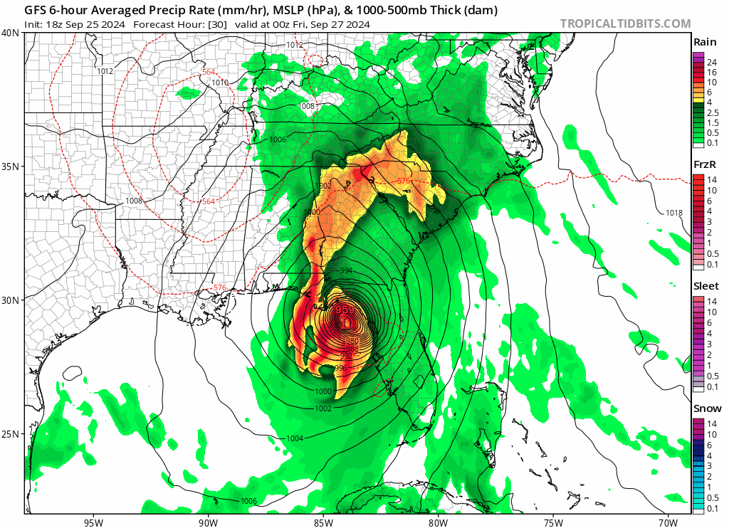
GFS continues the slowing trend.

-
Much of Helene's issues seem internal to me. I guess there could be some poorly analyzed from Hurricane John undercutting it, but i think that's less likely.
-
-
It's gained .6 degrees of latitude and has lost .2 degrees of longitude between the 12z nhc position and 14z recon center fix. It's moving nne.