HinghamBoss
Members-
Posts
381 -
Joined
About HinghamBoss

Profile Information
-
Gender
Male
Recent Profile Visitors
The recent visitors block is disabled and is not being shown to other users.
-
That was an insane storm here. Some of the most vivid cloud to ground lightning in awhile with quarter sized hail. Thunderstorm of yore.
-
Significant Miller B Nor'easter watch, Apr 3rd-4th
HinghamBoss replied to Typhoon Tip's topic in New England
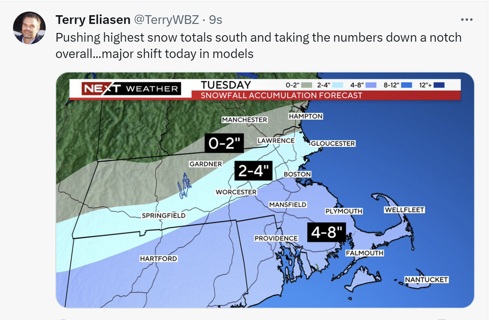
Was not banking on this one to work out given the situationals/time of year, but the last couple of days evolution is completely on script with last two years around these parts. -
From BOX: .NEAR TERM /THROUGH TUESDAY/... Key Points... * Quick hitting Winter Storm Tuesday, though the trend has been less snow and quite a bit further south. * Generally thinking the bullseye will be over southeast MA/southern RI where 6-10 inches is possible. * Dangerous travel possible with widespread 1-2" per hour snowfall rates possible Tue AM through the afternoon. May even have brief instances of 3" per hour rates. * Wet snow & strong winds along the coast may result in power outages.


