Shack
-
Posts
324 -
Joined
-
Last visited
About Shack

-
Wow. 39deg here for the low at MCN.
-
Reporting from St. Louis this morning. Out visiting our daughter and son-in-law. 39deg here this morning after a high of 93deg yesterday afternoon. Whiplash. But look at this reporting station: https://www.weather.gov/wrh/timeseries?site=UP801&hours=72 They are at 26deg have had a 63deg drop since their high of 89 yesterday !
-
63deg and Tornado Warning here in Macon-Bibb. Another fun morning with the wife and dogs huddled in the hall as this rotation passed right over my home. This was almost a carbon-copy of Thursday morning's track as the F-1 was about a mile north of my house.
-
63deg and Tornado Warning here in Macon-Bibb. Another fun morning with the wife and dogs huddled in the hall as this rotation passed right over my home. This was almost a carbon-copy of Thursday morning's track as the F-1 was about a mile north of my house.
-
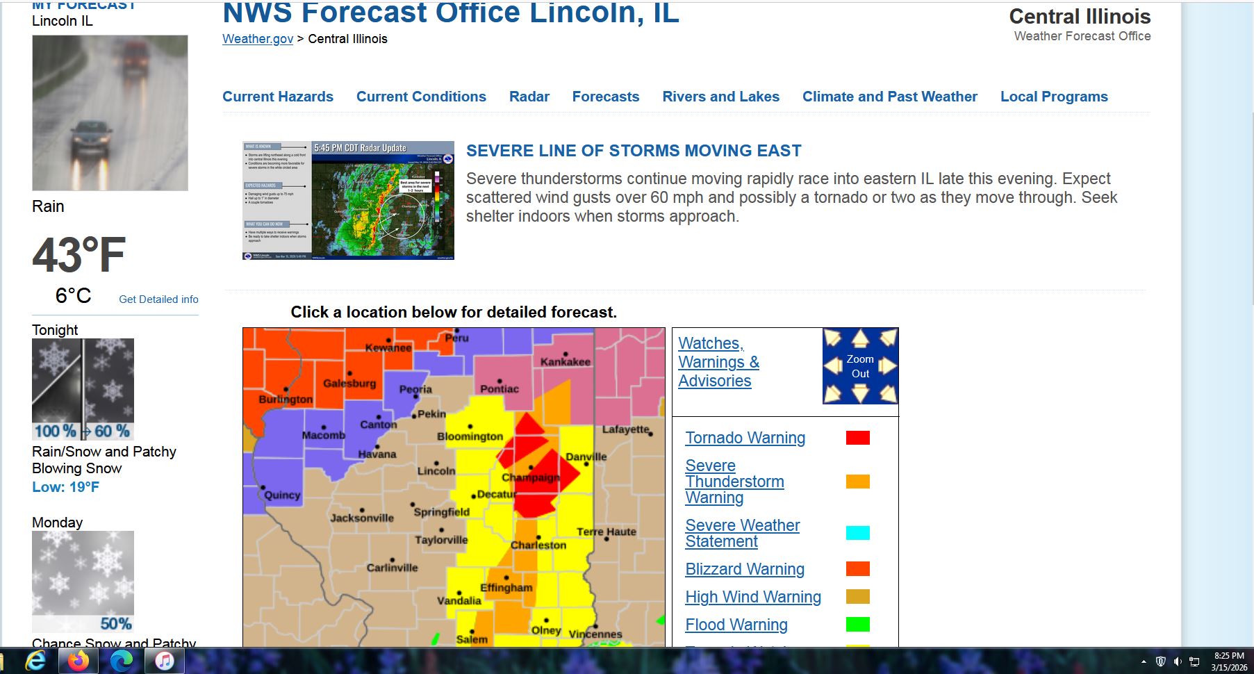
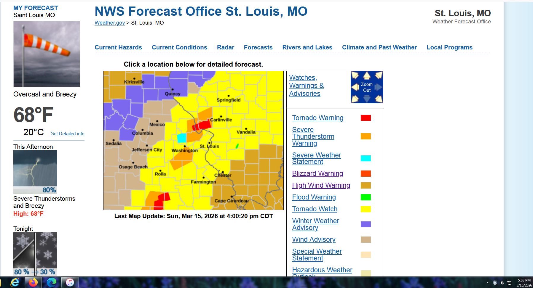
Boring here, but not in the midwest. How about a Tornado Warning and a Blizzard Warning only 70 miles apart ! And the same thing in St. Louis's market earlier today, too.


-
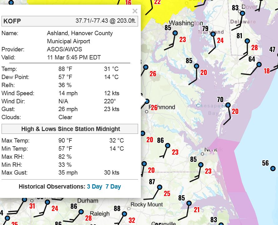
Here's a screenshot I took from the Ashland, Virginia airport's report yesterday. High of 90deg. Now look at the webcam right now.
-
Heckuva show being put on in Cape Cod. https://www.earthcam.com/usa/massachusetts/provincetown/?cam=capecodbay
-
ATL in the crosshairs. Wait 'til the socials get a peek at this....
-
The “I bring the mojo” Jan 30-Feb 1 potential winter storm
Shack replied to lilj4425's topic in Southeastern States
An ode to our Raleigh clan. It was hard for any of us to watch that transpire. The snow was predicted, a lot-us. Their hopes up, then came the, dry-slotus They threw in the towel With complaint and a grow'l Well, at least this time, it wasn't too hot-us. -
This little stretch of three weeks has been the most fun in quite a while here. Three weekends, three storms, with yesterday's being the exclamation point. Ya'll remember how warm it was on Christmas ? (81deg here in Macon) Little did we know.....
-
January 30th- Feb 1st ULL and coastal storm obs
Shack replied to JoshM's topic in Southeastern States
At the risk of the Raleigh crew hunting me down and beating me with a dry snow-board,....
-
January 30th- Feb 1st ULL and coastal storm obs
Shack replied to JoshM's topic in Southeastern States
Oh, my dang ! Yeah, likely won't amount to much, but my friends in that area are ecstatic. Model, schmodel. Never know until somethin' is happenin'.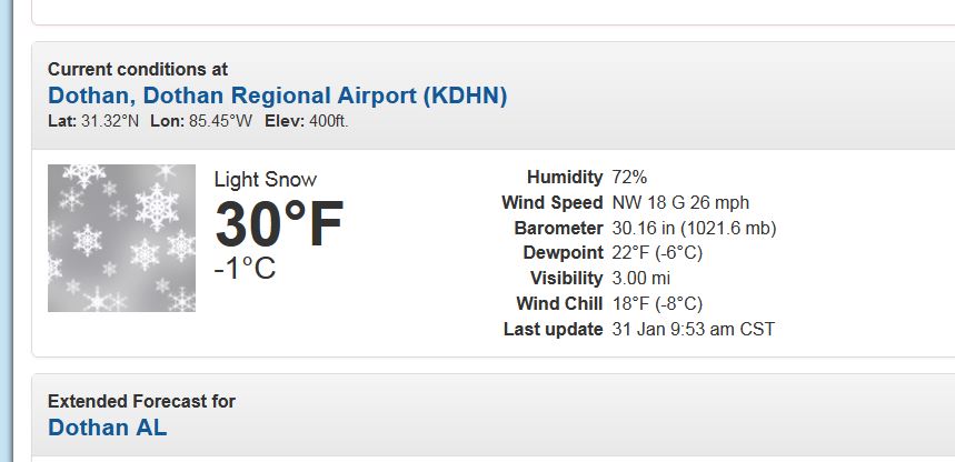
-
The “I bring the mojo” Jan 30-Feb 1 potential winter storm
Shack replied to lilj4425's topic in Southeastern States
Oh, my dang ! Yeah, likely won't amount to much, but my friends in that area are ecstatic. Model, schmodel. Never know until somethin' is happenin'.
-
The “I bring the mojo” Jan 30-Feb 1 potential winter storm
Shack replied to lilj4425's topic in Southeastern States
Nice band on radar back in Alabama between Birmingham and Montgomery. I don't recall seeing it modeled. I was suspicious that it might be virga but I do see MPING snow reports from it. Just hoping that feature holds together as the ULL moves east and I see a few flurries here in Macon.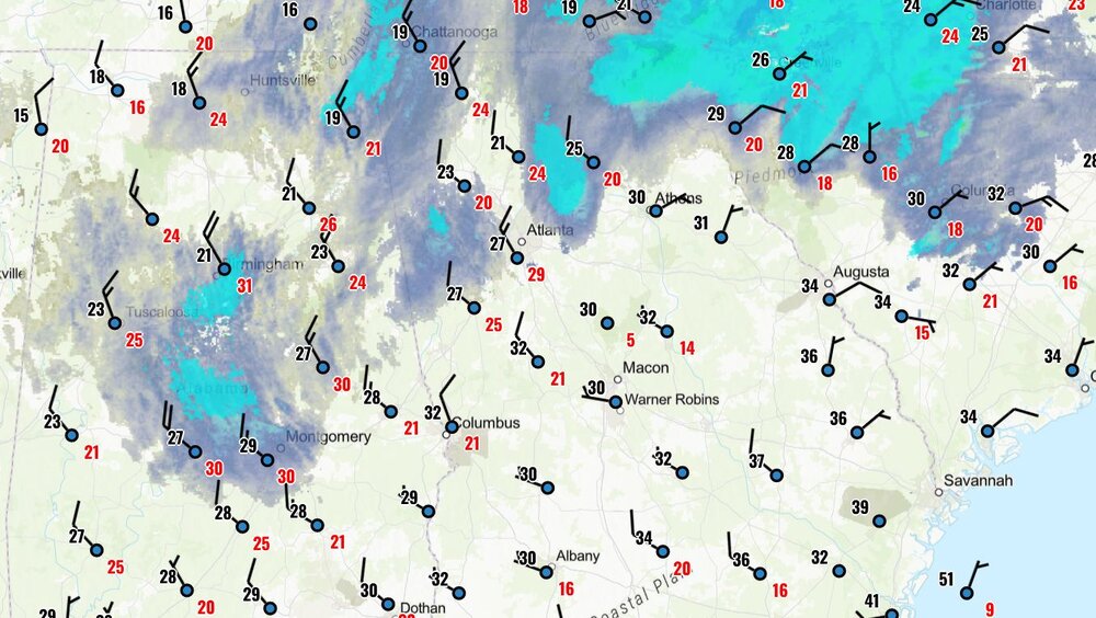
-
The “I bring the mojo” Jan 30-Feb 1 potential winter storm
Shack replied to lilj4425's topic in Southeastern States
Hot Dang ! We got Dick Tracy and Beethoven in the room. Ya'll know somethin's goin' down !