winter_warlock
-
Posts
3,359 -
Joined
-
Last visited
About winter_warlock

- Birthday May 18
Recent Profile Visitors
10,259 profile views


-
 I agree. Never seen that happen ...but I'm from a different time . Hell I graduated in 1985 ! I'm olddddddd
- 1,093 replies
-
- 1
-

-
- severe
- thunderstorms
- (and 1 more)
-
Damn I've never seen a school system let out early for the risk of thunderstorms . Damn
-
Thanks bro I know I saw that that's why I deleted it lol
-
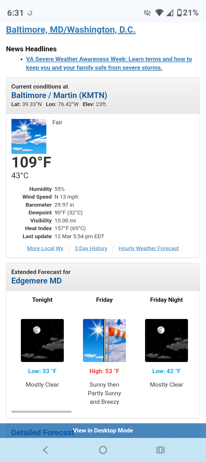
80 Degrees to Ripping Snow: March 12th
winter_warlock replied to SnowenOutThere's topic in Mid Atlantic
This is obviously a typo by LWX
-
80 Degrees to Ripping Snow: March 12th
winter_warlock replied to SnowenOutThere's topic in Mid Atlantic
Has changed to snow here in Sparrows point MD
-
Ok real stupid question for u all... Check out this system in the gulf... Would that be a tropical system in March??

-
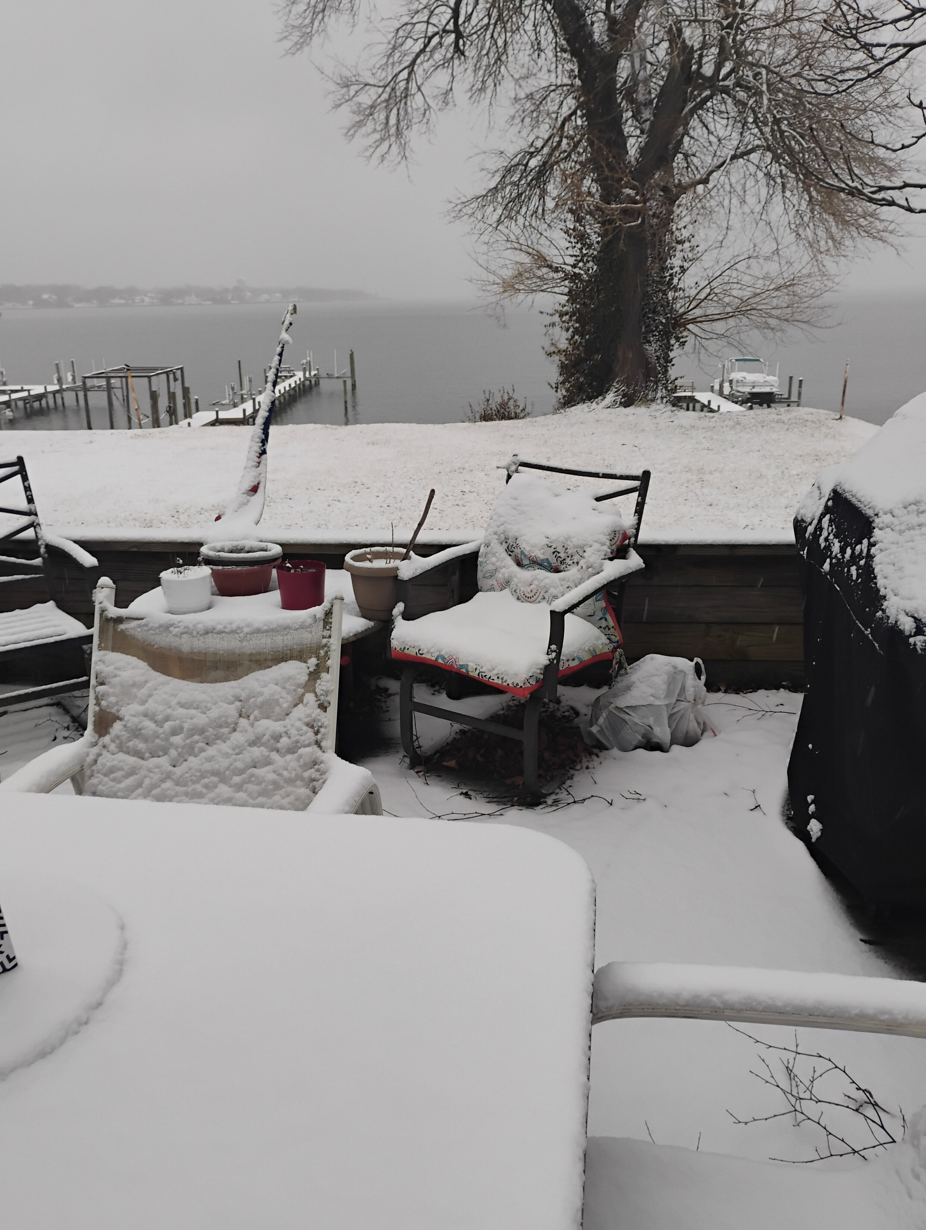
Winter of 2025-2026 total snowfall IMBY() Sparrows point MD) Dec 5-6th... .75 inches of snow Dec 13-14th. 2.125 inches Jan 1st ... .100 inches Jan 18th... .30inches Jan 24-25th. 10.3 inches Feb 22-23. 3.00 inches March 2nd. 1.00 inches ________________________________ Total snow..... 17. 575 inches
-
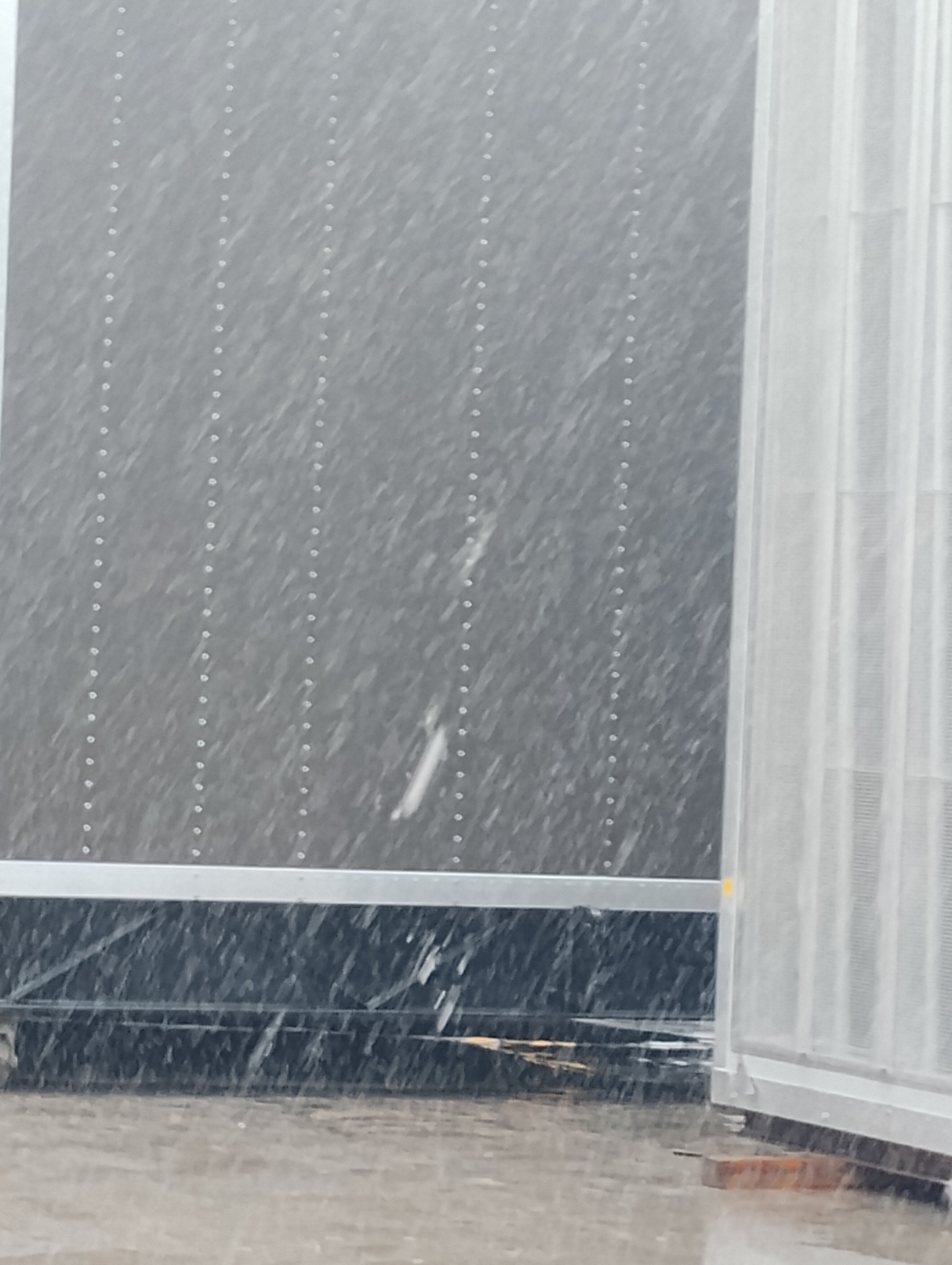
Outta gas and Outta Time: Early March Winter Storm finale
winter_warlock replied to Ji's topic in Mid Atlantic
I'm up to 1 inch here in sparrows point MD 32.3 F
-
Outta gas and Outta Time: Early March Winter Storm finale
winter_warlock replied to Ji's topic in Mid Atlantic
Light snow falling here. 31 F. About .25 inches here in sparrows point MD -
Outta gas and Outta Time: Early March Winter Storm finale
winter_warlock replied to Ji's topic in Mid Atlantic
Probably cause it's nothing worth posting -
Outta gas and Outta Time: Early March Winter Storm finale
winter_warlock replied to Ji's topic in Mid Atlantic
Well at this point of the season that's better then nothing!! I'll take it!! -
Outta gas and Outta Time: Early March Winter Storm finale
winter_warlock replied to Ji's topic in Mid Atlantic
Then why r u here during the winter?? -
Outta gas and Outta Time: Early March Winter Storm finale
winter_warlock replied to Ji's topic in Mid Atlantic
We want euro south,... GFS north lol -
Outta gas and Outta Time: Early March Winter Storm finale
winter_warlock replied to Ji's topic in Mid Atlantic
Euro AIFS looks decent but I don't think it has a lot of support -
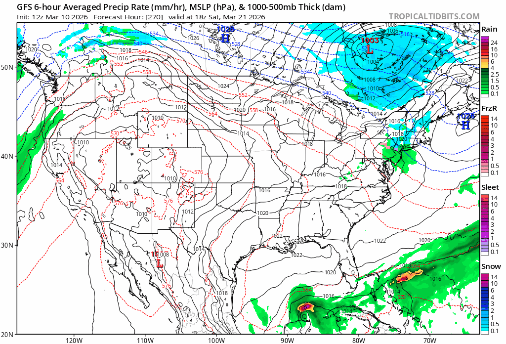
Late February/Early March 2026 Mid-Long Range
winter_warlock replied to WxUSAF's topic in Mid Atlantic
My only hope is the very cold temps we've had this winter will delay or maybe cut down on the amount of mosquitoes we get this year !