ineedsnow
-
Posts
22,757 -
Joined
-
Last visited
1 Follower

About ineedsnow

- Birthday 02/02/1986
Recent Profile Visitors
44,393 profile views


-

Augdewst 2026: Summer's Last Stand
ineedsnow replied to Prismshine Productions's topic in New England
Even saw a few around here.. ill snap a Pic tomorrow if I remember -
Augdewst 2026: Summer's Last Stand
ineedsnow replied to Prismshine Productions's topic in New England
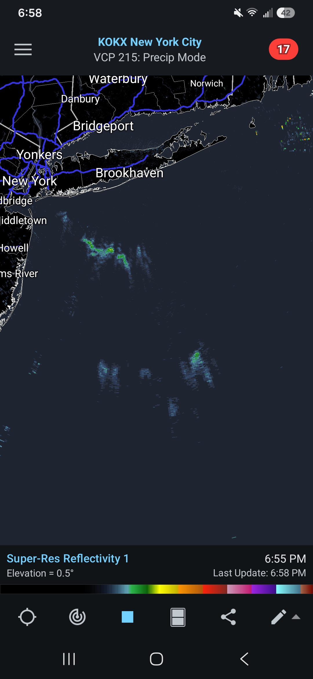
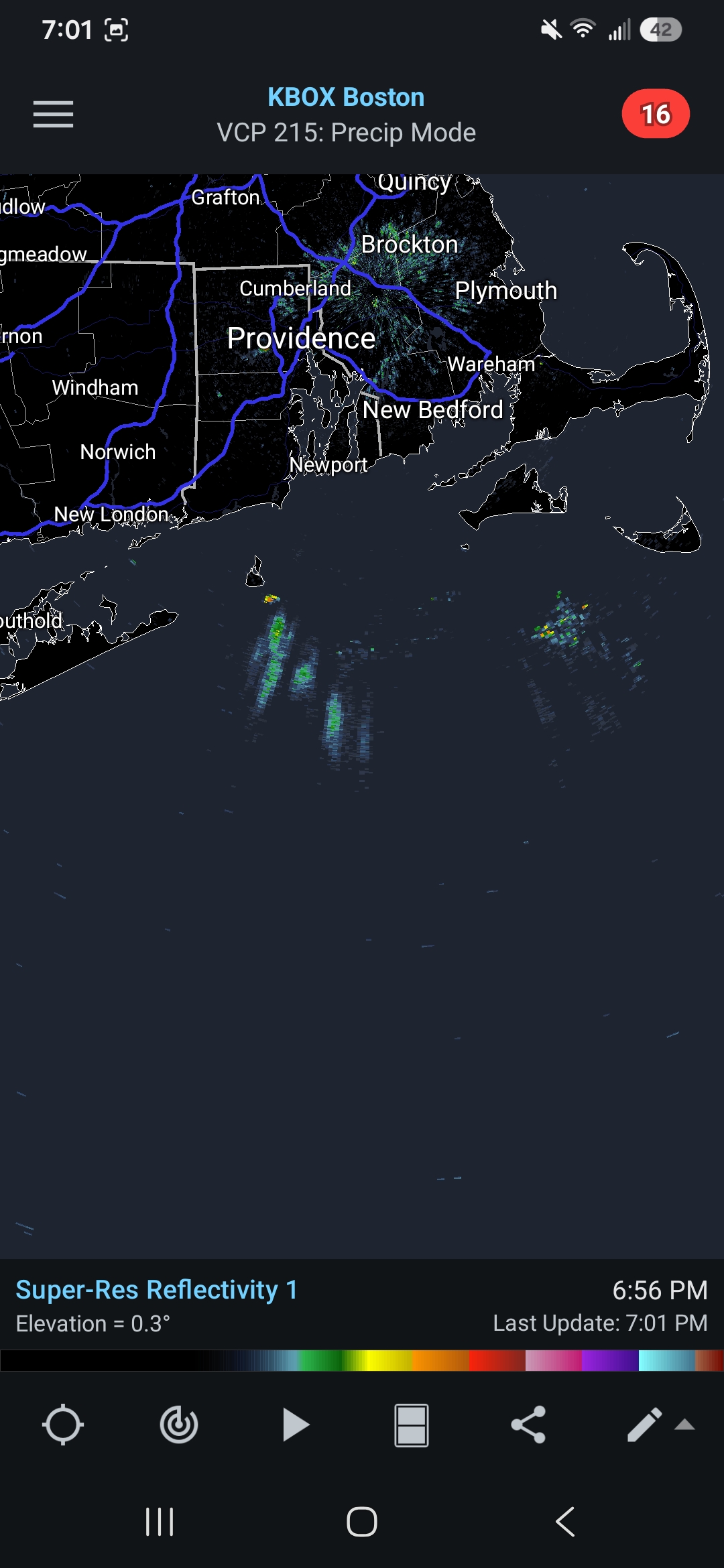
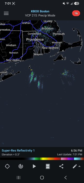
Both BOX and okx radars are picking up on something over the ocean and moving in all directions.. birds? Not sure how to post a loop on here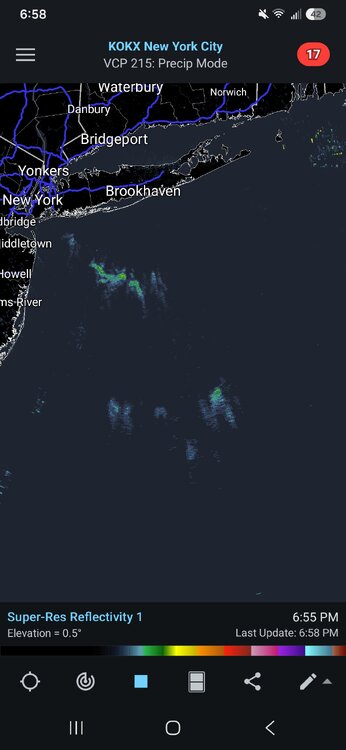
-
Augdewst 2026: Summer's Last Stand
ineedsnow replied to Prismshine Productions's topic in New England
Tornado warned storm for Indianapolis.. looks legit -
Augdewst 2026: Summer's Last Stand
ineedsnow replied to Prismshine Productions's topic in New England
@WxWatcher007 check this out.. pretty wild.. new way to check storm intensity? https://x.com/johndeanl/status/2083506132732231748 -
Euro also has something just not as robust.. ICON also faintly seeing it
-
6z GFS says congrats NC
-
Pattern would really have to change to bring something up.. but I wouldn't mind a NC trip
-
I would be fine without Summer ever again Really looking forward to cooler days and nights
-
we shorten
-
Euro also trying for something.. but heads ots which is expected
-
IDK some models have hints of it besides the GFS.. would be OTS anyways but I'm going on a 3 hour fishing trip out of Seabrook NH next Saturday so would be rough
-
never fails
-
sucks its not a cane pattern.. 12zGFS scoots that cat 1 OTS
-
Trust me it was tempting to drive right into it
-
This.is true.. when I saw the springfield tornado I could of got closer.. my heart was like do it.. but my brain was saying your close enough and try to live another day to see another one