ma blizzard
-
Posts
2,859 -
Joined
-
Last visited


-
ahead of schedule? seems like my allergies have been worse than usual for late April
-
81/58, now lets do this thru october
-
classic pre green up over performer
-
already up to 55 from a low of 28 this morning could be a contender for greatest diurnal swing of the year
-
eyeballing close to an inch so far
-
32.2 / 30, S
-
down to 34.5 and mostly snow here .. gonna need better rates / dynamics to cool that last couple of degrees though
-
35.4 mix of rain / snow / sleet
-
35.7/31, rn/sn mix
-
things that make you go hmmm should be an interesting nowcast
-
just need dynamics and good rates and it will snow, otherwise meh HRRR
-
0.5" overnight 30.3" on the season
-
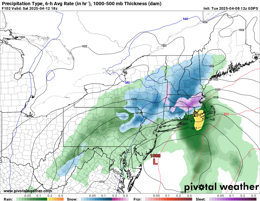
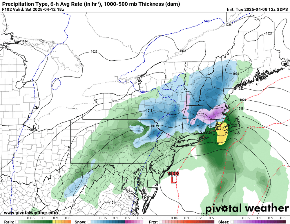
0z NAM looking thumpy Saturday morning
-
@ineedsnow caught you slacking
-
eh it would be a lot more interesting if the northern stream would dig another 100+ mi