HWY316wx
-
Posts
806 -
Joined
-
Last visited
About HWY316wx

- Birthday 03/18/1977
Recent Profile Visitors
1,955 profile views


-
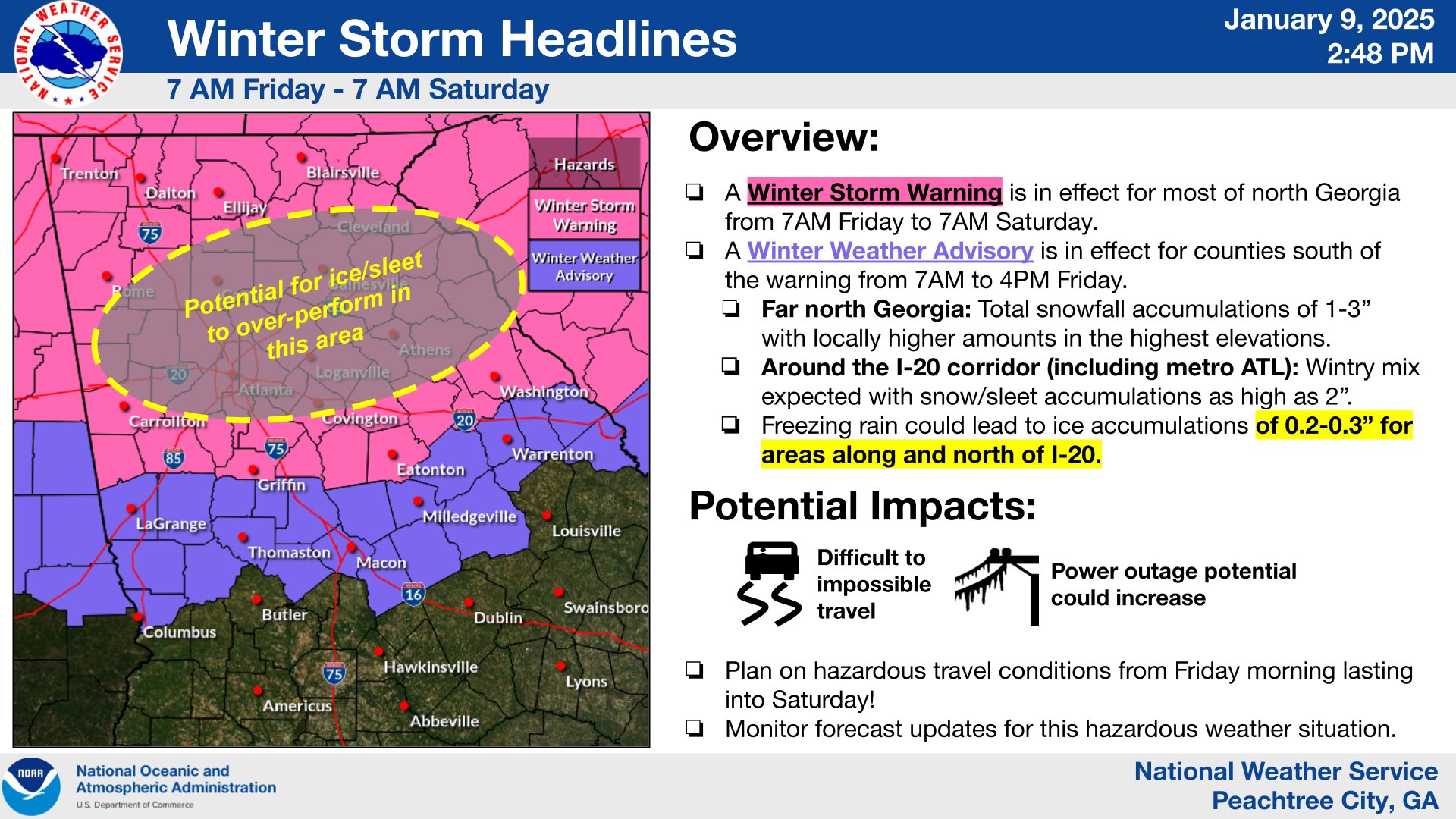
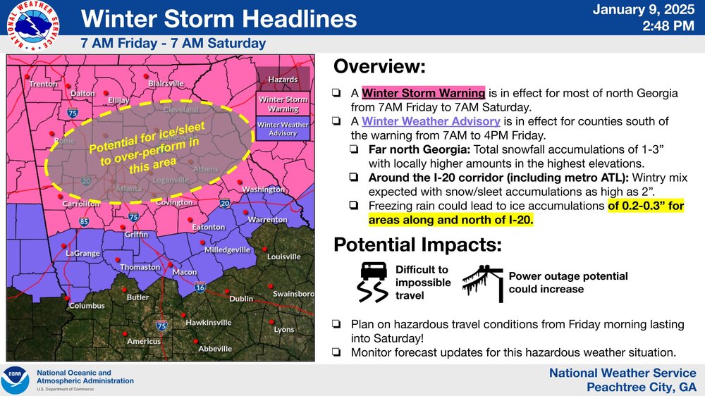
For the GA guys out of FFC: .LONG TERM... (Monday morning through next Friday) Issued at 324 PM EST Sat Jan 18 2025 For an excellent analysis of the expected conditions and uncertainties going into the system on Tuesday, please refer to the previous long term discussion issued during the early morning hours. Before diving into the winter precipitation potential, lets address the extreme cold expected for north and central GA on Monday morning. Temperatures across north GA are still expected to drop into the single digits in far north GA/the mountains and near 20 in the far southern portions of the CWA. Winds of 10 to 15 mph, gusting to 20 mph, mean temperatures will likely be well within at least extreme cold advisory range if not warning range. Given confidence in this outcome, a watch is necessary for areas along and north of I20 and I85. There are a few updates to the forecast as it pertains to model variability and trends for wintery precip on Tuesday: First off, global scale models have begun to come further in agreement in Gulf Low development. This has dropped our probability of widespread 0" snowfall amounts from around 30% (as of yesterday 1/17) to the 10th percentile. In other words confidence has increased that at least some snowfall is expected across central GA. Second, winter precip onset time has begun to move into the hires model space. NAM12km has run hot (or should I say cold) with snow coverage and the northward extent of 850mb/700mb moisture advection. While not completely out of the realm of possibility, the forecast is likely to continue to change as more Hires guidance comes into range. Third, precipitation accumulations vary significantly depending on the northward extend of mid level moisture and the strength of the sfc low. NBM inner quartile range for snow amounts sits from trace amounts south of the Columbus-Macon line to widespread 2-4" across much of central GA. (Two things to recall with this system, the highest probs for snow are actually south of the metro and model trends have slightly shifted wetter.) The 10th-90th range continues to hang around 10". Given the large spread in ensemble members, deterministic forecasts of snowfall will remain variable. Therefore, will continue to recommend watching probabilistic guidance over deterministic.
-
I am pulling for you guys and South GA and South S. Carolina! Would be epic to see measurable snow that far south! Euro had 6-7" in places in Florida!
-
Free information for you guys up in NC. The radar looks robust, but this is a fine drizzle back in Georgia. No way we get to 3/8" of ZR. moisture looks good on radar but whats hitting the ground is not impressive at all.
-
Big dry slot about to be over a decent part of GA. I am skeptical on ZR totals.
-
1/10-11 super awesome winter SE OBS thread
HWY316wx replied to strongwxnc's topic in Southeastern States
Sorry.. do you mean with the weather or was there planes that almost hit? -
1/10-11 super awesome winter SE OBS thread
HWY316wx replied to strongwxnc's topic in Southeastern States
Ryan Maue on Twitter says he has 5" there. -
1/10-11 super awesome winter SE OBS thread
HWY316wx replied to strongwxnc's topic in Southeastern States
Oh baby! No bueno. -
1/10-11 super awesome winter SE OBS thread
HWY316wx replied to strongwxnc's topic in Southeastern States
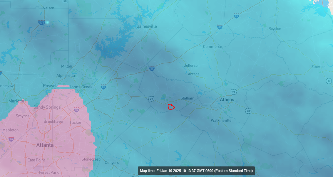
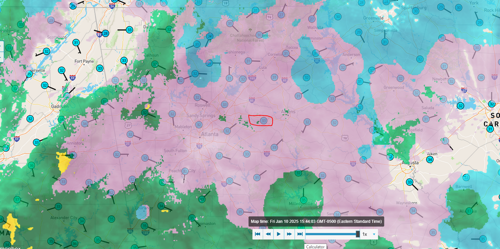
Really good sleet storm here in Statham / Winder. Just reference for you guys up stream. We have 2.5" here before the sleet started.
-
Really heavy band south of Atlanta that just keeps pumping it out. Also, just so I don't forget, NEVER EVER trust the NAM. What a fail.
-
1/10-11 super awesome winter SE OBS thread
HWY316wx replied to strongwxnc's topic in Southeastern States
Big fat flakes here in Winder, GA! Ground covered! -
It's moving NE and should be on top of me shortly. I probably have 1/2" at this point, hoping to get those waffle flakes they have been having in downtown ATL.
-
No way 2.3" of snow falls in South Georgia and almost to the coast. No way. LOL. That's a clown map for sure.
-
What is your wetbulb?
-
From FFC.
-
I am 15 miles East of North Gwinnett and expecting the CAD / ICE to be banging on us pretty good. That MOG / Hamilton Mill area seems to get really iced up good in Wedge events.