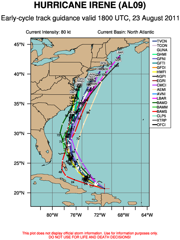
Time for a new thread since we hit the 1000 post mark.
Here is the link to the previous discussion.
as of 5pm the NHC had Irene at 90mph sustained winds which was down from earlier today.
12z model runs for August 23rd have Irene clipping the Outer Banks of NC and basically heading in a northerly to northeastely direction impacting the LI/SNE coast. Landfall on the models is anywhere from NYC over to the Westerly area of RI so there is still pretty considerable spread. Given that we are s

