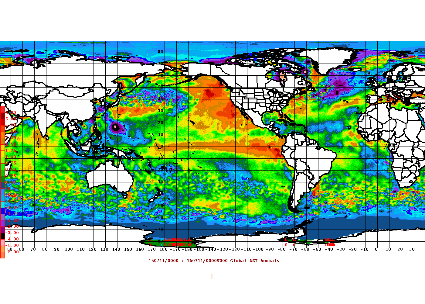
The latest CFSv2 ENSO forecast is indicating that the ENSO Region 1+2 anomaly will be at or above +1.00°C throughout meteorological winter (December-February). It is also indicating this region's anomaly should have peaked, will fall, and then again increase.
A secondary peak is actually not uncommon during strong or super El Niño events.The 1972-73, 1982-83, and 1997-98 events all had secondary peaks in this region. The 1997-98 event had a tertiary peak.

Since 1950, only three meteorological winters saw 2 or more months have Region 1+2 anomalies of +1.00°C or above: 1972-73, 1982-83, and 1997-98. The latter two featured all three months with such anomalies.
Given the modeling, it is very likely that August will have a Region 1+2 anomaly of at least +1.00°C. Since 1950, such anomalies have occurred in 1951, 1957, 1965, 1972, 1976, 1982, 1983, 1987, 1997, 1998, 2008, 2009, and 2014. However, only 3 of those 13 cases met the threshold being signaled on the CFSv2.
By October, ENSO Region 1+2 anomalies of +1.5°C or above, filtered out almost all of those cases, leaving only 1972, 1982, 1987, and 1997. Hence, by October, we should have a strong signal as to whether this current CFSv2 forecast has a reasonable chance of verifying.
In November, using the same anomaly threshold as October, only 1972, 1982, and 1997 remained.
Such anomalies during meteorological winter would have implications for North American temperature anomalies and possibly snowfall along the East Coast. Should the strong PDO+ persist, the PNA+ could also predominate (1982-83 and 1997-98) leading to another warmer than normal winter in the Pacific Northwest. All of that is still far out, but the scenario currently shown on the CFSv2 would typically favor warmth across much of North America.
In the more immediate future, one has typically seen El Niño events with Region 1+2 anomalies at or above +1.00°C produce cool anomalies in large parts of the East in August. Summer 2009 was an exception. Warmth has sometimes occurred in the Pacific Northwest and western half of the U.S.
In the end, it's still too soon to be sure about the upcoming winter. But if the CFSv2 is right, a cool autumn could yield to a warmer to much warmer than normal December across a wide swath of the U.S.
Given where things stand, one should be aware of this possible scenario, but not yet lock it in. Much can still change in Region 1+2.


Recommended Comments
There are no comments to display.
Create an account or sign in to comment
You need to be a member in order to leave a comment
Create an account
Sign up for a new account in our community. It's easy!
Register a new accountSign in
Already have an account? Sign in here.
Sign In Now