All Activity
- Past hour
-
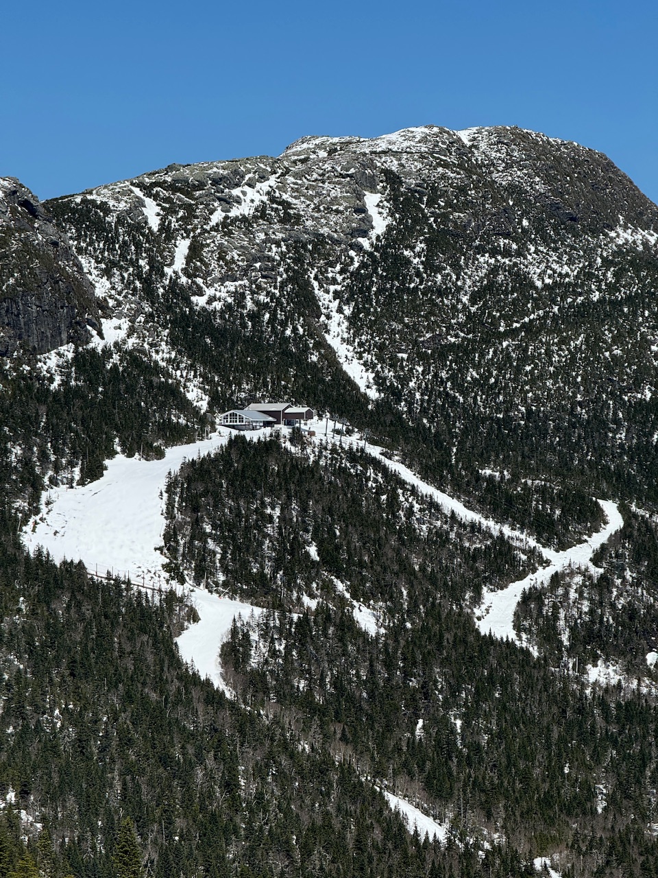
US National Weather Service State College PA Favorites · rSodenpstomc1t4h05l8313mt94l9h17a41tc18103lmma842c503tafmfgm · Check out the remarkable green up over the last month!
-
My best wishes to the female fox who announced very loudly that she is in heat outside our window at 330am
-
Low of 54.. ahhhh
-
Hazardous Weather Outlook National Weather Service State College PA 402 AM EDT Tue Apr 29 2025 PAZ004>006-010>012-017-018-024-037-041-300815- Warren-McKean-Potter-Elk-Cameron-Northern Clinton-Clearfield- Northern Centre-Cambria-Tioga-Northern Lycoming- 402 AM EDT Tue Apr 29 2025 This Hazardous Weather Outlook is for central Pennsylvania. .DAY ONE...Today and tonight. Severe thunderstorms with damaging winds 60 mph or greater and large hail exceeding 1 inch in diameter are probable this afternoon and evening. A few tornadoes are also possible. .DAYS TWO THROUGH SEVEN...Wednesday through Monday. The probability for widespread hazardous weather is low. .SPOTTER INFORMATION STATEMENT... Spotters are encouraged to report significant hazardous weather. $$ Hazardous Weather Outlook National Weather Service State College PA 402 AM EDT Tue Apr 29 2025 PAZ019-025>028-033>036-042-045-046-049>053-056-300815- Southern Centre-Blair-Huntingdon-Mifflin-Juniata-Somerset-Bedford- Fulton-Franklin-Sullivan-Southern Clinton-Southern Lycoming-Union- Snyder-Montour-Northumberland-Columbia-Perry- 402 AM EDT Tue Apr 29 2025 This Hazardous Weather Outlook is for central Pennsylvania. .DAY ONE...Today and tonight. Severe thunderstorms with damaging winds 60 mph or greater and large hail exceeding 1 inch in diameter are possible this afternoon and evening. .DAYS TWO THROUGH SEVEN...Wednesday through Monday. The probability for widespread hazardous weather is low. .SPOTTER INFORMATION STATEMENT... Spotters are encouraged to report significant hazardous weather. $$ Hazardous Weather Outlook National Weather Service State College PA 402 AM EDT Tue Apr 29 2025 PAZ057>059-063>066-300815- Dauphin-Schuylkill-Lebanon-Cumberland-Adams-York-Lancaster- 402 AM EDT Tue Apr 29 2025 This Hazardous Weather Outlook is for central Pennsylvania. .DAY ONE...Today and tonight. Strong to severe thunderstorms with gusty winds are possible this evening. .DAYS TWO THROUGH SEVEN...Wednesday through Monday. The probability for widespread hazardous weather is low. .SPOTTER INFORMATION STATEMENT... Spotters are encouraged to report significant hazardous weather. $$
-
74 at 4:30, warm overnight really pushed out leaves
- Today
-
Hit 77.0 yesterday. 10 out of 10 day.
-

2025 Atlantic Hurricane Season
BarryStantonGBP replied to BarryStantonGBP's topic in Tropical Headquarters
“From today's trip to the weather twitters. Deep tropic suppression because of warm sub-tropics would seem, to me, to decrease risk of a major landfall in the Caribbean and Central/North America.” LMAO no whoever said this keep getting your hopes up -
2025 Atlantic Hurricane Season
BarryStantonGBP replied to BarryStantonGBP's topic in Tropical Headquarters
Lmao not only the east Atlantic matters. Stop jumping to conclusions it will be above average at least -
2025 Atlantic Hurricane Season
BarryStantonGBP replied to BarryStantonGBP's topic in Tropical Headquarters
It will warm up soon btw “it will be below average/average!” -
FWIW, the ticks are terrible this year, absolutely terrible. We have an expert here that might be able to give us more details, maybe @JustinRP37 has some good data for us.
-
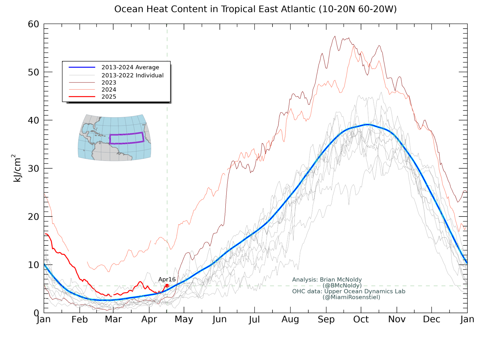
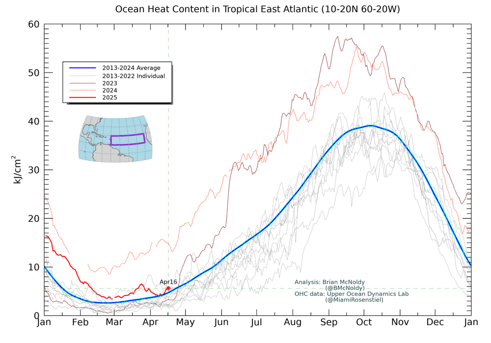
Thanks. The same website has OHC for the same region although it updates more slowly. I’ll be following this very closely also. This is the corresponding OHC for the same area as of April 16 as opposed to April 27. It shows that the OHC has also fallen a lot since one year ago, when it was way up at the 2013-24 average for late June! It was on 4/16/25 down to near the 2013-24 average for 4/16 although it actually was a bit warmer than 2023, which was within just days of rising rapidly and reaching then new daily record highs that would go all of the way into June of 2024: https://bmcnoldy.earth.miami.edu/tropics/ohc/ohc_east.png
-
Classic solid EML/deep summer setup tonight. A heat burst is occurring in S IA currently, with anvil showers across N MO/S IA. Oskaloosa, IA went from 76/64 to 81/43, with winds gusting to 69MPH.
-

2025 Atlantic Hurricane Season
LongBeachSurfFreak replied to BarryStantonGBP's topic in Tropical Headquarters
Again, that is only representative of the surface and not the OHC which is what really matters. We have seen a very windy NH winter which had the effect of turning over the surface. It’s not like the year over year temp dropped because the overhead temps were much colder then normal. Increased winds are well predicted by climate change models and are reason for counterintuitive storm number forecasts. -
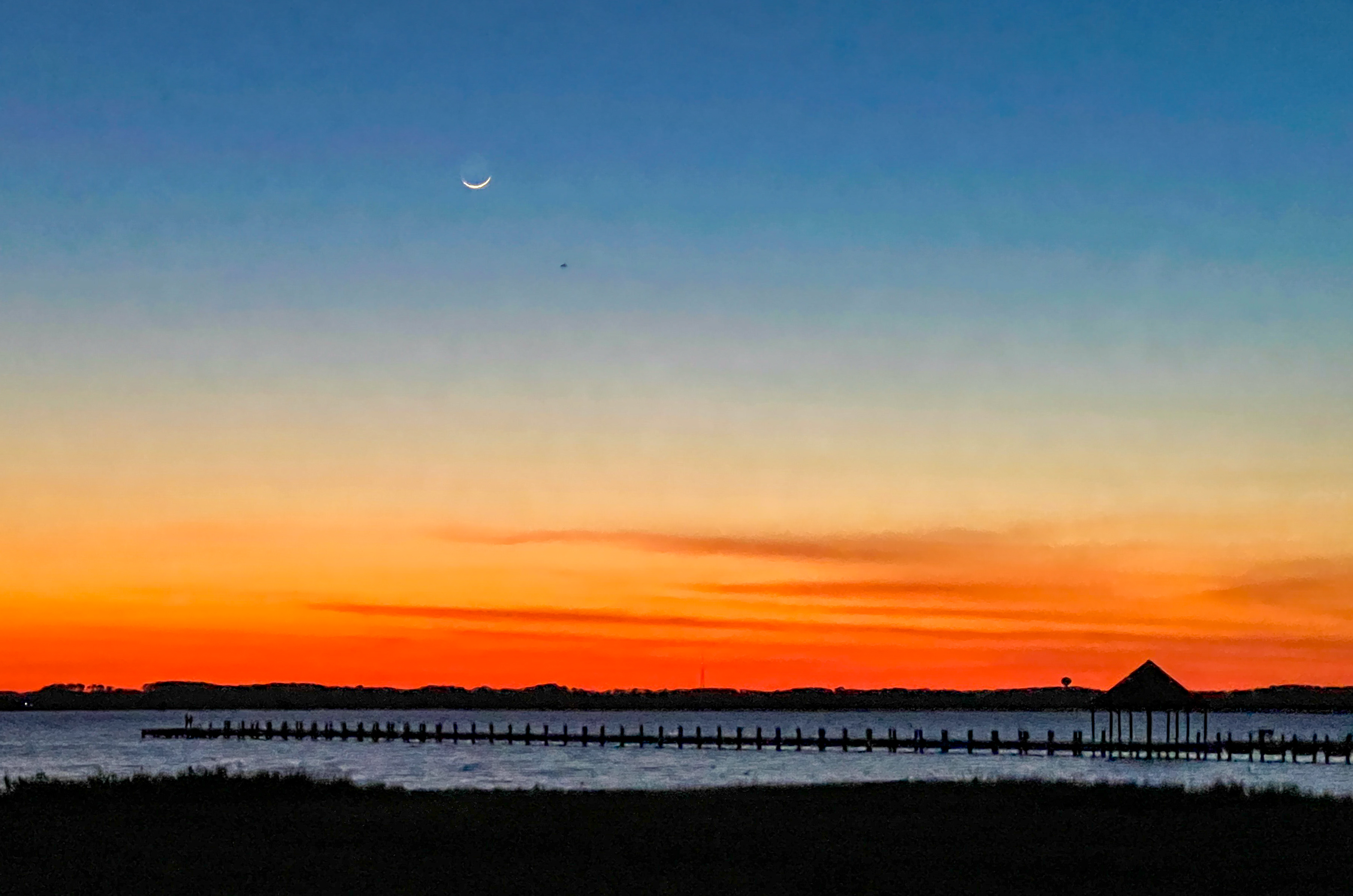
Very nice picture ! Was looking at that tiny sliver of the moon crossing Afton Mt west bound heading home from work tonight....
-
I'm calling it a night before waiting for the 00Z suite, but it's worth noting today that the Euro and AI-Euro both have the weekend trough cutting off and hanging around for a while and giving us a much-needed multi-day rain event. It seems to have some ensemble support. The GFS/GEFS, prior to the overnight runs, are very progressive with the trough and want nothing to do with the Euro idea.
-
77 today. Too bad I was inside all day
-
A little chilly but a beautiful afternoon/evening in Ocean City. Post sunset iPhone pic.

-
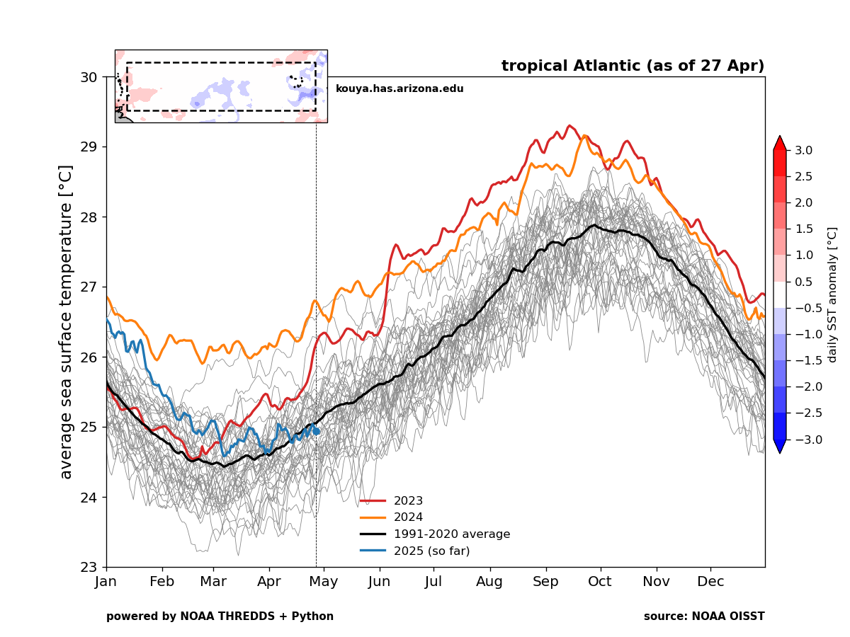
Your link doesn’t show anything. But check the image below out: The image below is the SST for each year 1982-2025 for the tropical Atlantic 10-20N, 20-60W. The black line is the 1991-2020 average, the red is 2023, orange is 2024, and blue is 2025 to date. Note how much cooler it is as of 4/27/2025 (near the 1991-2020 average) vs both 4/27/2023 and 4/27/2024! https://kouya.has.arizona.edu/tropics/tropATLsst.png

-
Storms were impressive looking but not a single report of a confirmed tornado yikes Edit: I spoke too soon there is one now
-

2025 Spring/Summer Mountain Thread
Buckethead replied to Maggie Valley Steve's topic in Southeastern States
Hikes are getting more colorful in the high country! The spring ephemerals are peaking at 5400'. The sunsets have been pretty good too. Sent from my SM-S908U using Tapatalk -
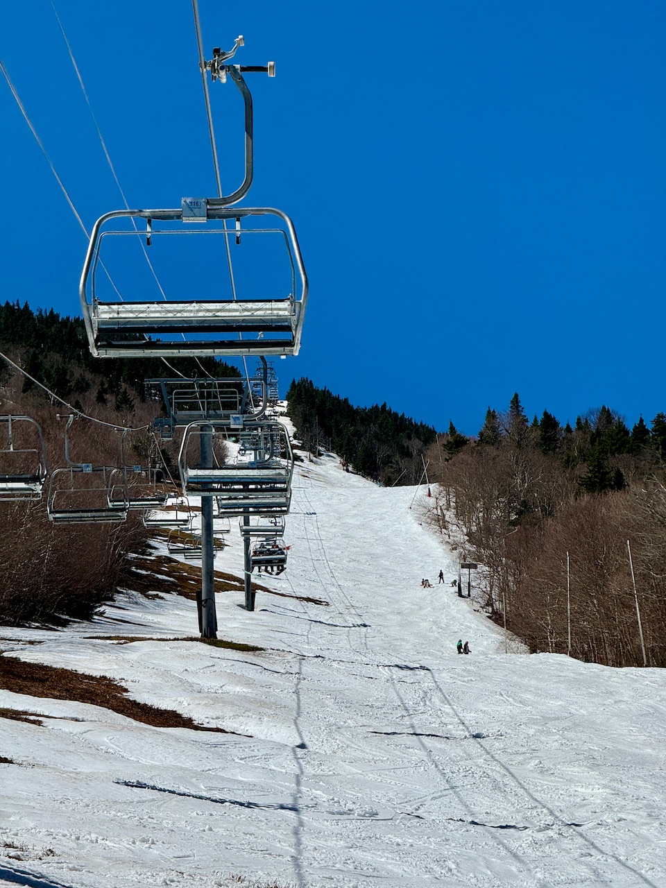
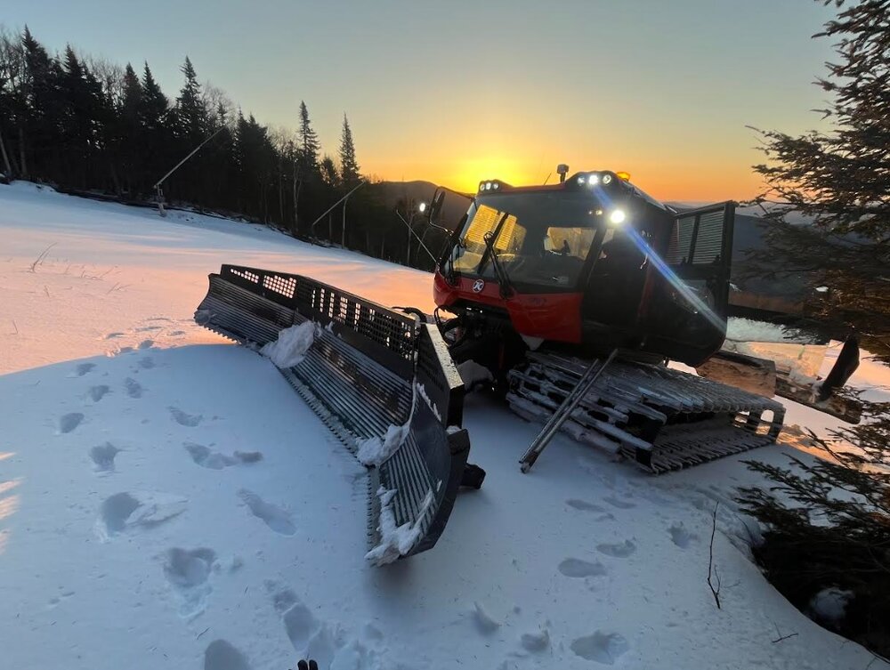
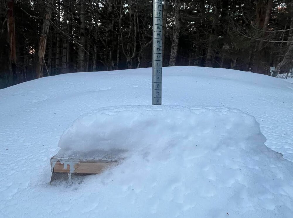
This is probably the end of the cold season. Might be time for a warm season thread. We didn't get to the High Road plot yesterday due to wind, but this morning a snowcat went up to check the snowfall at sunrise... and retrieve the snowboard and depth stake. The porcupines love to eat them in the spring as the sun warms the wood. 5" of refrozen snow sat on the board. The seasonal measured total rises to 362". That's often a 24 hour total, so there's some settling. It looks like we move on to the warm season rapidly now.
-
I love snow, but there is nothing that hits better than a 72/30 day of full sun and long daylight. 10/10 day. Staff day has become a fun gathering with the Quad running for employees only, the day after “last day.”


-
The last two times we had a significant tornado come through the metro were the EF1 that went through Minneapolis in 2011 and the Hugo EF3 in 2008. We are well overdue. Crazy thing is both of those tornadoes were overshadowed by EF5s elsewhere the same day (Joplin and Parkersburg). .
-
Hangs by you
-
2025 Atlantic Hurricane Season
BarryStantonGBP replied to BarryStantonGBP's topic in Tropical Headquarters
but cold sstas https://www.tropicaltidbits.com/analysis/models/cansips/2025040100/cansips_ssta_noice_atl_6.png