All Activity
- Past hour
-
Aside from the special teams disaster, 5 on 5 was pretty damn good.
-
It's definitely a thread the needle kind of setup with decent bust potential. Part of the problem (which the CAMs are likely picking up on) is that the better ascent/forcing will start to peel away by late afternoon/early evening before convective temps are achieved. There is, however, a 6 hour window from 18z to 00z though where sky's the limit if everything aligns just right.
-
12Z euro actually had two quite warm days warm days May 7th, 8th....outside chance at a stray 90 or two. I do not believe it will happen but we'll see. WX/PT
-
I doubt this pattern lasts throughout the summer. I'd be quite surprised if it did. WX/PT
-
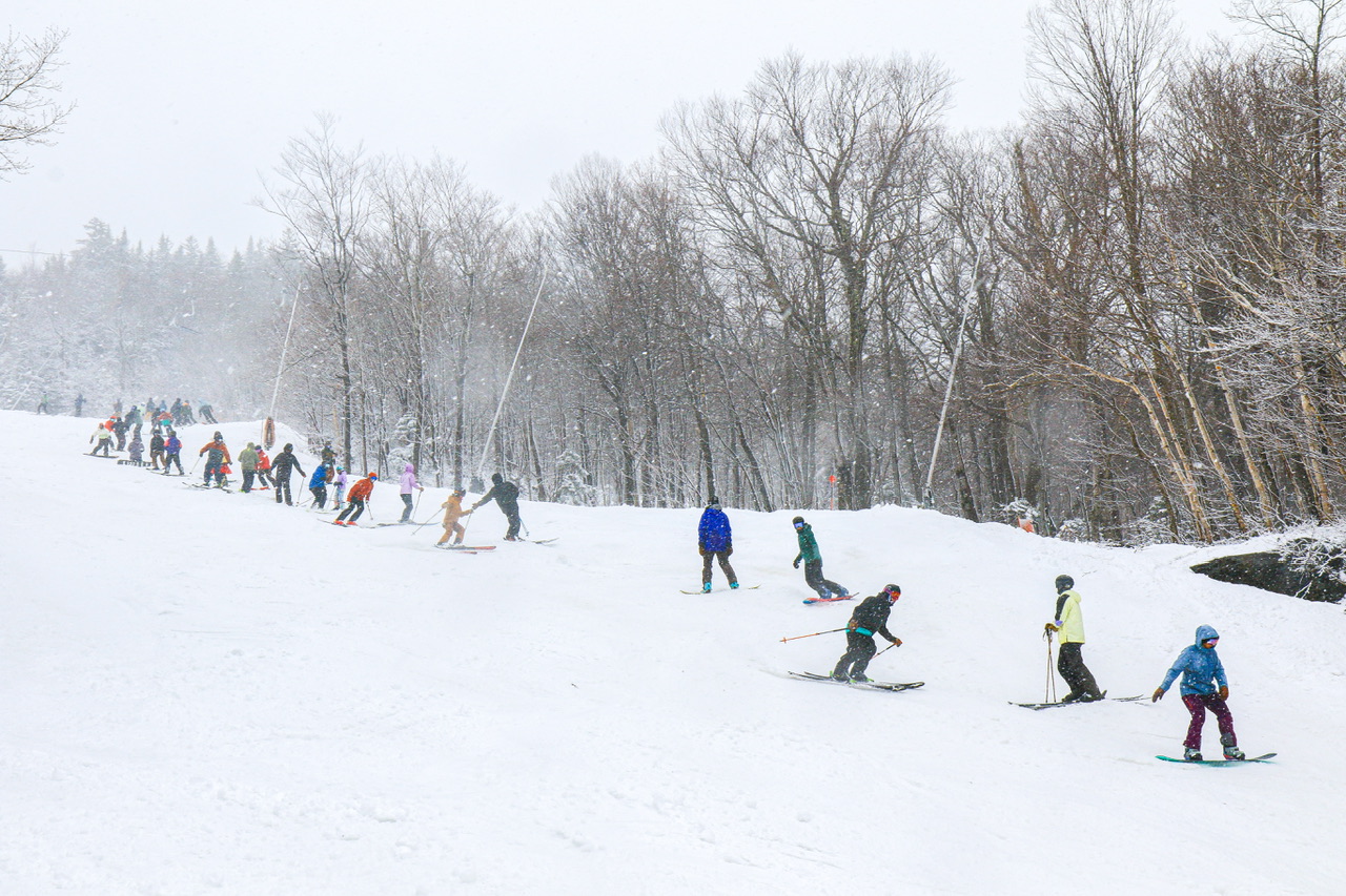
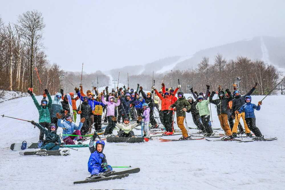
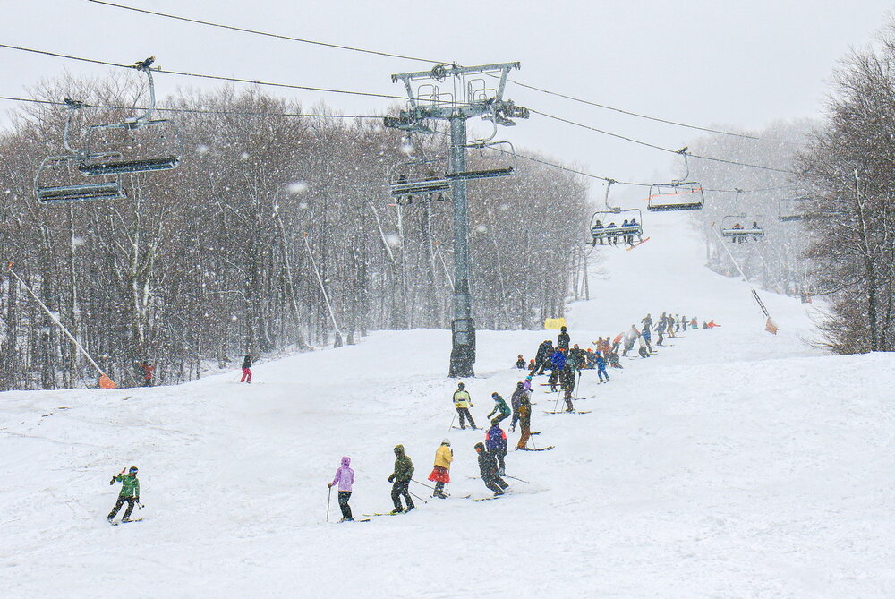
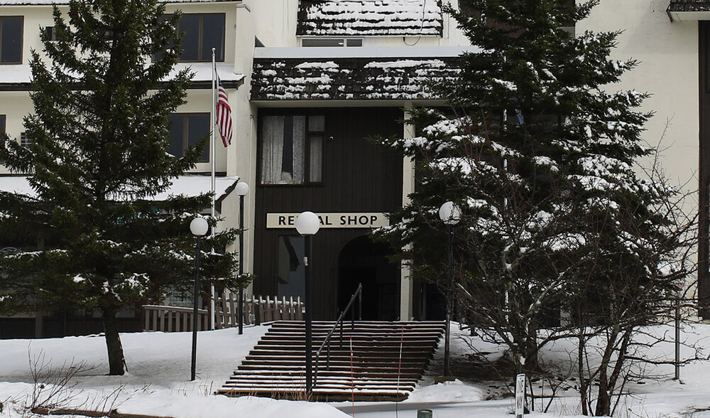
Closing day brought a couple inches of snowfall at the plots 0-4” on the trails. Photos from below 2,500ft. Above 3,000ft saw 4” or more per MMSP. We could only verify 2” so far.

-
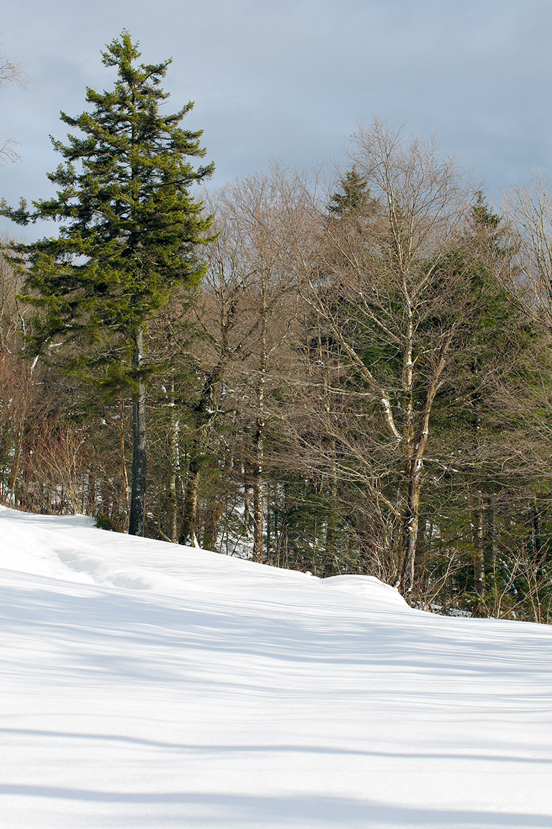
Several days back, it looked like today held the potential to be one of those warm, sunny ski days with spring corn snow. Mother Nature appeared to have other plans though, and the weather modeling quickly started to show the potential for fresh snow instead of sunshine. Indeed, the snow came to fruition, and as of this afternoon, snow levels had dropped all the way to the bottoms of the valleys. Down at our site in the Winooski Valley, it snowed much of the afternoon, with decent intensity at times, but temperatures were a bit too warm to see any substantial accumulations. Accumulation was easy at higher elevations however, and after a quick look at the thick white coating visible on Bolton Valley Main Base Webcam, I popped up to the mountain for a ski tour. Heading up the Bolton Valley Access Road, snow accumulations began to appear around the 1,200’ elevation. I found 2 to 3 inches of new snow in the Village at ~2,000’ where I started my tour, and my ascent revealed that the 2,000’-2,500’ elevation band saw the most rapid accumulation gains. I found 5 to 6 inches of new snow at 2,500’, with only modest gains above that up to ~3,200’. The elevation profile for accumulations in the Bolton Valley area today were as follows: 340’: 0” 500’: 0” 1,000’: 0” 1,200’: T 1,500’: T-1” 2,000’: 2-3” 2,500’: 5-6” 3,000’: 6-7” 3,200’: 6-8” By the time I was out for my tour in the late afternoon, temperatures were above freezing at all elevations of the resort, so the new snow was already wet. And it definitely skied like wet snow at that point, but there was plenty of liquid in there to keep you off the old base at most elevations above 2,000’. In any event, it’s always great to get out for a tour in fresh snow, and the sun had quickly come out as the storm pulled away to make for some excellent views. The weather modeling suggests we may get another shot at snow in about a week or so, so we’ll keep an eye on the potential for more touring in fresh accumulations as we head into May.


- Today
-
Wow that’s crazy! We’re pushing 4” for the month of which 1.5” has fallen in last week
-
Low of 55, high of 71. Beautiful spring day. Sitting at 1.98" for the month.
-
.thumb.jpg.6a4895b2a43f87359e4e7d04a6fa0d14.jpg)
Central PA Spring 2025
Yardstickgozinya replied to canderson's topic in Upstate New York/Pennsylvania
That would be horrible, the possibility of 5 less professional sports teams to talk about. Get em Kirb !!!
-
Interesting looking at the East Coast surf zone temps compared to 2024 and also reviewing the Atlantic basin as a whole. The Atlantic is near 2 degrees F cooler than last year on this date, lesser hurricanes activity is a possible outcome, however, the near shore water temps actually are somewhat above 2024 at this time. Beach season may arrive earlier this year.
-
They will probably be 10 games under 500 in a few days. Just a rudderless ship right now. No life. This could unravel pretty quickly. Someone(or 2) needs to be fired. Some of this was clearly correctable/preventable by actually doing something to improve the team in the offseason.
-
Except for 1 magical run to the cup in 2018 the caps always know how to disappoint in the playoffs.
-
This wind really blows.
-
Gorgeous week coming up.
-
I usually don’t get excited at these hyped up severe outbreaks but tomorrow really looks like the real deal around here.
-
This week looks warm but not excessively so heading into May. Mostly mid to upper 70s for forecast highs here, with Wed and Thurs being the warmest days at around 80. Being 5-10 degrees above historical avg is pretty typical in these parts anymore.
-
It’s so bad lol
-
These would be excellent offshore surfing winds in a couple months, granted not as strong though. current surf conditions are: Surf easing for PM hours with breezy offshores knocking down the surf We have plenty of rideable lines sticking around the knee to thigh high zone early PM with standouts in south Ocean County consistently hitting waist high. Winds are breezy WNW-NW so conditions are clean, but looking racy/challenging on the low tide early PM. Swell drops out through the PM with winds shifting more NW over the afternoon/evening hours so bring a longboard that can get you into the small surf through the stiff offshore breezes.
-
This wind is relentless.
- Yesterday
-
Hard sell.
-
The first heatwave will be in June. A stray 90 degree day after May 20th, possibly near Memorial Day weekend. Nice low humidity pattern will continue.
-
It's like with Citizens United, the only way to beat the corporations is by Congressional action. The US is one of only two nations that allows drug ads-- the other one is New Zealand.
-
Average wind speed today 15.8 mph Highest gust 52 mph. With clear blue skies
-
Will we see our first heatwave? Severe weather? Or just a continuation of average to below average precip, above average temps and windy conditions?