All Activity
- Past hour
-
Very dire situation unfolding in Middle TN. Large intense violent tornado on ground. Long tracker.
-
4/2-4/3 Potential Major Severe WX Outbreak
ICEHOCEY77 replied to Geoboy645's topic in Lakes/Ohio Valley
yeah riding a boundary too, nothing really in it's way either. -

4/2-4/3 Potential Major Severe WX Outbreak
vman722 replied to Geoboy645's topic in Lakes/Ohio Valley
Has the look of a supercell that’s guna be a problem for quite some time. It’s pretty unimpeded. This late it’s really a worst case scenario in TN barring something miraculously stopping this. -

2025-2026 ENSO
Stormchaserchuck1 replied to 40/70 Benchmark's topic in Weather Forecasting and Discussion
Pretty much a >90% chance it will be negative for the Winter. -QBO with El Nino favors Stratosphere warmings. The weight is 3-1. Last Winter the +QBO really correlated at 10mb. Paired up with La Nina's, they usually work out that way. March actually has a pretty neutral historical signal.. and it was warm Stratosphere March -
4/2-4/3 Potential Major Severe WX Outbreak
ICEHOCEY77 replied to Geoboy645's topic in Lakes/Ohio Valley
just got a scan from 1:27 so maybe it's coming back -

4/2-4/3 Potential Major Severe WX Outbreak
vman722 replied to Geoboy645's topic in Lakes/Ohio Valley
Nope, it’s def down unfortunately. -
The March 2025 30 mb QBO came in at +11.82, a slight rise vs Feb. I still think this has a good chance to go negative by summer.
-
4/2-4/3 Potential Major Severe WX Outbreak
ICEHOCEY77 replied to Geoboy645's topic in Lakes/Ohio Valley
bad time for the Memphis radar to go down, any one have an update since 1:23 CT? -
TORE Severe Weather Statement National Weather Service Memphis TN 123 AM CDT Thu Apr 3 2025 MSC009-093-TNC047-069-030700- /O.CON.KMEG.TO.W.0085.000000T0000Z-250403T0700Z/ Marshall MS-Benton MS-Fayette TN-Hardeman TN- 123 AM CDT Thu Apr 3 2025 ...TORNADO EMERGENCY FOR SLADEN... ...A TORNADO WARNING REMAINS IN EFFECT UNTIL 200 AM CDT FOR NORTH CENTRAL MARSHALL...NORTHERN BENTON...SOUTHEASTERN FAYETTE AND SOUTHWESTERN HARDEMAN COUNTIES... At 122 AM CDT, a confirmed large and destructive tornado was located over Slayden, or 12 miles north of Holly Springs, moving northeast at 50 mph. TORNADO EMERGENCY for Slayden. This is a PARTICULARLY DANGEROUS SITUATION. TAKE COVER NOW! HAZARD...Deadly tornado. SOURCE...Radar confirmed tornado. IMPACT...You are in a life-threatening situation. Flying debris may be deadly to those caught without shelter. Mobile homes will be destroyed. Considerable damage to homes, businesses, and vehicles is likely and complete destruction is possible. Locations impacted include... Ghost River State Natural Area, Saulsbury, Mt Pleasant, Lagrange, La Grange, Moscow, Early Grove, Williston, Grand Junction, Michigan City, Lamar, Hays Crossing, Pattersonville, Slayden, Forty Five, Taska, Rossville, and Somerville. PRECAUTIONARY/PREPAREDNESS ACTIONS... To repeat, a large, extremely dangerous, and potentially deadly tornado is on the ground. To protect your life, TAKE COVER NOW! Move to an interior room on the lowest floor of a sturdy building. Avoid windows. If in a mobile home, a vehicle or outdoors, move to the closest substantial shelter and protect yourself from flying debris. Tornadoes are extremely difficult to see and confirm at night. Do not wait to see or hear the tornado. TAKE COVER NOW!
-

4/2-4/3 Potential Major Severe WX Outbreak
vman722 replied to Geoboy645's topic in Lakes/Ohio Valley
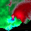
One of the most violent signatures I’ve ever seen. Godspeed to anyone in the path of this beast. -
Violent tornado with that Byhalia MS cell. 80 kt VROT, huge TDS.
-
4/2-4/3 Potential Major Severe WX Outbreak
ICEHOCEY77 replied to Geoboy645's topic in Lakes/Ohio Valley
Holly Springs cell has finished cycling and is back on the ground. -
It's ridiculously warm. 71 at 2am, Oak Ridge is 77 with a heat index of 79, talk about summer hitting immediately.
- 70 replies
-
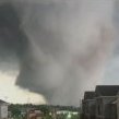
The debris ball that just went through Selmer TN on one of the PDS warnings was apocalyptic. Multiple PDS warnings right now in Tennessee and northern MS
- Today
-
Large tornado moving directly into Selmer TN, pop nearly 4500, this could be bad.
-
4/2-4/3 Potential Major Severe WX Outbreak
ICEHOCEY77 replied to Geoboy645's topic in Lakes/Ohio Valley
Confirmed now. NWS Memphis dragged their feet on that update. -
4/2-4/3 Potential Major Severe WX Outbreak
ICEHOCEY77 replied to Geoboy645's topic in Lakes/Ohio Valley
Cell south of Memphis as well. Rain wrapped and about to cross I-55 -
And another strong tornado near Senatobia MS.
-
Strong tornado in progress near Middleton TN currently, perfectly discrete supercell.
-
4/2-4/3 Potential Major Severe WX Outbreak
KeenerWx replied to Geoboy645's topic in Lakes/Ohio Valley
Absolutely breathtaking footage... -

4/2-4/3 Potential Major Severe WX Outbreak
SchaumburgStormer replied to Geoboy645's topic in Lakes/Ohio Valley
https://x.com/jerredprice/status/1907596259956871428?ref_src=twsrc^google|twcamp^serp|twgr^tweet -
Ground is sleet covered and slick. So, short lived wintery event.
-
I'm about to reach an inch with storms continuing the last hour.
-
Very warm evening across the Ohio Valley, with temperatures in the upper 70s at 11 pm exceeding all records from the month of April for that hour. More akin to a warm July night than April 2nd.
-
Getting a bunch of storms this evening as expected, but what wasn't is the first had intense CGs; I counted 6. I typically don't get much cg lightning its rare, once a year. I've noticed my best lightning in recent years has been in April. This is also the most intense tstorm with a temp so low 3.5C at the time of the first. My DP has been floating 0.2 above my air temp since 9. Didn't have the wait long for the 2nd, 20 mins later another randomly sprung up with frequent lightning but no cgs. That lasted nearly 45 mins over 100 strikes. At 11:30 I now have a third round, thank God this isn't in the middle of the night like that one April 6th belter years ago.


.thumb.png.4150b06c63a21f61052e47a612bf1818.png)
