All Activity
- Past hour
-
No, just can't seem to get away from it.
-
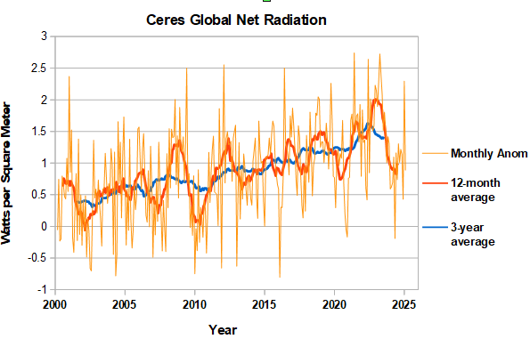
CERES data updated through February. Noisy from month to month. Last month's anomaly came in lower after an upward spike in January. The 12-month average is starting to turn up so the net radiation bottom for this enso cycle has probably been passed. If so net radiation fell to a similar level following the 2015/16 and 2023/24 ninos. The 3-year average remains stubbornly high, indicating that the next big step won't be cooler.
-
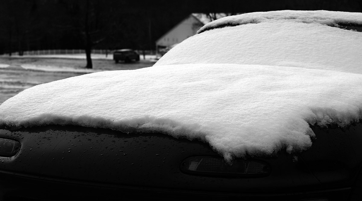
Currently 40 degrees 33 ha just can’t get away from the cold.
-
The very low soil moisture has been pretty persistent as the strong winds quickly dry things out behind the parade of storms through the Great Lakes that have been generally underperforming on moisture.
-
Got down to 35.8⁰.....could tell last night that it was going to drop pretty good. Had that crisp feel to the air. Hopefully the coldest we will see until September, but somehow I doubt that.
-
Saw TAN 34 and EEN 30.
-
excited for the msp crew
-
We frost!!
-
Seeing it laid out like that is interesting. I move around a lot and some areas seem to handle low soil moisture better than others. N and W are so much more heavily forested that it makes more of a difference.
-
A frosty 30.3 this morning. This is 16 degrees colder than the 100 year historical average. Our frost free average date has increased to May 15 in the last 25 years. It used to be May 10.
-
Cool here in the Quinebaug valley, down to 37F
-
Yeah, warmer and drier than normal until further notice.


- Today
-
Currently 45°, but damn…some of the weenie lake and river valley sites in C/S NH are at or near 32° this morning. Hell to the no.
-
33 this morning. .
-
-

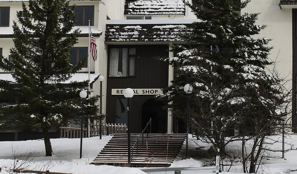
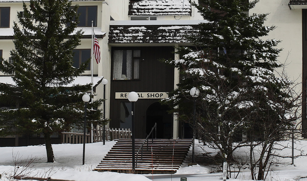
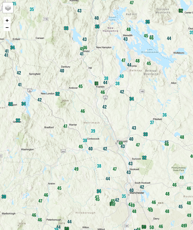
Winter 2024-2025 All Tri-State Snowfall Totals Maps
The 4 Seasons replied to The 4 Seasons's topic in New York City Metro
There is now. I found two archives for radar. There is now a new section of the site that has radar loops for the entire event as well sfc and h5 maps for past moderate events (3"+) or higher. It's being updated on a weekly basis but i am back 5 years now to 2020. https://www.jdjweatherconsulting.com/storm-archive -
Absolutely love this – the passion for the pattern is real! It’s funny how the excitement can sometimes beat the actual results. Reminds me a lot of crypto too – getting in early, spotting the signs before others catch on, can set you up for big wins down the line.
-
Incredible, it’s such a different world in the northern reaches of New England, even now. Totally looking forward to those glorious shots of the mountain vista once the endless days of warmth and sun take over!
-
A below normal summer...wow...must have seemed like a dream, lol. I'm always amazed at the stats you can find. Many thanks for the education! And I like the reference to the minimum. I always think sun spots when a strange cold episode occurs, or volcanoes
-
Aside from the special teams disaster, 5 on 5 was pretty damn good.
-
It's definitely a thread the needle kind of setup with decent bust potential. Part of the problem (which the CAMs are likely picking up on) is that the better ascent/forcing will start to peel away by late afternoon/early evening before convective temps are achieved. There is, however, a 6 hour window from 18z to 00z though where sky's the limit if everything aligns just right.
-
12Z euro actually had two quite warm days warm days May 7th, 8th....outside chance at a stray 90 or two. I do not believe it will happen but we'll see. WX/PT
-
I doubt this pattern lasts throughout the summer. I'd be quite surprised if it did. WX/PT
-
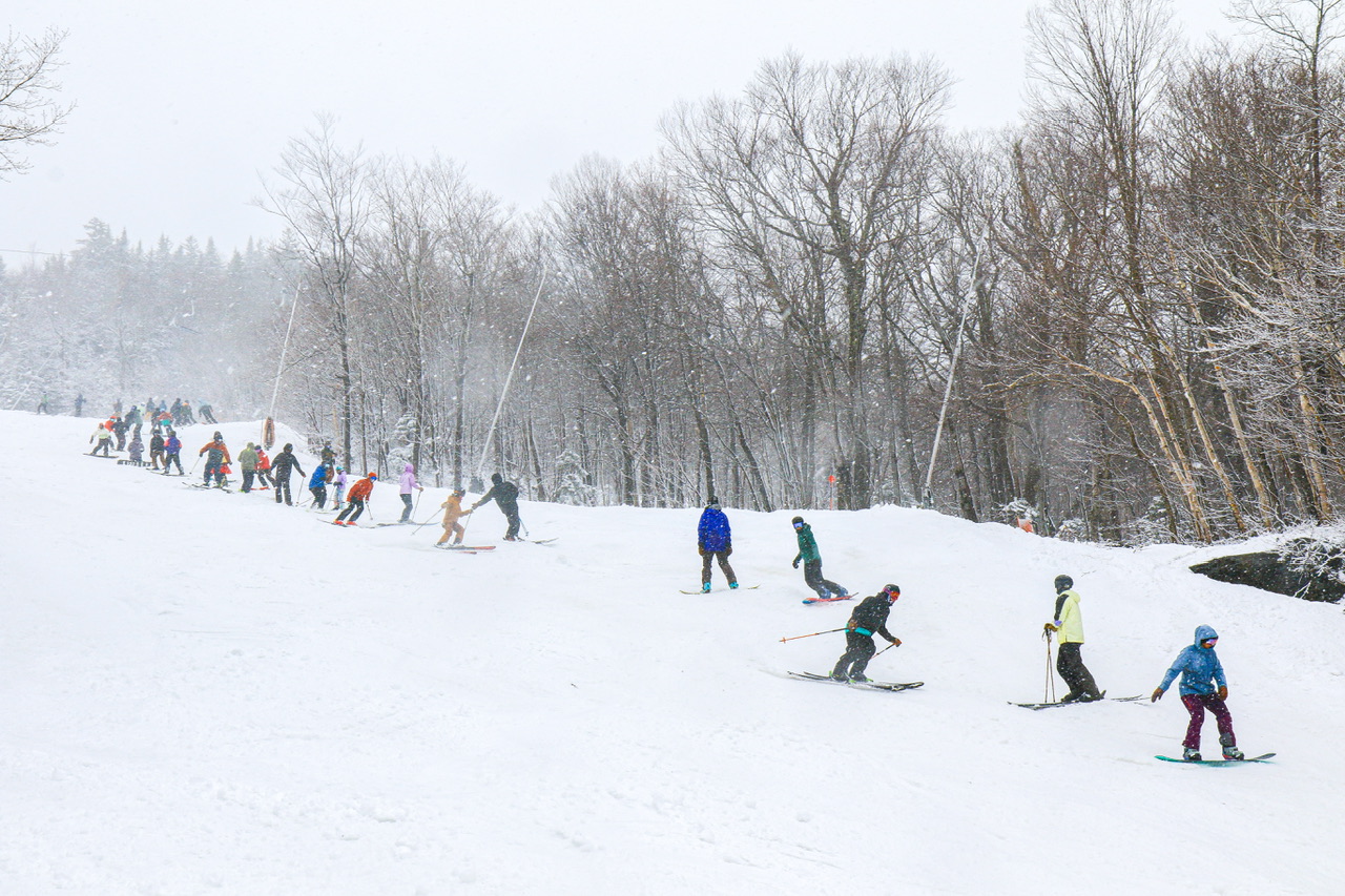
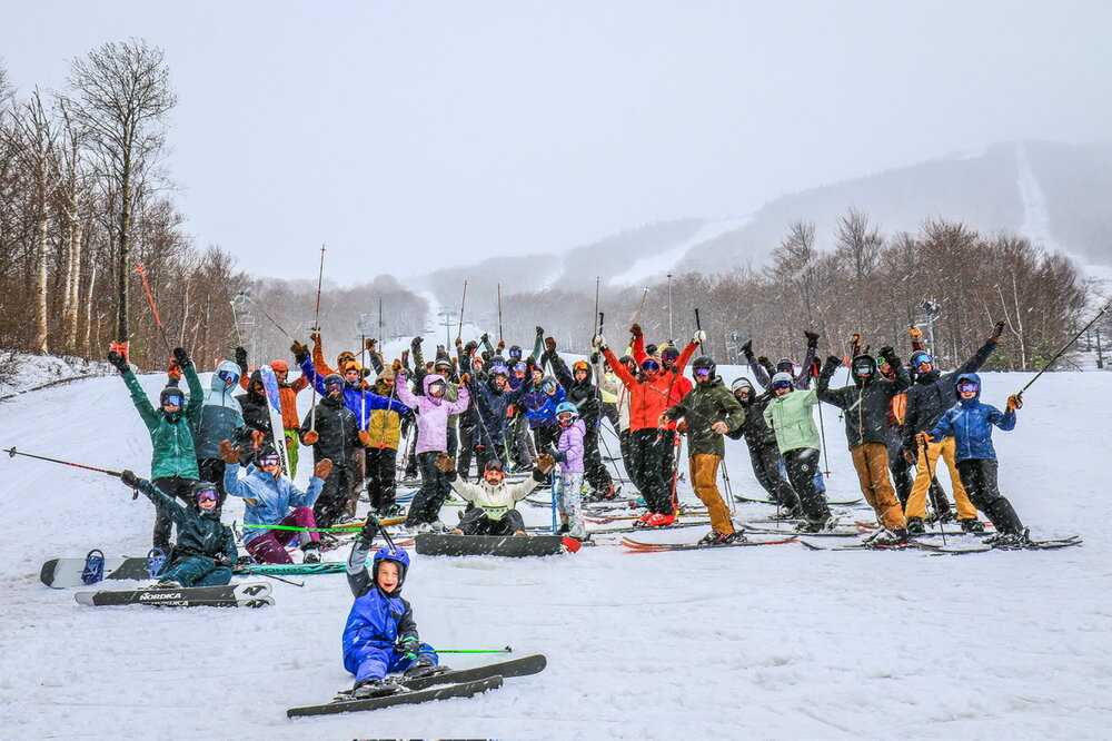
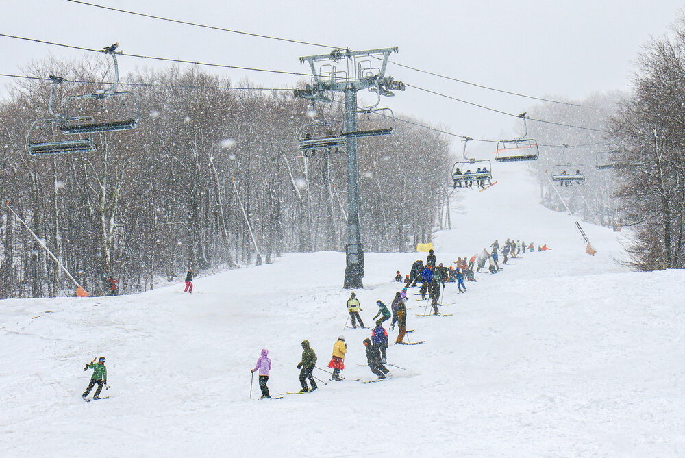
Closing day brought a couple inches of snowfall at the plots 0-4” on the trails. Photos from below 2,500ft. Above 3,000ft saw 4” or more per MMSP. We could only verify 2” so far.

-
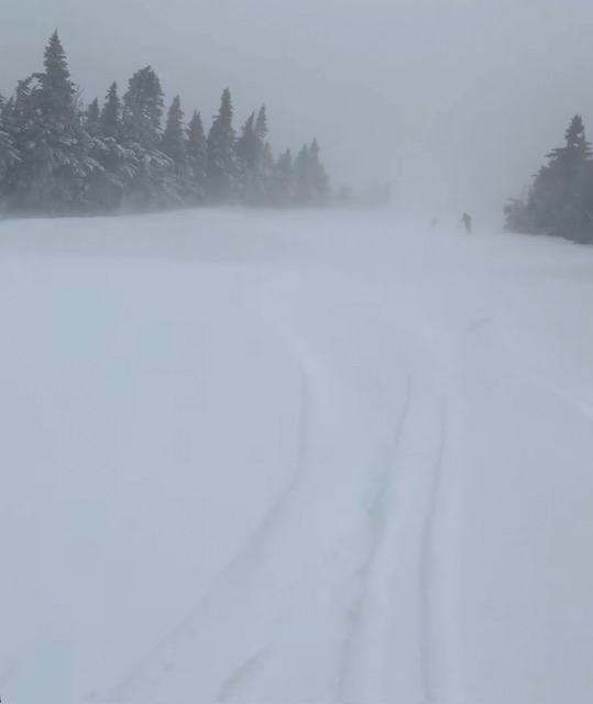
Several days back, it looked like today held the potential to be one of those warm, sunny ski days with spring corn snow. Mother Nature appeared to have other plans though, and the weather modeling quickly started to show the potential for fresh snow instead of sunshine. Indeed, the snow came to fruition, and as of this afternoon, snow levels had dropped all the way to the bottoms of the valleys. Down at our site in the Winooski Valley, it snowed much of the afternoon, with decent intensity at times, but temperatures were a bit too warm to see any substantial accumulations. Accumulation was easy at higher elevations however, and after a quick look at the thick white coating visible on Bolton Valley Main Base Webcam, I popped up to the mountain for a ski tour. Heading up the Bolton Valley Access Road, snow accumulations began to appear around the 1,200’ elevation. I found 2 to 3 inches of new snow in the Village at ~2,000’ where I started my tour, and my ascent revealed that the 2,000’-2,500’ elevation band saw the most rapid accumulation gains. I found 5 to 6 inches of new snow at 2,500’, with only modest gains above that up to ~3,200’. The elevation profile for accumulations in the Bolton Valley area today were as follows: 340’: 0” 500’: 0” 1,000’: 0” 1,200’: T 1,500’: T-1” 2,000’: 2-3” 2,500’: 5-6” 3,000’: 6-7” 3,200’: 6-8” By the time I was out for my tour in the late afternoon, temperatures were above freezing at all elevations of the resort, so the new snow was already wet. And it definitely skied like wet snow at that point, but there was plenty of liquid in there to keep you off the old base at most elevations above 2,000’. In any event, it’s always great to get out for a tour in fresh snow, and the sun had quickly come out as the storm pulled away to make for some excellent views. The weather modeling suggests we may get another shot at snow in about a week or so, so we’ll keep an eye on the potential for more touring in fresh accumulations as we head into May.