All Activity
- Past hour
-
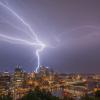
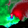
Tornado Warning PAC003-129-292130- /O.NEW.KPBZ.TO.W.0011.250429T2117Z-250429T2130Z/ BULLETIN - EAS ACTIVATION REQUESTED Tornado Warning National Weather Service Pittsburgh PA 517 PM EDT Tue Apr 29 2025 The National Weather Service in Pittsburgh has issued a * Tornado Warning for... East Central Allegheny County in southwestern Pennsylvania... Northwestern Westmoreland County in southwestern Pennsylvania... * Until 530 PM EDT. * At 517 PM EDT, severe thunderstorms capable of producing both tornadoes and extensive straight line wind damage were located over Churchill, or over Penn Hills, moving east at 65 mph. HAZARD...Tornado. SOURCE...Radar indicated rotation. IMPACT...Flying debris will be dangerous to those caught without shelter. Mobile homes will be damaged or destroyed. Damage to roofs, windows and vehicles will occur. Tree damage is likely. * Locations impacted include... Pittsburgh, Penn Hills, Monroeville, Plum, West Mifflin, Murrysville, Wilkinsburg, Munhall, North Versailles, Swissvale, O`hara Township, Forest Hills, Wilkins Township, Turtle Creek, North Braddock, Pitcairn, Homestead, Edgewood, Churchill and Delmont. PRECAUTIONARY/PREPAREDNESS ACTIONS... Move to an interior room on the lowest floor of a well-built building away from windows. If you are outdoors, in a mobile home, or in a vehicle, move to the closest substantial shelter and protect yourself from flying debris. && LAT...LON 4039 7991 4048 7993 4057 7956 4056 7956 4041 7949 TIME...MOT...LOC 2117Z 260DEG 57KT 4044 7985 TORNADO...RADAR INDICATED MAX HAIL SIZE...0.00 IN $$ Rackley
-
I think the line did weaken some as far as the precip goes. But still very high winds, especially when it first hit. Enough to knock my power out. Sent from my SM-S931U using Tapatalk
-
Third strongest wind gust recorded at KPIT. 71.3 mph
-
Power is out here in Monroeville
-
CNN: Millennials are giving Gen Z advice for their first potential recession ...oh yeah, how about, think the next time before you cast a flippant vote, flouting the virtuosity of knowing what the fuck your doing -
-
Power went off briefly twice. Back up.
-
This is going to be a major event for the region.
-
My power just went out. Very high winds. Sent from my SM-S931U using Tapatalk
-
It's super nice IMBY right now. Big joint in hand. Beautiful temps with a fresh breeze.
-
Warning has that line moving E at 75 mph. Widespread wind damage likely in the Pittsburgh metro. Also TPIT is down.
-
Topped out at 84° at ORD yesterday, which is the first official 80°+ day of the year for Chicago. It was also just shy of a record high for the date as well.
-
Think there was a brush fire on 291 around exit 4 on the eastbound side. Saw smoke and several police cars and fire truck…though I didn’t see any fire. Maybe they got it out
-
There are signals from different directions that we could turn wet from May 3 - May 13. Will it happen?? 30% probability.....................
-
Looks like it, barring some last minute weakening its right in the bullseye. Hope I can get dinner off the grill in time!
-
Looks like Allegheny County is actually going to be rocked this time.
-
dropped down to 70 here with the south winds off the water after a high of 74
-
Warmer in my house than outside 81 in the house 78 outside. 3-2-1 till the AC is flipped on. trying to prevent that by having every window jacked open. Nice breeze.
-
Got to 39 here, now it's 82.
-
By looking at the radar heading into Pittsburgh, you’d think southern PA would get smacked later tonight…
- Today
-
If this holds together, about to get ugly here. Sent from my SM-S931U using Tapatalk
-
DTW got up to 86F. Dont think my area got higher than 80-81. Actually glad it got into the mid-80s because todays record high was such low hanging fruit, better to break it than tie it. Going into the 30s tonight with a frost advisory.
-
That would be fantastic. Build up the soil moisture in our warm season source region. This way maybe we can actually have a severe season this year. With all the wind and jet dynamics maybe we will we can get some EML high wind events. Been a long, long time since we saw one of those classic region wide squall lines that survives all the way to the coast.
-
Cincinnati area could see a second round of storms later this afternoon. good clearing in S indiana
-
87° on the car thermo just north of the river crossing in north CON. Usually it’s a 2° error so we’ll call it 85°.
-
1st 80F.


