All Activity
- Past hour
-
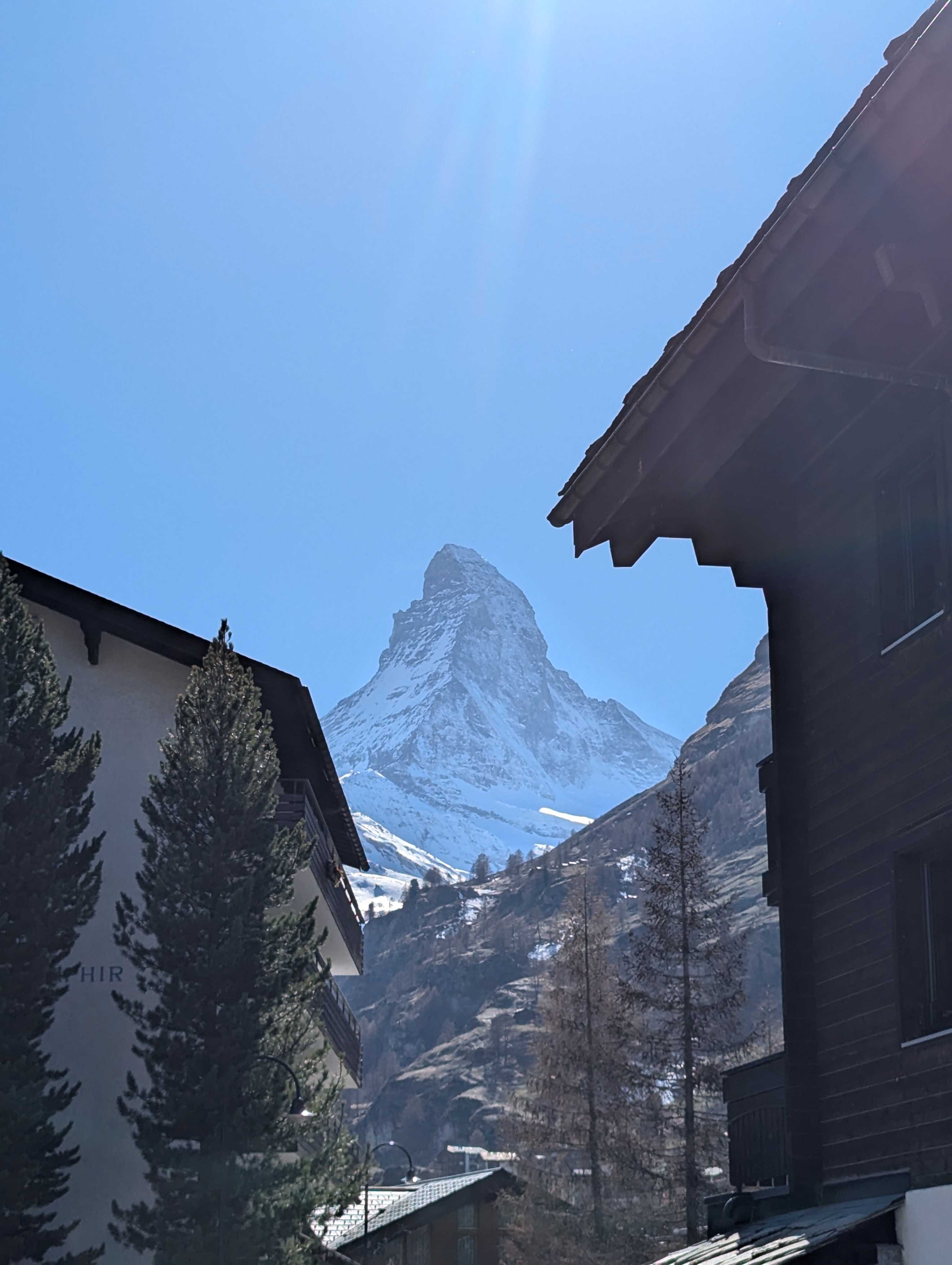
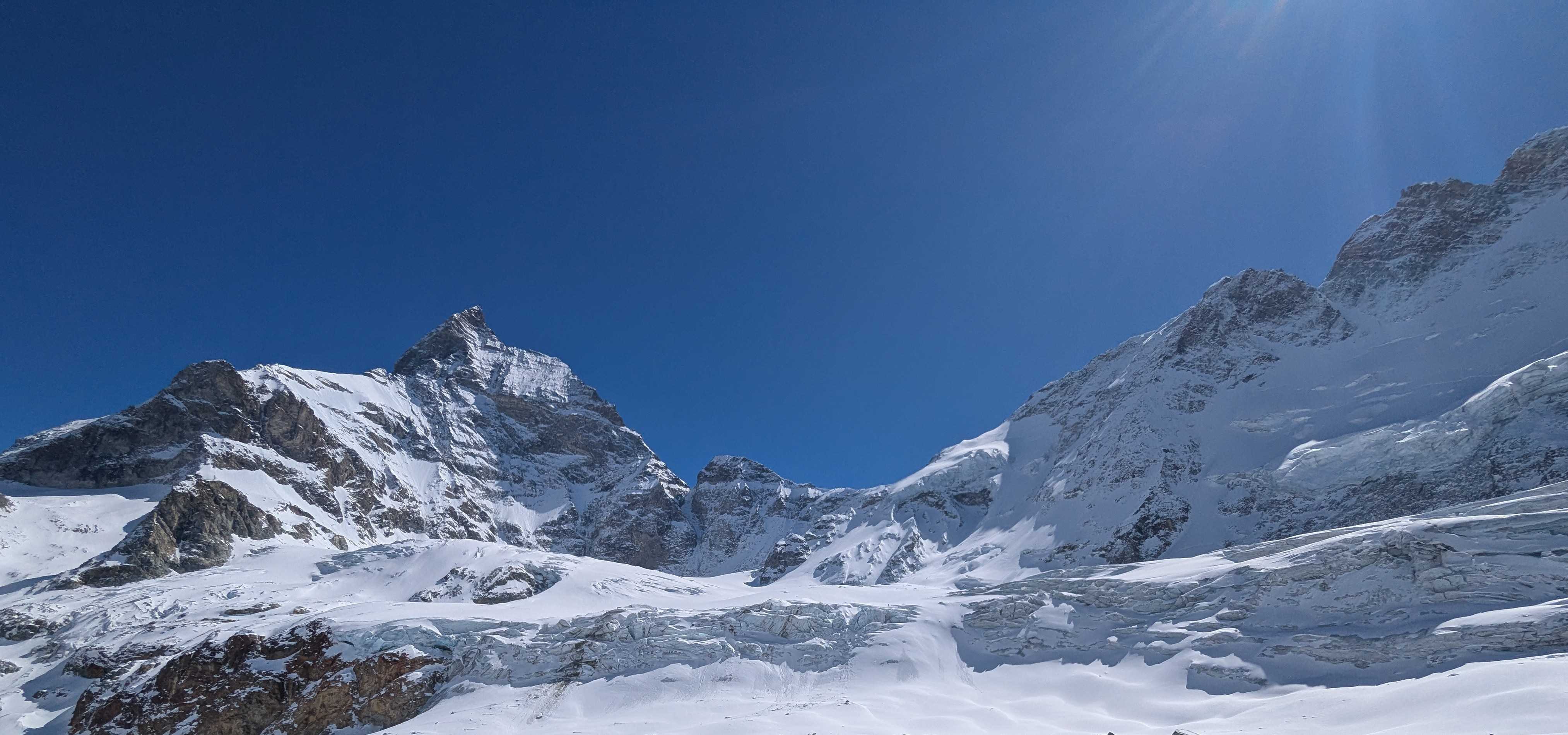
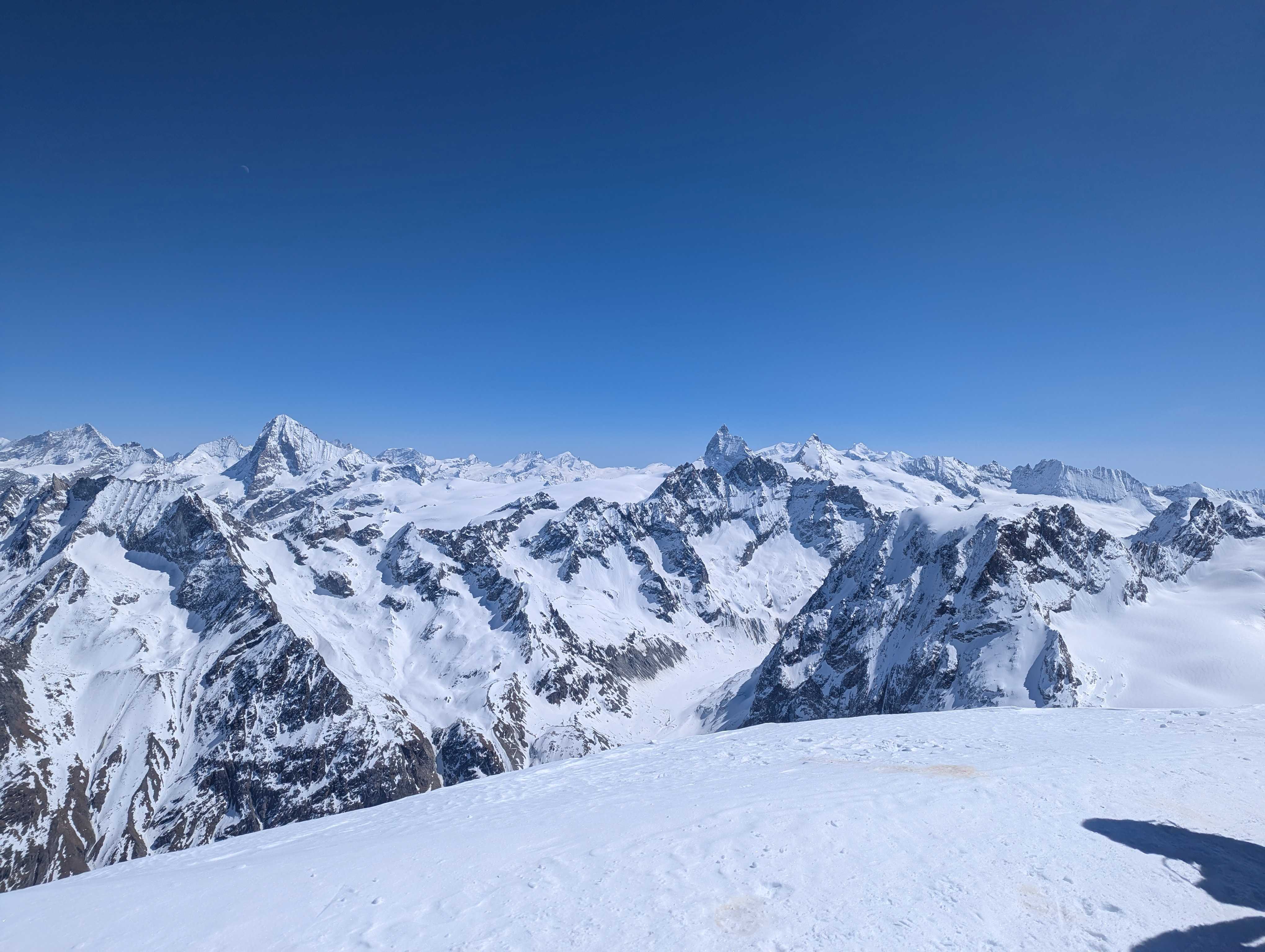
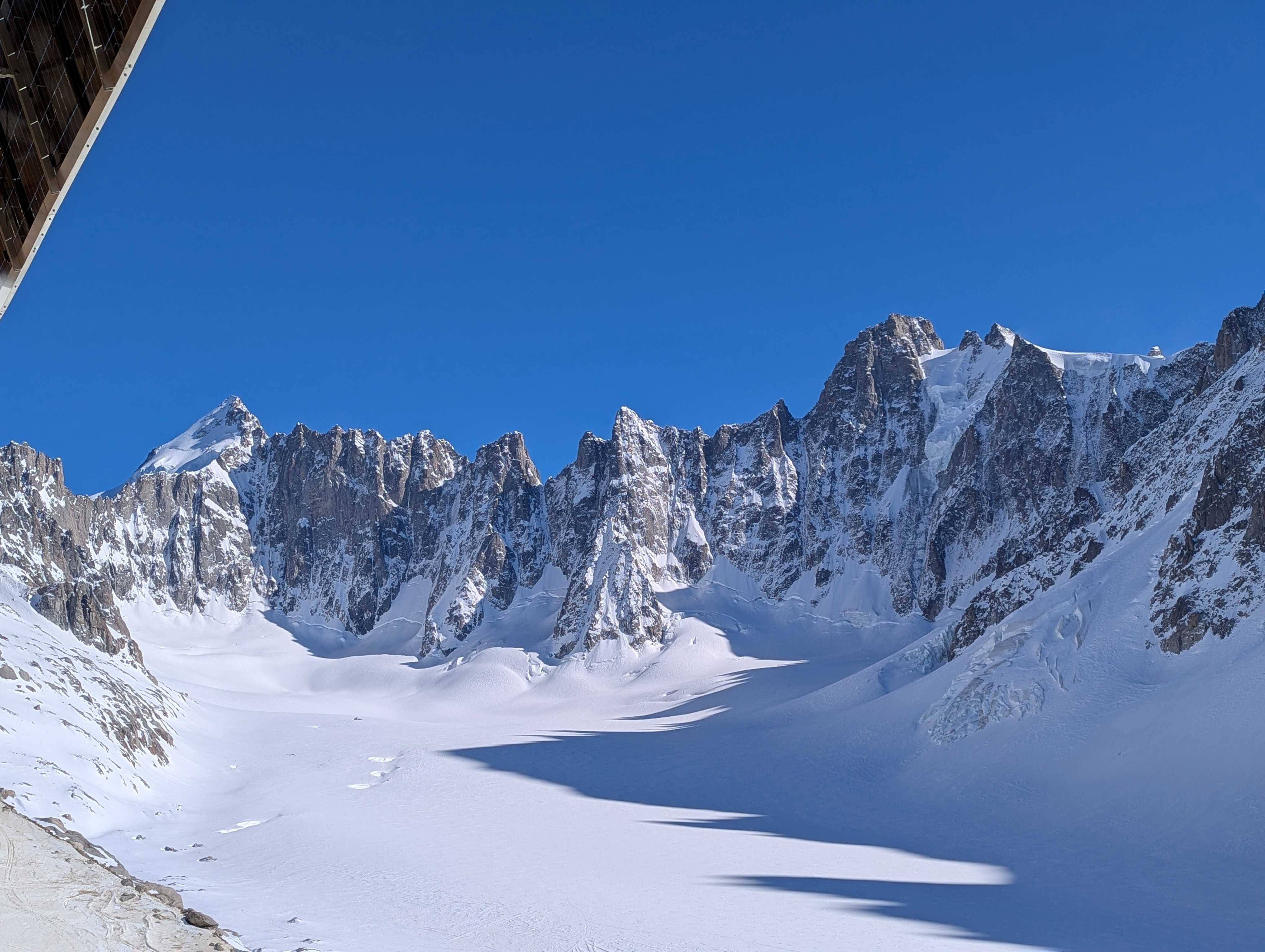
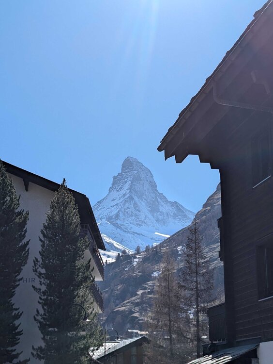
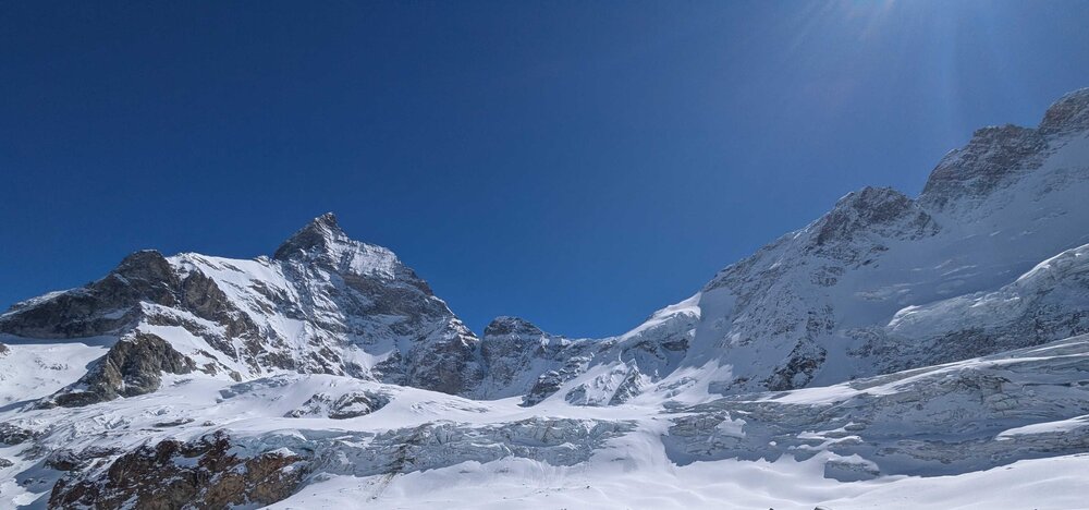
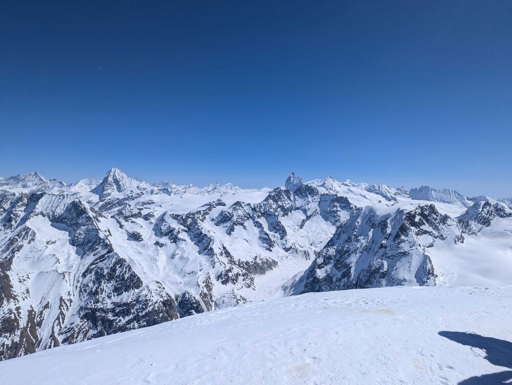
On Day 5, after skinning up the serpentine wall, we crossed a glacier, did another technical climb, and then skinned up the Pigne d'Arolla which had views of the Italian and Swiss Alps (you can see the French Alps from there too). This photo (bottom photo) looks east towards the Matterhorn. Frankly, one of the most spectacular spots imaginable (even when shared with 20-30 others!) The other photo (middle) is day #6, looking at the 'west' side of the Matterhorn. It took us 2+ hours to descend from the Col de Valpeline (3,500m) past the Matterhorn to reach the outskirts of the Zermatt ski area where we stopped had one of the best beers of my life. The Matterhorn looks very different from the different sides - not surprisingly but we are so use to seeing the photo below from the village of Zermatt.
-
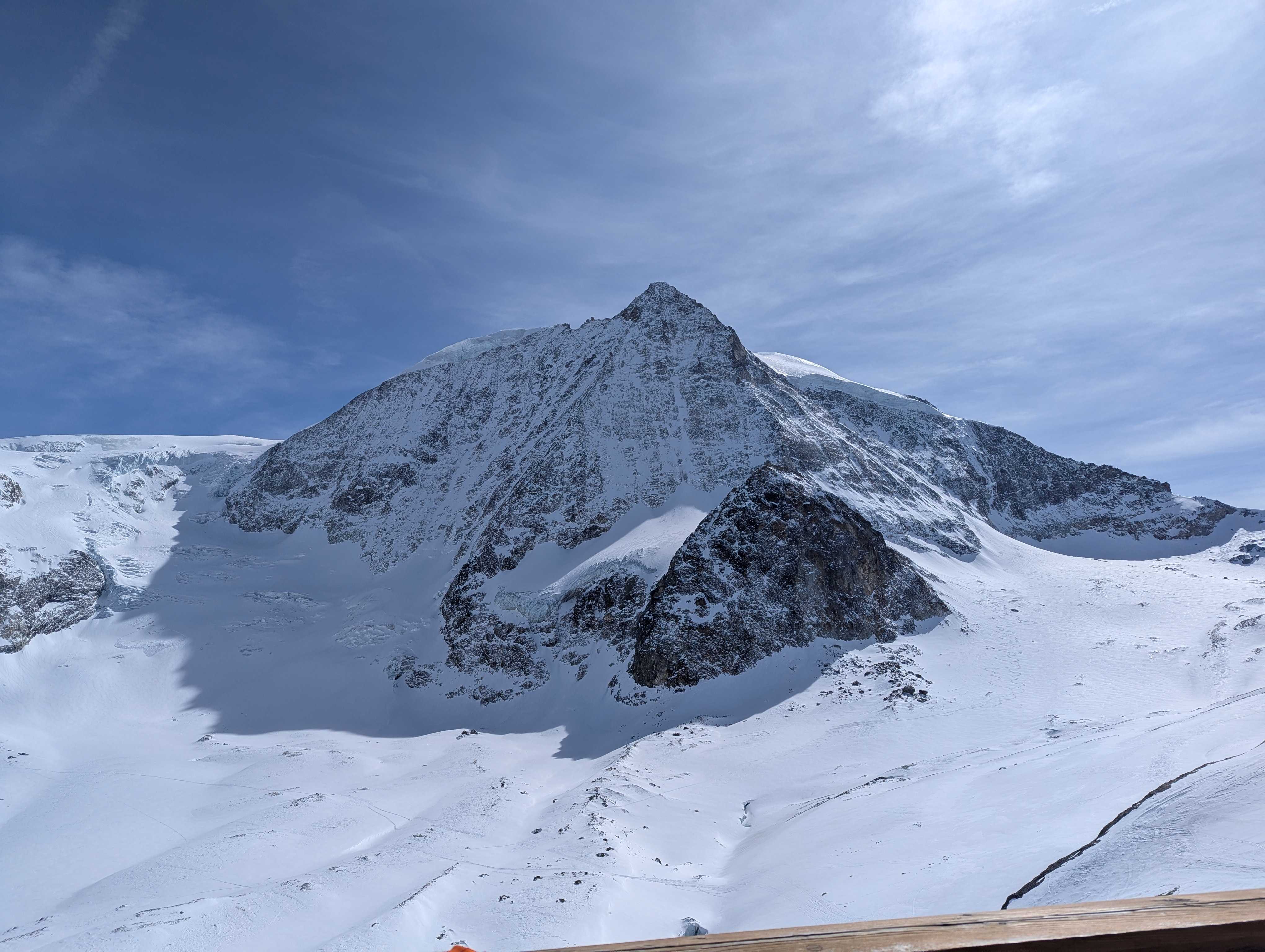
Both pictures taken from the Dix Hut. Mount Blanc De Cheilon (bottom photo) was directly across the from the hut. We would start day #5, by skiing down and then skinning up the Serpentine Wall (top photo) on the left side of photo. The serpentine wall is just left of Mount Blanc De Cheilon, i.e. put the two photos side by side and you have a perfect landscape.

-
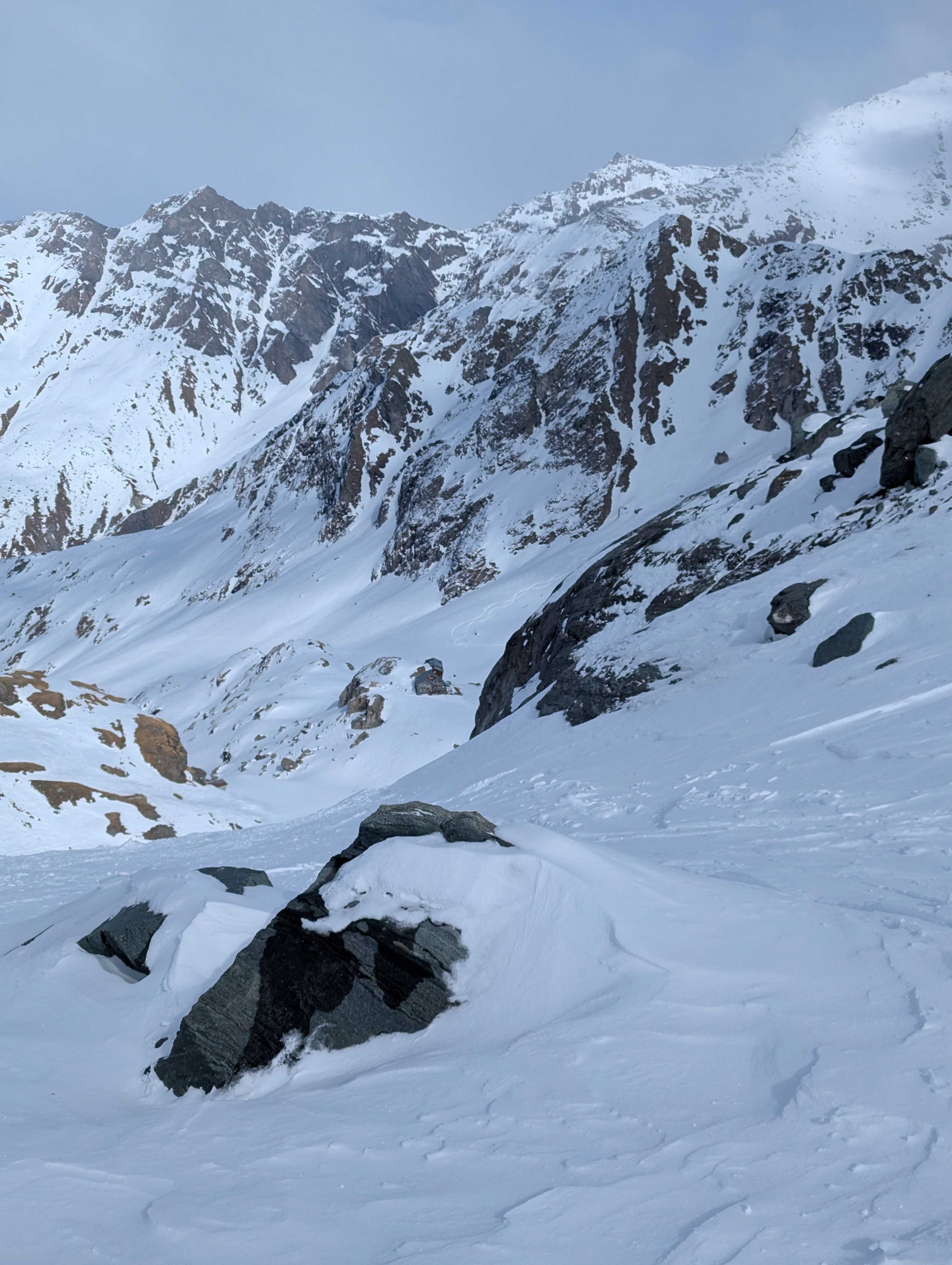
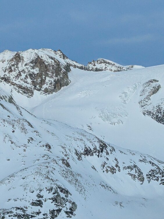
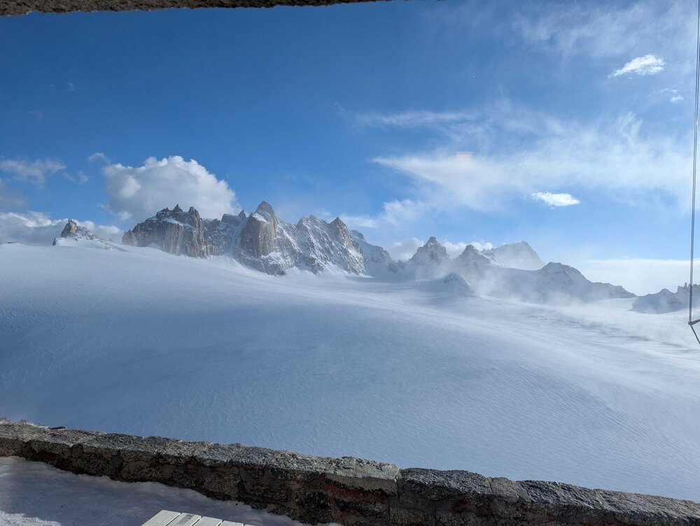
Day Two started by skiing down the Argentiere Glacier then a combination of technical climbs (crampons/ropes) and touring across two glaciers. The bottom picture is the last glacier we crossed at the end of day #2 as seen from the Trient Hut. At the end of day #2, we (5 of the 6) were all questioning our ability to finish. It was a brutal day. The top picture is looking down at the Prafleuri Hut (look carefully in middle of picture) where we spent night #3, we had just skied down a glacier and had some 'interesting' skiing left to get to our bed.

-
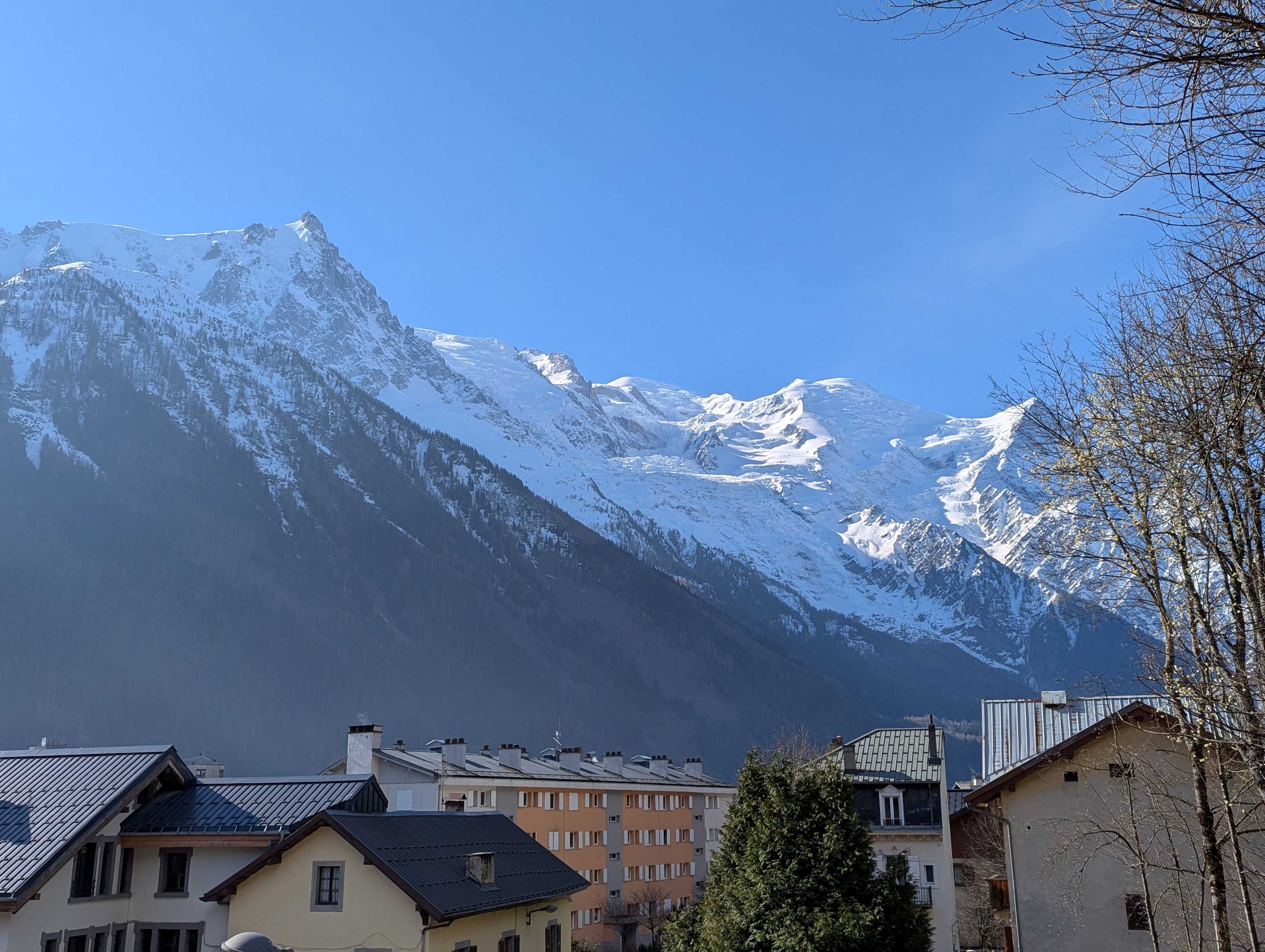
Sorry about multiple posts and the inconsistent chronology...I didn't reduce the pictures enough and don't post pictures often so the order is a bit messed up. The Mount Blanc massif from downtown Chamonix. The evening sunsets on the ice fields were spectacular from the town. At the end of Day from the hut/'refuge' just above the Argentiere Glacier.


- Today
-
It's a few inches over for me. I had a few tenths of crusty goo not 4".
-
Look at this crap. Not even one full day of sunshine, and barely more than a day without light rain. Then more wind. When is this shit going to end? Today Cloudy, then gradually becoming mostly sunny, with a high near 55. North wind 6 to 10 mph, with gusts as high as 25 mph. Tonight Increasing clouds, with a low around 37. Light northwest wind. Monday Mostly cloudy, with a high near 61. Calm wind becoming south 5 to 8 mph in the afternoon. Monday Night Showers likely, mainly before 2am. Mostly cloudy, with a low around 47. Light south wind. Chance of precipitation is 60%. New precipitation amounts between a tenth and quarter of an inch possible. Tuesday A chance of showers, mainly after 8am. Partly sunny, with a high near 58. West wind 6 to 13 mph, with gusts as high as 34 mph. Chance of precipitation is 30%. New precipitation amounts of less than a tenth of an inch possible.
-
My new station says I had a 37, so not bad for winters last gasp. The point forecast put the next shot at a 42 low, and I don't count it if it ain't in the 30's, lol. Bye winter..had two slight snows and a slighter sleet, so not too shabby compared to the last bunch of winters, but still pretty pitiful. I'd like to see Rory get his slam, though all three in tandem is what a real slam is, but it's hard enough to get all three in a lifetime
-
+.5" 32.5"
-

E PA/NJ/DE Spring 2025 Obs/Discussion
JTA66 replied to PhiEaglesfan712's topic in Philadelphia Region
Looking at the LR for our next snow opportunity, I think we’re back to being patient. -
Apologies in advance if this was already mentioned (took a quick look at the last few pages and didn't see it referenced), but is this not the 2nd latest recorded snowfall, if not the latest, in the last 50 years there?
-
Really like this set up for us.But we will see,just say there is a chance for now,When you start to see a ridge into Mongolia, ULL headed towards the Koreas and ridge into the Sea of Okhotsk into the Bearing Sea,this is normally severe in our parts,but there will always be some sort of a HP in the East that could very well cut off the moisture flux
-
Caps got rolled today
-
 scottysnow joined the community
 -
Simulated radars look really interesting, but the soundings suggest that the convection will be elevated due to early evening cooling and therefore have limited SVR potential. That said, the dynamics are really strong, so this is certainly worth a look.
-
-
sucks 2 b u.
-
I'm sure CoastalWx will agree wholeheartedly!
-
Do people think this looks right? Seems overdone for me, especially at lower elevations...
-
I think it's real this time
-
-

Spring 2025 Medium/Long Range Discussion
Powerball replied to Chicago Storm's topic in Lakes/Ohio Valley
You have my condolences... -
Suicide weather yesterday, it returns tomorrow. TWC/Wunderground now says it might as well include some rain if they have maintained overcast skies for tomorrow over the past several days. So much for the 1st dry weekend of Spring 2025. Normally we would have at least one dry weekend or two every Spring, but I feel that this is just not going to be our year. Even wet springs like 2011 had some dry weekends. The last time it rained literally EVERY SINGLE WEEKEND the entire Spring was in 2019.
-
That actually would be worth it
-
+2.5, 60.1" ots Sent from my SM-S156V using Tapatalk
-
Over a foot of pure paste that falls at rush hour or a sudden ice storm causing black ice issues Sent from my SM-S156V using Tapatalk
-
I timed my grass seed planting well- it’s coming up really good after the recent rains. Hopefully I don’t lose half my grass like I did in last year’s drought.