All Activity
- Past hour
-
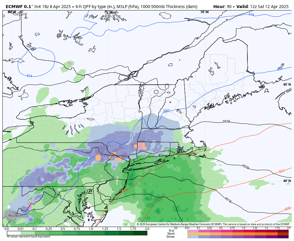
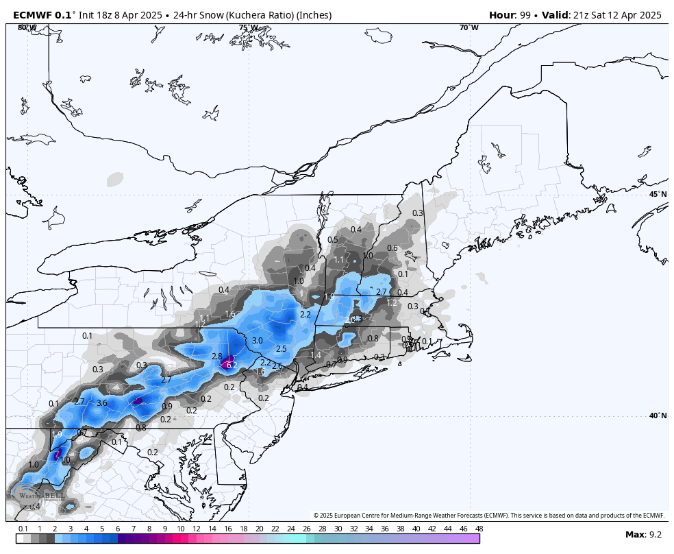
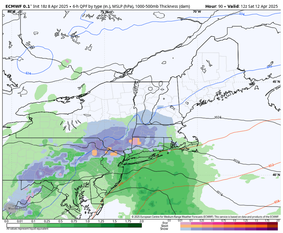
The 18z Euro is looking even more interesting for areas of the LSV back towards I-81 on Saturday am. I would be ecstatic even seeing a little snow TV in my yard. Might as track it until the very end…

-
I hope numbnuts is sitting out on his porch in his shorts and t-shirt. 33° here with a real feel of 22°.
-
2.5". Puts us pretty close to seasonal avg. Sent from my SM-S921U using Tapatalk
- Today
-
Love to see it.
-
…not that long ago this person said:
-
Getting close to that Sent from my SM-S921U using Tapatalk
-
Wow, I love this sunset image. Have you ever seen pink snow? I have on two occasions-- January 2004 (sunrise) and February 2009 (sunset). Heavy falling snow turns pink through a sunrise or sunset.
-
See I could get behind that. It’s getting violent.
-
Great pics folks Wonder why no pics of sheet drizzle and mud?
-
Our best Arctic outbreaks that I can remember are: January 1977 Christmas 1980 January 1982 January 1984 January 1985* January 1994 February 2016 *this was our top Arctic outbreak
-
You live in a great radiational cooling area, I'm envious. We only get cold air here via CAA. Our temps closely match JFK.
-
Doesn't look that bad other than obligatory rainy weekend.
-
Records:Highs:EWR: 88 (1991)NYC: 90 (1991)LGA: 89 (1991)JFK: 82 (1959)Lows:EWR: 23 (1982)NYC: 25 (1982)LGA : 25 (1982)JFK: 26 (1982) This was the earliest 90 on record before 2010. Is this the widest gap between record high and record low in the NYC record? I love this wide variance.
-
Quick 2” this afternoon .
-
you should post this in OT where it belongs
-
Yeah I'm super excited! was a fairly competitive selection process here, so i'm glad i got in, and it'll be cool to do legit fieldwork
-
Ah, not much for wind here yet. HRRR is interesting, there would be a lot of surprised folks in the mid-coast area. We are pasted.
-
Winds have really picked up as well in the last 30 mins or so with development of the meso off the coast.
-
Some of the best rates and largest flakes of the season, radar just keeps filling in.
-
My average last freeze for the past 4 yrs is April 14th
-
Who was Upper 50’s? Most stayed in 40’s
-
Freeze warnings up - note in the CTP disco Therefore, we issued a Freeze Warning with a probable top 5 latest date for min temp <= 25F at Harrisburg
-
The 18z NAM paints high elevation snows for western areas Friday night. With a wrapped up system this is likely.
-
Ripping winds
-
So useless now.