All Activity
- Past hour
-

4/2-4/3 Potential Major Severe WX Outbreak
HillsdaleMIWeather replied to Geoboy645's topic in Lakes/Ohio Valley
IWX also confirmed two fairly long trackers that went from Stueben County into Branch County MI. If warm front had gotten further north there'd have been way more tornadoes. -
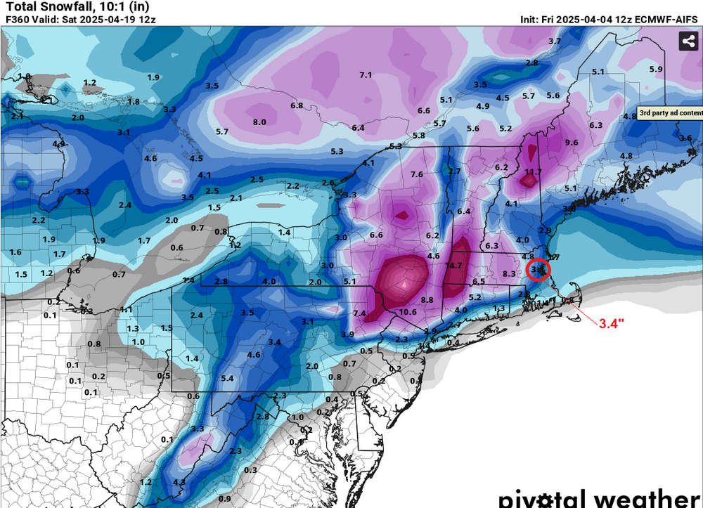
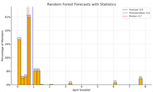
The ECMWF AIFS (4/3 12z) appears to be continuing to struggle with snowfall, very likely bringing the southern extent of measurable snowfall too far to the south. The 18z had 7.4" at Boston and none at New York City. Boston could see some measurable snowfall (probably <1"). When one runs an AI model, the numbers generated are consistent with a much lower snowfall than what the AIFS is showing: 77% of members from the above forecast are < 1" of snow. Just 5% of members are 3.4" or above (AIFS value). The trimmed mean is probably the best idea, as it excludes outliers that could skew the forecast average. New York City will likely see no measurable snowfall (AIFS: 1.4"), though there remains a possibility of a trace of snow. IMO, the AIFS is still learning. I expect far fewer "false alarms" next year.
-
Tuesday night Wednesday morning going to be very cold so holding off on moving plants outside
-
Yeah, going to be a significant temperature gradient across the area, with a lot of model variation about how the thermal boundaries set up. Convection seems likely along the boundary later in the day - not seeing forecast soundings that impress me, but I suppose that an isolated severe event can't be totally ruled out. Looking forward to the potential for more early morning rumbling tonight, though.
- 378 replies
-
- severe
- thunderstorms
-
(and 2 more)
Tagged with:
-
Beer?
-
Good model signal again overnight for early morning convection.
-
E PA/NJ/DE Spring 2025 Obs/Discussion
KamuSnow replied to PhiEaglesfan712's topic in Philadelphia Region
I slept through it (in my defense I'm working through hopefully the end of a flu, lol). Didn't get the wind here so much, but we did get another 0.92" of rain. Also lost power briefly, apparently. -

2025 Short Range Severe Weather Discussion
Jackstraw replied to Chicago Storm's topic in Lakes/Ohio Valley
Just ran to the store in town. Pretty good lightning with a few CG's and some pea sized hail on the way home. A little surprised by the hail anyway. Moderate to really heavy rain. Thought this crap was supposed to stay south -

4/2-4/3 Potential Major Severe WX Outbreak
nwohweather replied to Geoboy645's topic in Lakes/Ohio Valley
Unreal how many actually touched down. I see there was another in Clyde as well. I do not envy IWX and CLE with the beam heights in this area. Toledo proper has the airport radar but that is what it is. -

2025-2026 ENSO
Stormchaserchuck1 replied to 40/70 Benchmark's topic in Weather Forecasting and Discussion
Weak vs Moderate vs Strong ENSO is just different amplitude of the same thing. I think the differences are just from not having enough climate data and weaker events having more weight from other things. With 50-100 more years of climate data, the differences will be sorted out and you'll only see a "weak" vs "strong" signal in the data. -
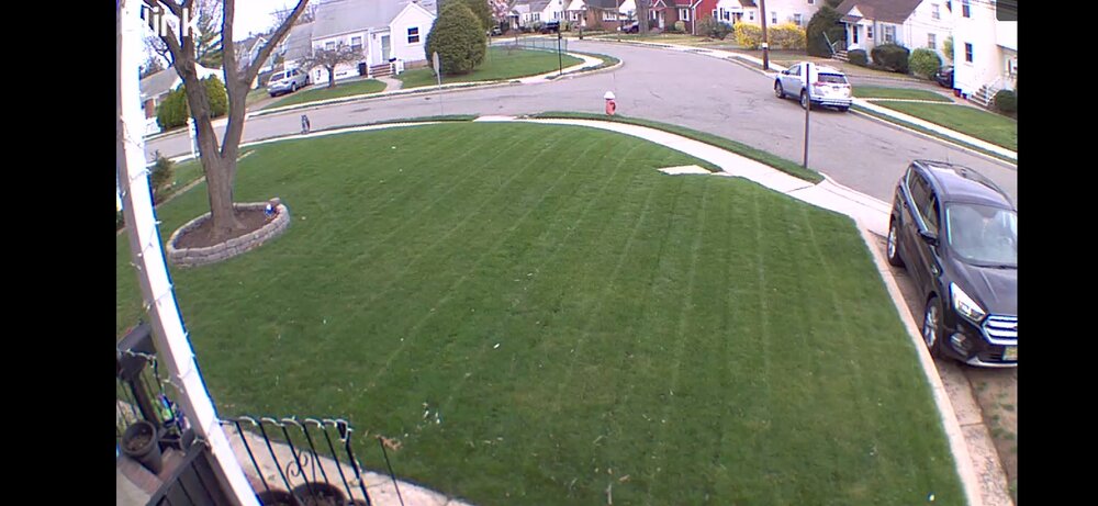
This spring is way better than the previous 4. My yard is almost fully greened up. I had to cut it today.
- Today
-
Beautiful basketball weather. One of the unusual days where we have humidity and calm winds. Really liking the start to spring so far.
-

Texas 2025 Discussion/Observations
canderson replied to Stx_Thunder's topic in Central/Western States
Welp mom and dad are in a closet. Tornado just to the SW of them Edit. It lifted they are good. Today has SUCKED -
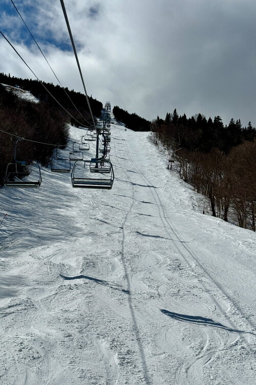
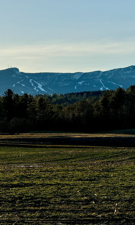
Good dichotomy in the landscape this time of year. Winter and spring today. Riding chairlifts to plenty of snow on the hill, while enjoying warmth and late daylight dog walks in the valley.
-
He went full MAGA conspiracy nut.
-
Mountain West Discussion
mayjawintastawm replied to mayjawintastawm's topic in Central/Western States
That could attract tourists from as far away as... Colorado. Driven that a bunch of times, and by that stage, anything is worth stopping for. -

2024-2025 La Nina
Stormchaserchuck1 replied to George001's topic in Weather Forecasting and Discussion
Stratosphere warming is still going strong.. one of the strongest ones in history, actually, because it's having these +1800dm anomalies cover 3-4 weeks. I think the highest I ever saw 10mb get historically on a daily was +2900dm. Latest daily map 3-10 is about when it started.. last 22 days: It will probably last for another week. -

2025 Short Range Severe Weather Discussion
SchaumburgStormer replied to Chicago Storm's topic in Lakes/Ohio Valley
CC drop on the storm N of cape girardeau -
Did Mike Elias actually think this Rotation is good enough to make the playoffs? Lol Awful Edit- The line up isn't as good as it is made out to be either. Too much swinging for the fences. Not enough situational hitting.
-

E PA/NJ/DE Spring 2025 Obs/Discussion
Birds~69 replied to PhiEaglesfan712's topic in Philadelphia Region
No injuries or fatalities...all in good fun. That peak wind was impressive, 95-105mph. Surprised there hasn't been more damage/fires from lightning because the last two events were light shows galore. Continuous strikes... -

E PA/NJ/DE Spring 2025 Obs/Discussion
Hurricane Agnes replied to PhiEaglesfan712's topic in Philadelphia Region
Before round 2 comes through, I did pick up 0.41" from the thunder-boomers this morning. Had a low of 61 so far this evening and made it up to 71 for a non-diurnal high just after midnight. Currently 62 with dp 41. -
-

E PA/NJ/DE Spring 2025 Obs/Discussion
snowwors2 replied to PhiEaglesfan712's topic in Philadelphia Region
You’re scaring me now‼️… ...NWS Damage Survey for 04/04/25 Downburst Event......Media/Nether Providence Township Downburst...Estimated Peak Wind: 95-105 mphPath Length /statute/: 0.66 milesPath Width /maximum/: 1800 yardsFatalities: 0Injuries: 0Start Date: 04/04/2025Start Time: 04:48 AM EDTStart Location: Media / Delaware County / PAStart Lat/Lon: 39.9135 / -75.3827End Date: 04/04/2025End Time: 04:48 AM EDTEnd Location: 1 ENE Media / Delaware County / PAEnd Lat/Lon: 39.9194 / -75.3729Survey Summary:A strong downburst of winds from a severe thunderstorm producedsignificant damage early Friday morning. The most significantdamage occurred in the borough of Media and Nether ProvidenceTownship in Delaware County, Pennsylvania. In Media, the most concentrated damage occurred to the northeast of downtown between east State and 4th Streets. Several trees weresnapped at their trunks or uprooted. A building at the corner of Jasper and Monroe Streets lost a significant amount of its roof covering. The damage in this area was unidirectional with downed trees and roof coverings pushed to the northeast. In Nether Providence Township, the most significant damage occurred between Providence Road and I-476, south of East Baltimore Pike. Several more trees were uprooted and snapped in this area, falling unidirectional towards the east-southeast. Additional sporadic tree damage was noted between the two concentrated areas of damage. The overall diverging, unidirectional pattern of the damage is consistent with a downburst event. The damage to multiple roofs aswell as snapping of trees along their trunks leads to an estimated maximum wind speed of 95-105 mph.The National Weather Service would like to thank Delaware County Emergency Management and Mr. Lou Ruh for their valuable assistancewith this damage survey, along with residents who reported these impacts. -
These maps remind me of the Alanis Morrisette song "Ironic".


