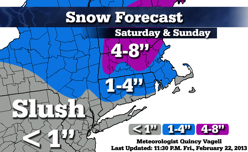
Regional Snowfall Forecast: Feb. 23-24
 What a challenging forecast and I still think the models have more to resolve, mainly on Sunday with respect to enhancement of snow along a trough.
Essentially, a light mixture of rain and snow overspreads the region through later today. Across the lower Hudson Valley, Connecticut, Rhode Island and southeastern Massachusetts, I expect virtually no daytime snow accumulation. Low pressure develops south of the area tonight, but the heaviest precipitation and best lift also stays south.
Some snow falls early Sunday morning and a period of light to moderate snow may develop for a good chunk of the second half of the day, especially across northern Massachusetts and central New England. Here, snowfall totals are forecast to finish in the 4 to 8 inch range by 12:00 a.m. Monday. (Could snow possibly linger later? Yes.)
We'll see how things continue to change!


0 Comments
Recommended Comments
There are no comments to display.
Create an account or sign in to comment
You need to be a member in order to leave a comment
Create an account
Sign up for a new account in our community. It's easy!
Register a new accountSign in
Already have an account? Sign in here.
Sign In Now