After Weekend Nor'easter threat for OES exists on Tuesday!
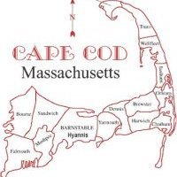
Potential exists for Ocean Effect Snow bands to develop as an upper level low develops to the southwest of the region. Now the evolution of said trough and upper level low remain in question as overall the guidance for 12z 12/06/2020 is still questioning this transition. Newly updated water vapor imagery as I watch, shows the main energy that develops into the upper level closed low is still diving southward with no eastward motion. This suggests it will try and phase with the southern stream system and create a formidable surface storm over the North and South Carolina piedmont region. This low has two avenues of track, one to the ENE and off the coast with little fanfare, or two up the East Coast in more of a NNE track. The latter performs a major impact event for eastern New England, while the former represents little impacts. Ocean Effect Snows will only develop if the ocean storm tracks close enough to the region to veer the flow from an anticyclonic burst of westerly winds, to a more cyclonic burst of NNE to N winds across a very mild Gulf of Maine and Cape Cod Bay. 850mb temps which are found 2500 to 5000 feet above the surface of the ocean, dive into the -6 to -12C range for a good 36 hour period. The winds veer to north-northeasterly at the same time and provide the necessary forcing for ocean effect cloud seeding and developing of snow showers. Again any accumulations will be light!


0 Comments
Recommended Comments
There are no comments to display.
Create an account or sign in to comment
You need to be a member in order to leave a comment
Create an account
Sign up for a new account in our community. It's easy!
Register a new accountSign in
Already have an account? Sign in here.
Sign In Now