Weekend Storm Threat (Analyzing the 00z and 06z NAM) - SNE WEATHER UPDATE!
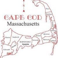
Latest 6z NAM run comes in hot with over a foot of snow for Chatham in about a 12 t0 18 hour period from 10z Saturday, February 1st to around 00 FEB 2nd or 7pm EST Saturday night. The latest run of the NAM intensifies the shortwave, as a stronger negative tilt occurs as it approaches the NC coastline, around 35N: 75W. This run also brings the surface low from the central GOM to the interior of SC and NC before it reaches the location of 35N: 75W. Then the low tracks Northeastward towards the 40N:70W benchmark location which favors a heavy snow threat for Cape Cod and the Islands. Even the HIRES NAM or 3KM Resolution NAM brings the surface low closer and throws over .3" of Liquid over CHH as the run does not go beyond 60 hours. However, the storm will start within 48 hours of the 12z runs this late morning into the early afternoon. Also water vapor imagery suggests that the northern stream is digging more southward in last few frames than what the recent 00z and 06z guidance even suggests. We could see a sea/saw effect continue for the next day and then trends could be west towards 24 hours and closer to the onset of the precipitation. For a bigger and more severe event, like talking blizzard potential, we need a stronger phase, a colder scenario and a much stronger surface low passing at the benchmark or just about 24 miles west of it.


0 Comments
Recommended Comments
There are no comments to display.
Create an account or sign in to comment
You need to be a member in order to leave a comment
Create an account
Sign up for a new account in our community. It's easy!
Register a new accountSign in
Already have an account? Sign in here.
Sign In Now