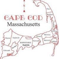
Fascinating Weather heading for New England this week into the first week or longer of December - SNE WEATHER UPDATE!
Snowstorm threat has become slightly enhanced the last few cycles. 06z GFS went from .5" of QPF as snow next weekend to 1.7" of QPF as snow for the 18z GFS run. The storm track is slowly becoming suppressed on the GFS, while the other models are spilt apart in their potential solutions. We are still under six days away, and just over five days away from the impacts of the storm. The first upper level vortexes are moving through by Wednesday with some mix of snow and rain showers. SNE will see mostly rain drops Wednesday, otherwise known as travel day. Thanksgiving Day looks cold and dry for the area.


0 Comments
Recommended Comments
There are no comments to display.
Create an account or sign in to comment
You need to be a member in order to leave a comment
Create an account
Sign up for a new account in our community. It's easy!
Register a new accountSign in
Already have an account? Sign in here.
Sign In Now