Interior New England - no surprise first snowfall occurs late week
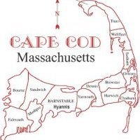
It is becoming increasingly clear, that the models are showing more confidence in an interior New England, mainly northwestern New England snowfall is going to happen later Thursday into Friday morning. The quick nature of the system, what the weather world calls a progressive storm, is something that won't be spectacular by any stretch of the imagination, but could have some moderate travel impacts where it does indeed snow and accumulate. The one thing that is blatantly obvious in the weather pattern developing now through November, is that there will be some amazingly cold air masses invading the region. These air masses are driven by the mid to upper levels of the atmosphere over North America that will be originating from the Polar regions, arctic in appearance. There are some very cold temperatures being printed out by the models, especially the GFS for Saturday this weekend and Tuesday of next week, indeed for CHH climate numbers, we could be as much as 10 to 20 F below normal both days. Low temperatures in those two days could be in the upper 20s with northeasterly winds aiding to the presence of ocean effect showers. Precipitation type unknown at this point and it is over 7 days away. Time will tell if CHH gets their first measurable snow then or not. For now, areas northwest of Worcester, MA will see some accumulating snowfall and I don't know how much just yet.


0 Comments
Recommended Comments
There are no comments to display.
Create an account or sign in to comment
You need to be a member in order to leave a comment
Create an account
Sign up for a new account in our community. It's easy!
Register a new accountSign in
Already have an account? Sign in here.
Sign In Now