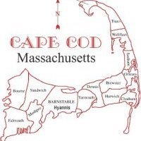
Short Range Guidance edging northward with Precipitation shield tomorrow for Cape and Islands
Could Cape Cod see their first accumulating snows of the season tomorrow afternoon into Monday? I think so, latest guidance is edging towards an impact with some snow, the question is how much precipitation does fall over the area? WV suggests that the northern confluence zone and northern stream energy causing the southward movement of the precipitation is actually moving out of Quebec, Canada at a quicker fashion, is it enough to allow the southern stream disturbance to intensify and push precipitation back into SNE? I don't know, but tomorrows short range guidance will get a much clearer idea and I will give an accumulations map if we edge that way tomorrow morning. Let's Go Patriots!


0 Comments
Recommended Comments
There are no comments to display.
Create an account or sign in to comment
You need to be a member in order to leave a comment
Create an account
Sign up for a new account in our community. It's easy!
Register a new accountSign in
Already have an account? Sign in here.
Sign In Now