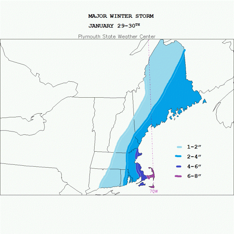
**Winter Storm Alert** final map
This is my final map for this snowstorm. Not as widespread with the snowfall amounts, 12:1 ratios make sense as it will get colder throughout the storm. Ocean enhancement/effect snows will add to the amounts over mid and outer Cape Cod. Not buying latest NAM run as the hires NAM shows significant accumulations for the south shore, Cape and Islands. Winds might be a problem with the fluffy snowfall. Blizzard like conditions will hamper travel tomorrow night into the morning hours on Tuesday. I will get video of the heavy snow as 1"/hour snowfall rates are possible for a time Tuesday morning.


0 Comments
Recommended Comments
There are no comments to display.
Create an account or sign in to comment
You need to be a member in order to leave a comment
Create an account
Sign up for a new account in our community. It's easy!
Register a new accountSign in
Already have an account? Sign in here.
Sign In Now