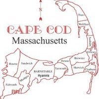
*Winter Storm Alert*
12z and 18z models beginning to indicate a secondary shortwave riding up the coastline forming a coastal storm on the frontal boundary and could become quite potent
-winter storm threat is increasing as models gain confidence in what disturbance will do what on Sunday through Tuesday
-Snow threat remains high, models increasing precipitation into the region as a frontal boundary plows offshore and the coastal low develops into a powerful nor'easter
-as Nor'easter develops a potentcy wind threat increases out of the northeast
- as nor'easter strengthens coastal flooding becomes a threat
-Please stay tuned to the latest updates from the Taunton NWS WFO


0 Comments
Recommended Comments
There are no comments to display.
Create an account or sign in to comment
You need to be a member in order to leave a comment
Create an account
Sign up for a new account in our community. It's easy!
Register a new accountSign in
Already have an account? Sign in here.
Sign In Now