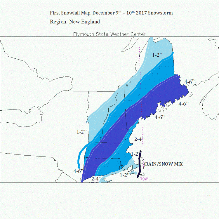
First Snow Map for December 9th and 10th 2017 Snowstorm
I have a narrow swath of accumulating snow of about 4-6" from western CT and MA to Downeast ME where I think the best cold air source and moisture combination remains as models have come in extremely amplified over the last 12 hours. Remember this is not the final map, I will issue that Friday evening


0 Comments
Recommended Comments
There are no comments to display.
Create an account or sign in to comment
You need to be a member in order to leave a comment
Create an account
Sign up for a new account in our community. It's easy!
Register a new accountSign in
Already have an account? Sign in here.
Sign In Now