February 2nd Snow & Ice Forecast
 There have been no major changes to the previous forecast. Some of the snowfall totals have been trimmed back ever so slightly. A fairly widespread area of 5 to 10 inches of snow is expected, with a jackpot across much of interior Massachusetts, where most or all of the precipitation should fall as snow.
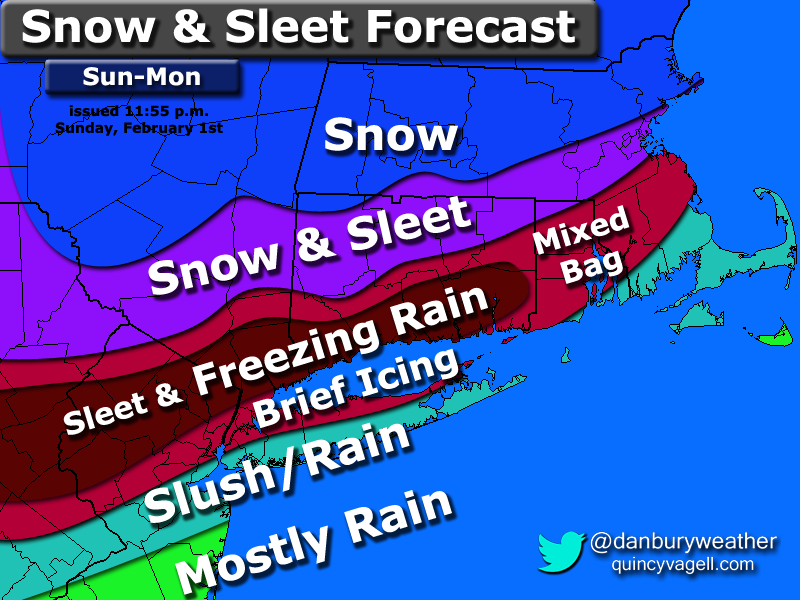
Snow becomes heavy at times early Monday morning and begins to mix with sleet and freezing rain by the morning rush around New York City. The mixing then spreads into southern New England by mid morning. After a few hours of sleet and freezing rain across the coastal plain of Connecticut, precipitation should quickly begin to lighten up by late morning to midday.
Across northeastern Massachusetts, snow will continue through early afternoon before tapering off by early evening and as a result, around a foot of snow is forecast here. The greatest threat for icing extends from northern New Jersey into the lower Hudson Valley and portions of southern and central Connecticut.


0 Comments
Recommended Comments
There are no comments to display.
Create an account or sign in to comment
You need to be a member in order to leave a comment
Create an account
Sign up for a new account in our community. It's easy!
Register a new accountSign in
Already have an account? Sign in here.
Sign In Now